
Ñustapakana is a place where ceremonies were conducted by the Incas at the uppermost portion of the Sacsayhuamán Archaeological Park, located about 15 minutes away from the historic district of Cusco. The Incas created Ñustapakana during the fifteenth century in relation to the springs of the Chacán basin at the end of a sacred road that led down to Qorikancha or Temple of the Sun.
The location remained undiscovered for nearly 500 years. In December 2024, the Ministry of Culture of Peru completed the restoration of the 2.71-kilometer ritual path, and it was opened to the general public. This is where it originated from, how to get to it, what it costs to visit, and what one sees at the top.
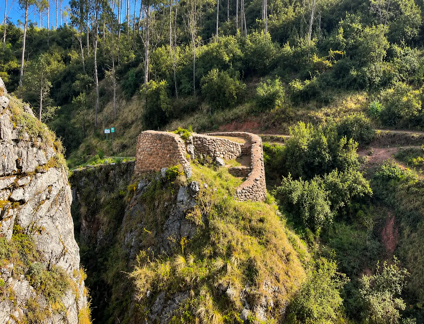
What Is Ñustapakana?
The ruins of the site are found at the extreme end of a prehistoric road in the Sacsayhuamán Archaeological Park, in the upper part of the micro-basin known as Chacán. Archaeological investigations into the region categorize Ñustapakana along with the Quespehuara site, as sites built by the Incas as ritual fountains.
It is this centrality of water that explains most things about the site. The Incas did not erect this site for protection or storage. They built this site because of the water emerging from the ground and, in the Andes, water was considered sacred.
Where Does the Name Come From?
The name derives from the Quechuan language and consists of two elements. Ñusta is a Quechuan term meaning princess or noblewomen from the Inca elite class. Paka is a term meaning to hide and also means hiding place, whereas Pakana is a derivative of Paka. When put together, the term Ñustapakana means the hiding place of the ñusta.
This should be treated more as a toponymic translation than a fact because there is no colonial chronicle explaining the name. However, since the Andean place names usually denote function and given the translation, one can deduce that the site was a place used by women from the Inca elite class in some kind of rituals probably purification rituals.
What Makes Ñustapakana Different From Sacsayhuamán
Sacsayhuamán astounds one with its sheer size. Huge stones the size of little trucks, without the use of mortar, built in three tiers in a zig-zag pattern. Every tourist attraction in Cusco includes this place, and on a crowded day, you find yourself amongst hundreds of people at the esplanade.
The Ñustapakana attraction is an entirely different experience. It has smaller architecture and much more engineering. The structure consists of stone pathways, retaining walls, stairs, terraces, and the engineering of a channel system which slows down water and redirects it. It will most probably be empty for hours on end.
For tourists already familiar with Cusco or seeking something else, this difference is what makes it worthwhile.
Where Is Ñustapakana Located?
Distance and Altitude From Cusco's Plaza de Armas
This location lies within the Sacsayhuamán park, which is approximately 15 minutes by car from the old part of Cusco. The large esplanade of Sacsayhuamán is located at approximately 3,555 meters (11,660 feet) above sea level, while the higher parts of the park reach 3,700 meters (12,140 feet). This means that Ñustapakana is among those higher parts.
The Sector of Llaullipata and the Chacán Basin
The practical starting point is Llaullipata, the area in which the Ministry of Culture officially gave the rehabilitated road back to the community. From this point, the trail goes in the direction northwest up to the micro-basin of Chacán, which is known as an area formed by the Chacán River and the springs from which it originates. Chacán itself has been studied for years due to its archaeological value namely Devil’s Balcony.
How the Site Fits Into Sacsayhuamán Archaeological Park
Visitors often assume Sacsayhuamán is just the walls. In reality the protected park covers roughly 3,000 hectares, and the famous esplanade takes up a tiny fraction of it. Inside those boundaries sit Q'enqo, K'usilluchayoq, Inkilltambo, the so-called Temple of the Moon, Chacán, and Ñustapakana. Understanding the park as a landscape of shrines rather than a single monument changes how you plan your days in Cusco.
The Origin of Ñustapakana
Who Built It and When
The Ñustapakana is one of the structures from the imperial Inca era. The construction of hills around Cusco was initiated by the emperor Pachacutec during the fifteenth century, and the construction of the Sacsayhuamán complex went on after him until it was finished under the rule of Huayna Cápac during the early sixteenth century.
This statement cannot be backed by an inscription or any other document specifying the exact ruler responsible for the construction of this part. The dating is based on architecture and the construction method as well as the fact that it is connected to the imperial water system.
Occupation Before the Incas
These hills were inhabited even before the arrival of the Inca Empire. There was a Killke Culture settlement where the Sacsayhuamán archaeological site is now located, dating from around 900 to 1200 AD, and there have been Killke artifacts found at the park. This earlier habitation of the hills was proven for the Sacsayhuamán site as a whole and not specifically the Ñustapakana area, thus, the best way to phrase it would be: the Inca constructed on an already settled site.
The Site’s Role in Hanan Qosqo
The Incan capital was divided into two parts, Hanan Qosqo (the higher) and Urin Qosqo (the lower), and the fortress of Sacsayhuamán was situated within the higher part of the city. According to some chroniclers, Sacsayhuamán could be referred to as the “House of the Sun of Hanan Qosqo.” As the flow of water came down from the heights into the city, the one who had control over the higher basin was controlling the water flow.
A Short History of the Site
Ñustapakana Under the Inca Empire
The use of this road was made during the empire by the Inca aristocracy for processions related to the worship of water. The priests and noblemen traveled from the base of Qorikancha to the springs on top. The architecture of the road was meant to facilitate this movement by means of stairs where there was steep incline and causeways for marching processions.
What Happened After the Spanish Conquest
The conquest spelled the end of that world swiftly. Following the siege of 1536, the Spaniards used Sacsayhuamán as a quarry for their building stones. Through repeated expeditions against what they termed as idolatry, colonial officials banned Andean rituals. The path became useless and therefore went out of use. Earth accumulated on the causeway, the canals silted, and the terraces were used for grazing cattle.
Buried for Centuries and Recovered in 2024
The Ministry of Culture, via the Decentralized Culture Directorate of Cusco, initiated a project that lasted for several years and aimed at reconstructing the road. The workers did an archaeological study of the place, reconstructed the lateral walls and stone ways, built staircases, cleaned and reinforced the water systems, and reconstructed the environment in such a way that the intervention looked naturally integrated into the landscape. The completed road was officially launched in Llaullipata.
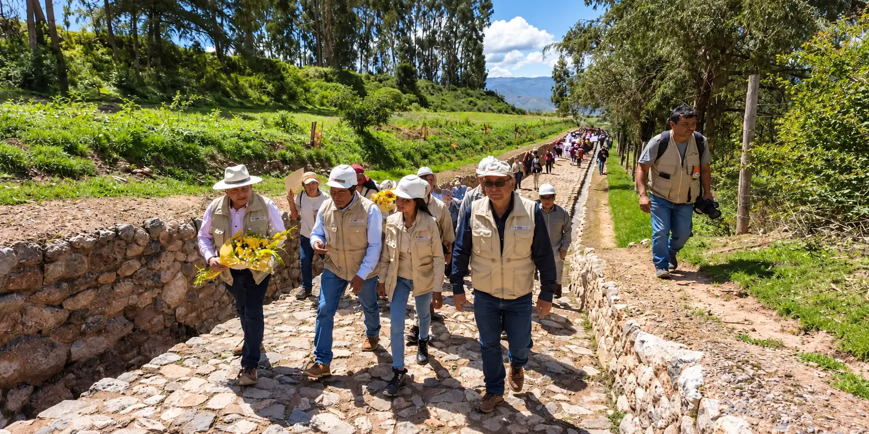
Restoration of Ñustapakana
| Responsible entity | Ministry of Culture – Decentralized Culture Directorate of Cusco (DDC Cusco) |
| Budget | More than S/ 10.6 million |
| Duration | Approximately four years and three months of work |
| Completed | December 2024 |
| Length recovered | 2.71 kilometers (1.68 miles) |
| Elements restored | Stone causeway, lateral walls, water distribution canals, flow reducers, stairways, terraces, Inca enclosures |
What Characterizes Ñustapakana?
Architecture Organized Around Water
The unique aspect of this site is the hydrological one. Everything here has been designed in order to channel water, control its speed, separate it, and let it flow downwards. While Sacsayhuamán is monumental architecture, Ñustapakana is Inca engineering in practical form.
Canals, Flow Reducers, and Hydraulic Control
On the restored path, you will notice not only canals, but also elements of reducing the flow speed of water. Andean terrain is rather steep, and fast-moving water causes erosion and damage to canals and terraces. To prevent this problem, the Incas created stepped paths and flow controllers which absorbed some of the water energy. Once you get to notice such an element, you will notice the same principle used in Tambomachay and Machu Picchu’s fountains.
Causeways, Lateral Walls, and Ceremonial Terraces
The road is built with a real stone causeway having lateral walls on both sides that mark its boundaries and demarcate it from its surroundings. Steps take care of steep gradients. Terraces are built to widen the causeway and make platforms that were almost surely used for ceremonies. The entire construction has unmistakable Inca craftsmanship.
A Path Built Into the Landscape
The road takes the contours of the landscape into consideration instead of trying to subdue it. It curves according to the slope of the hill, makes use of rock formations whenever helpful, and ascends in a gradual manner instead of tackling the slope straightaway. This method of construction of roads according to the landscape is one of the surest signs of Inca engineering.
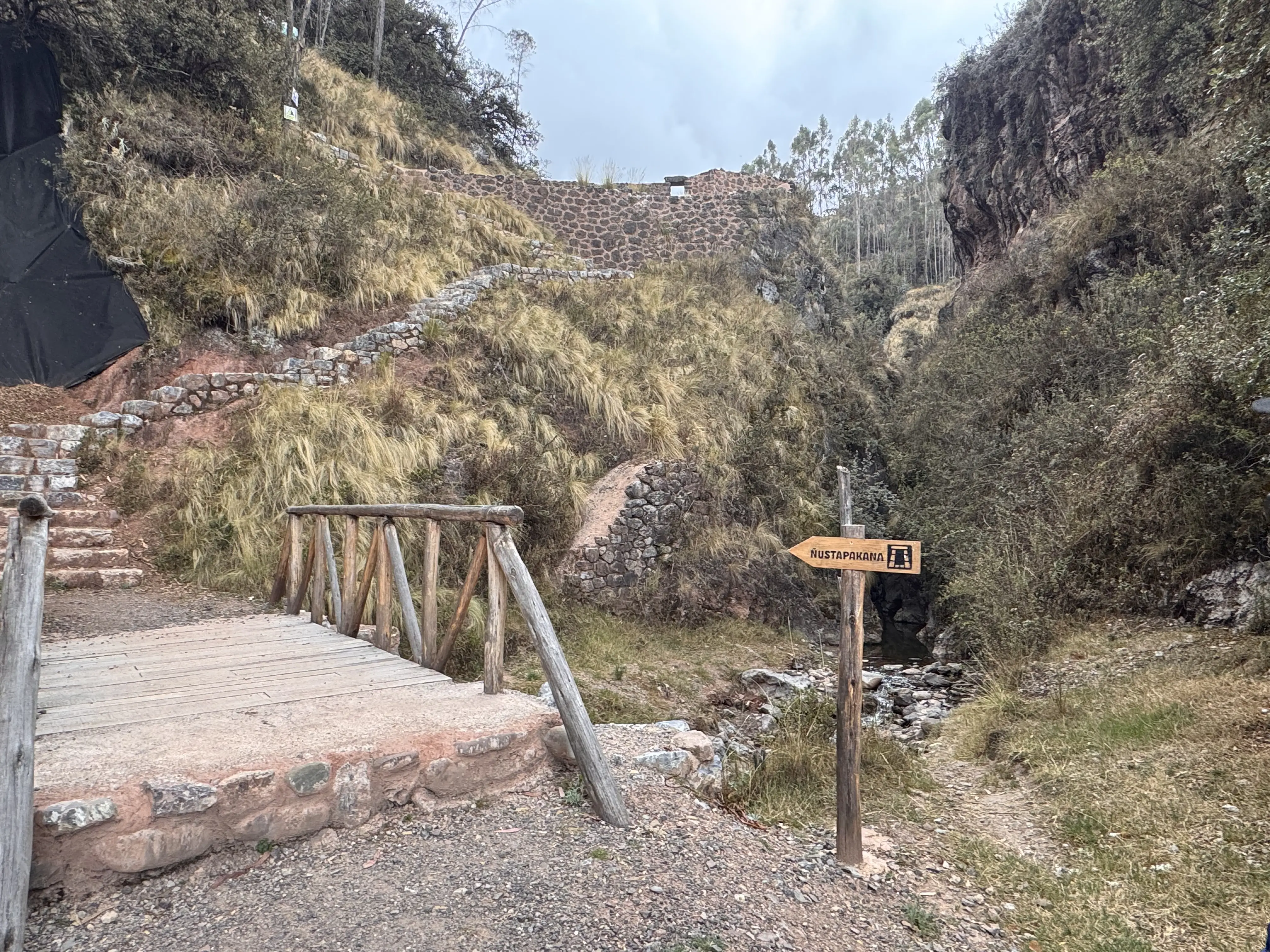
The Qorikancha and Ñustapakana Ritual Road
A 2.71-Kilometer Path Buried for Centuries
This reconstructed path is 2.71 kilometers long that once connected Qorikancha with upper regions of the park. There might be some references saying this length to be a little above two kilometers. However, the length reported by the archaeologists who conducted this project is 2.71 km.
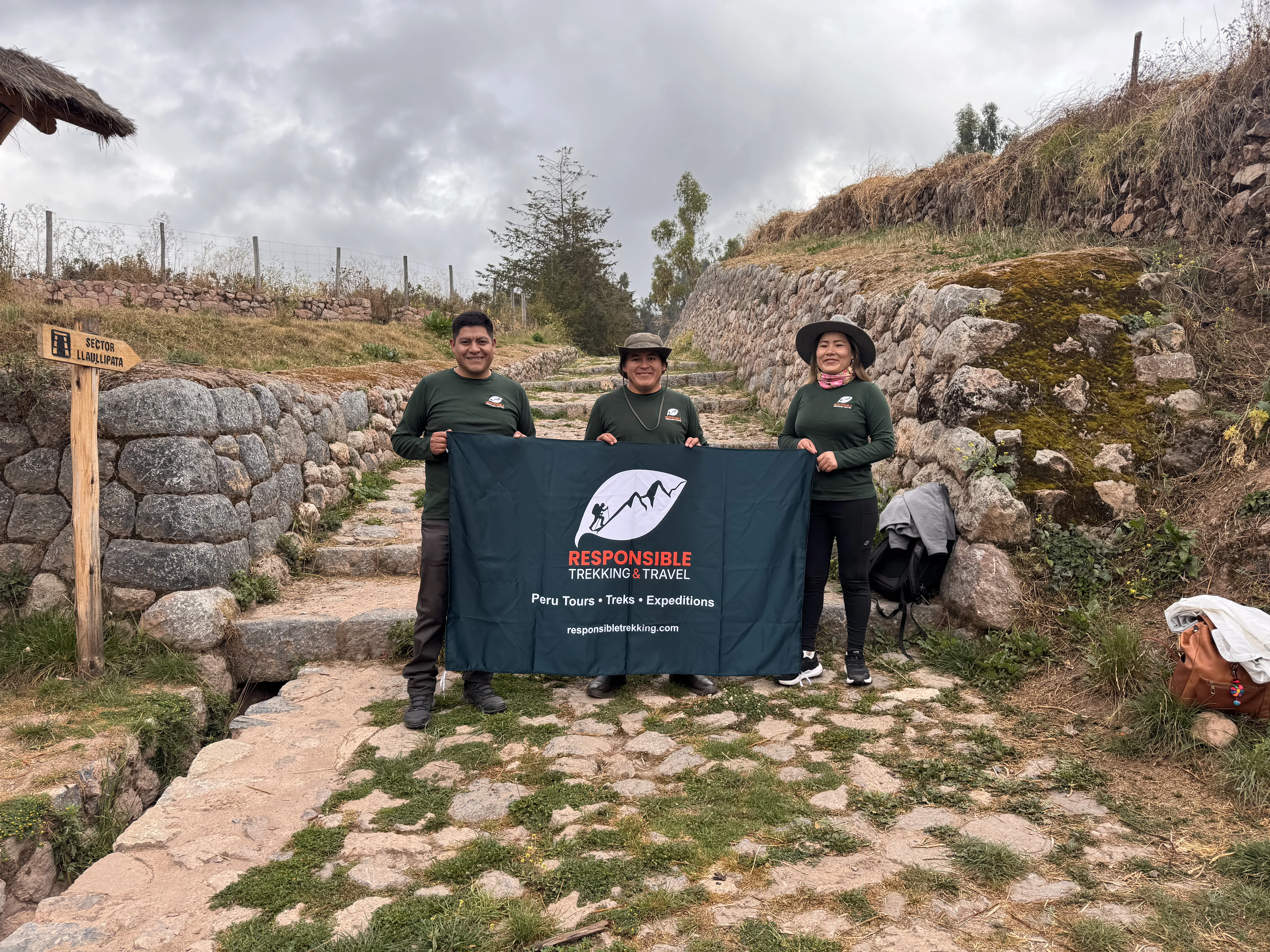
The Three Restored Sections of the Route
| Section | What you see | Character |
|---|---|---|
| Llaullipata – Wakarumiyoq | Trailhead, first stretch of causeway, canals tied to the Inca water system | Gentle warm-up, good orientation over the city |
| Wakarumiyoq – Chacán | The Devil’s Balcony natural viewpoint, rock outcrops, open hillside | Most scenic stretch, best photography |
| Chacán – Ñustapakana | Ceremonial sector, springs, terraces and enclosures | Quietest part, the ritual heart of the route |
What the Four-Year Restoration Involved
It is not enough to just clear out a path; archaeologists had to do excavations for the purpose of understanding the road's original structure. Consolidation of walls, causeways, stairways, and canals was done next by conservators. There was also an effort for integrating the landscape so that the road would not be a mismatch with its environment, as well as an outreach effort for engaging with the communities residing within the national park. This aspect is important because these communities cultivate and raise livestock in this very landscape.
Why the Inca Elite Walked This Route
As part of the renovation project, archaeologists refer to this road as ritual because it is employed in rites associated with the worship of water and its rational utilization because this is the method through which the water was channeled into the llaqta of Qosqo. From a more practical perspective, this was the road linking the most sacred temple of the empire with the source of the life-giving water of the capital city.
Why the Incas Chose This Place
The Ceremonial Springs of the Chacán Basin
Spring sites appear throughout the Chacán watershed, and they were considered sacred by the Inca. The study of the Inca ceremonial fountains of Ñustapakana and Quespehuara is focused on the manner in which such water sites were artistically shaped and enclosed as opposed to just remaining natural springs.
How Ñustapakana Supplied Water to the Llaqta of Qosqo
The water obtained in the upper moiety was channeled through channels downhill to the city sections of the Inca capital. This was no mere coincidence. Water intakes, channels, braking devices, distribution points, and the ritual road all complemented each other, and the control of this flow enabled the upper moiety to exert control over the whole capital.
The Water Cult in the Andean Worldview
Water meant life and fertility within the Andean cosmology, and it served to unite the above world with the underworld. Offerings and cleansing rituals were performed wherever water flowed out from the ground. That is how one can see the meaning behind the site. One is not seeing a construction of plumbing works with an additional temple built there.
What You Can See From Ñustapakana
Panoramic Views Over the Cusco Valley
The effort is rewarded through the vista. The views from the upper sections of the road give a direct look downward at the Cusco valley, with the historic core visible below, its red tiled rooftops and the modern city rising up on the surrounding hills. The view itself is noticeably elevated and expansive compared to the view from the esplanade of Sacsayhuamán, which is partially obstructed by the walls themselves.
The Devil’s Balcony
At the Wakarumiyoq-Chacán sector, you will see the Devil’s Balcony, which is a natural rock formation that acts as a lookout point for the region. This is obviously the place where you need to stop for water and a snap for your visit.
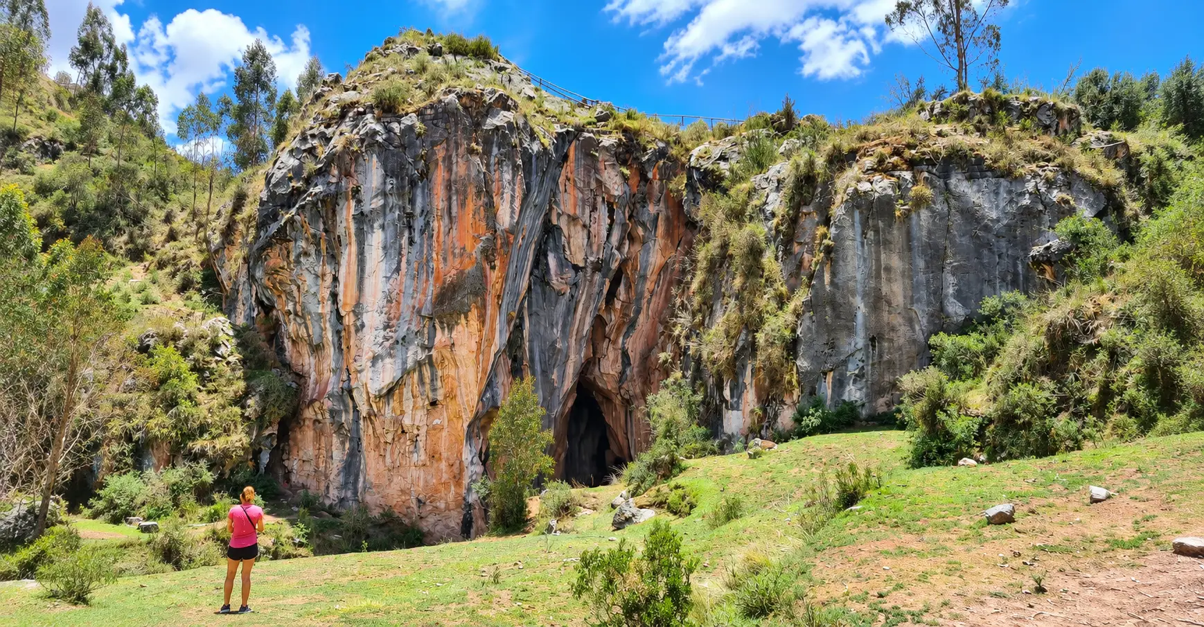
Archaeological Sites Visible Along the Way
The road is also an observation point for all of the rest of the park. You can see the esplanade of Sacsayhuamán, the terraces of the Chacán Valley, and the farming lands of the communities which exist within the park's boundaries. Have your guide show you the ancient irrigation systems cutting across the hillside they're not always easy to spot at first.
The Best Photo Spots Along the Route
For the most pristine lighting over the city and minimum chance of clouds developing in the afternoon, get up early. Devils Balcony will be at its best from around 10:30 AM to noon since the sun will be rising above the rock face. Terraces located close to the upper sector are best captured in the afternoon.
How to Get to Ñustapakana
How to Get There and What It Costs
The table below shows all the transportation methods to get to the site, the time taken and the cost involved for each method. All costs are in Peruvian soles.
| Option | How it works | Time | Approx. cost |
|---|---|---|---|
| Walk from Plaza de Armas | Climb through San Cristóbal and follow the stairways to the Llaullipata trailhead | 45–60 min uphill | Free |
| Taxi from Plaza de Armas | Take Avenida Don Bosco and continue past the Hacienda Llaullipata to the signboard | About 15 min | S/ 15–25 (agree the fare first) |
| Public transport + walk | Local bus toward the Sacsayhuamán road, then walk to Llaullipata | 30–45 min | S/ 1–2 plus walking |
| Ñustapakana ritual road | Reported as open access, outside the ticketed complex | — | Free |
| Sacsayhuamán (Circuit I ticket) | Tourist Ticket circuit covering Sacsayhuamán, Q’enqo, Puca Pucara, Tambomachay. Valid 1 day | — | S/ 70 foreign / S/ 40 national |
| Cusco Tourist Ticket (full) | 16 sites across the city, Sacred Valley and South Valley. Valid 10 days | — | S/ 130 foreign / S/ 70 national |
| Huchuy Qosqo (if extending) | Separate entrance ticket, not part of the Tourist Ticket | — | About S/ 22 |
The Cusco Tourist Ticket gives you a 50 percent reduction in price if you are between 10 and 25 years old and have your student ID. The only place where the Cusco Tourist Ticket can be purchased is from the COSITUC office on Avenida El Sol.
Walking From the Historic Center
It is possible to hike all the way from the Plaza de Armas. Start the ascent from San Cristóbal, take the staircases that will lead you to the park, and then join up with the trail in Llaullipata. This will require you to climb for 45 to 60 minutes in total before reaching the starting point of the trail.
By Taxi Along Avenida Don Bosco
It is easier to take a taxi from Plaza de Armas, which follows Avenida Don Bosco. The journey will take around 15 minutes. You should settle your price before boarding the vehicle, as there are no metered taxis in Cusco.
Finding the Trailhead
After you get past the Hacienda Llaullipata, check out the signboard that indicates the start of the hike. Here is where the road becomes paved again. Drop your pin from your phone while you still have signal, and inform your driver about whether you wish to be picked up from the same point or the opposite one.
Visiting With a Guide
You can walk the road yourself. Should you do so, however, is an entirely different matter. Few things about this road speak for themselves. The flow reducers seem like any other pieces of masonry, the canals are aligned in a way that is not obvious to the eye, and the connection between the road and the Cusco water system can only be appreciated once explained. A knowledgeable guide makes this walk memorable.
What the Walk Is Like to Ñustapakana
Distance, Duration, and Difficulty
Expect that the walk will take between one-and-a-half and two hours, taking into account your speed and stops along the way. The level of difficulty is considered intermediate. Stairs and inclines are to be found here, but altitude plays the main role against you. Provided you are in decent shape and well adapted to Cusco, everything will be alright.
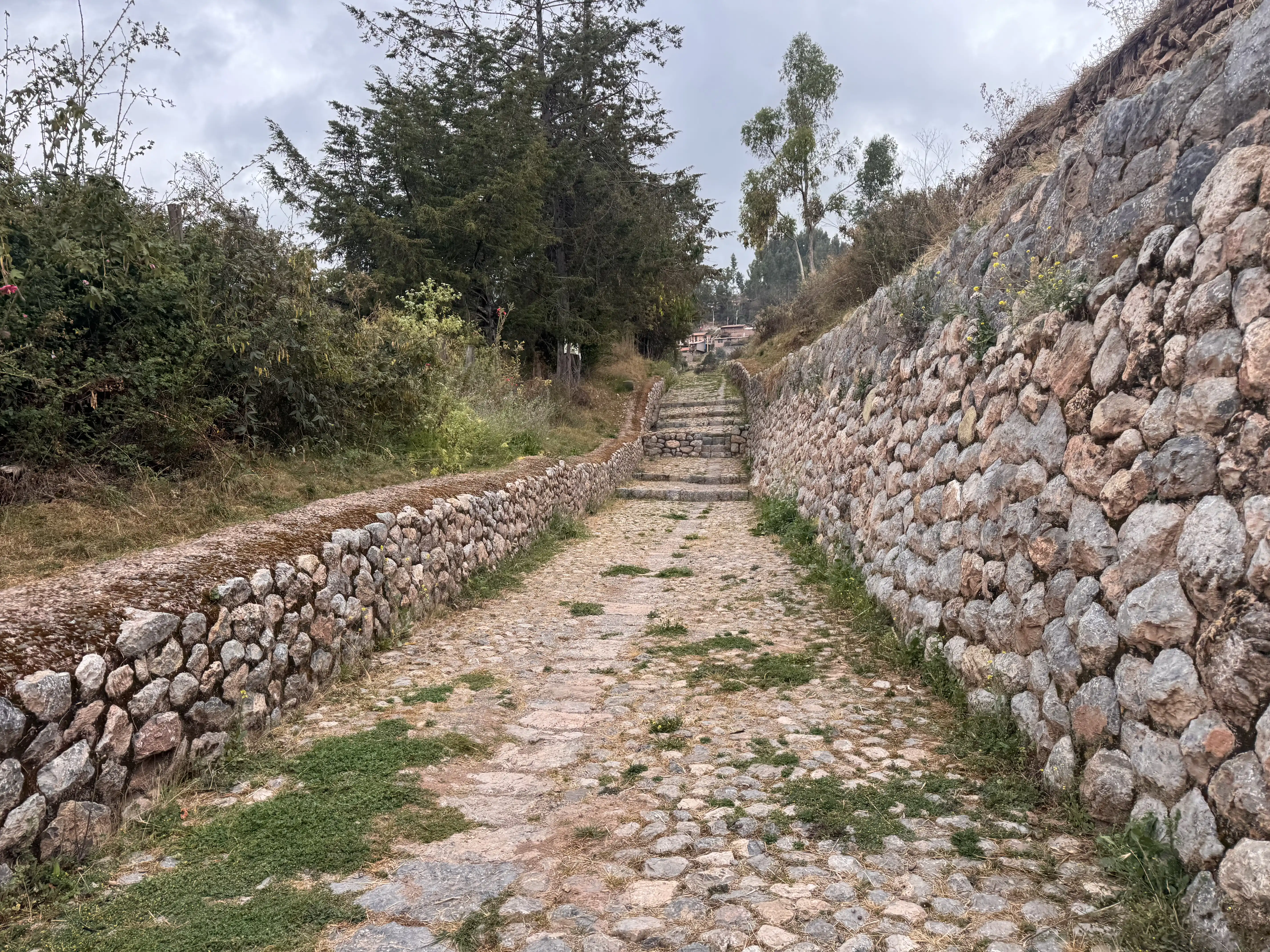
Terrain and Trail Conditions
The terrain alternates between stone causeway (restored) and earth path. The stones become slippery during the wet season, from November to March, and therefore extra care is needed, as well as better footwear. Trekking poles are useful coming down if you need the knee support.
How Ñustapakana Connects to Huchuy Qosqo
Inca Road Network outside Sacsayhuamán
It was not the end of the sacred path at the boundary of the park. It was one of the roads of the extensive Qhapaq Ñan road network that connected the capital city of Cusco to other parts of Tahuantinsuyo. Following the high ground north of the park will take one into the puna, which is the highland grassland that separates the valley of Cusco from the Sacred Valley, which is traversed by the Huchuy Qosqo trek route.
Walking Toward Chacán, Qoricocha, and the Puna
Typical Huchuy Qosqo trails start either at Tambomachay or Qoricocha lake, but not at Ñustapakana. The common factor in both is the landscape, where you can walk from the highlands of Chacán towards the puna and join the trail. Consider Ñustapakana as one stage of walking out of the city and not as the signposted beginning point of the trail.
Distance, Elevation, and Time
The distance from Qoricocha to Huchuy Qosqo is somewhere around 13-16 kilometers, while the pass height is 4,200 meters (13,780 feet) followed by a long descent. The elevation of Huchuy Qosqo is estimated at 3,600 meters (11,800 feet), and the elevation of Lamay, where it lies, is 2,938 meters. The inclusion of Ñustapakana trek further increases the walking day, hence the reason why it takes two days to complete the trek.
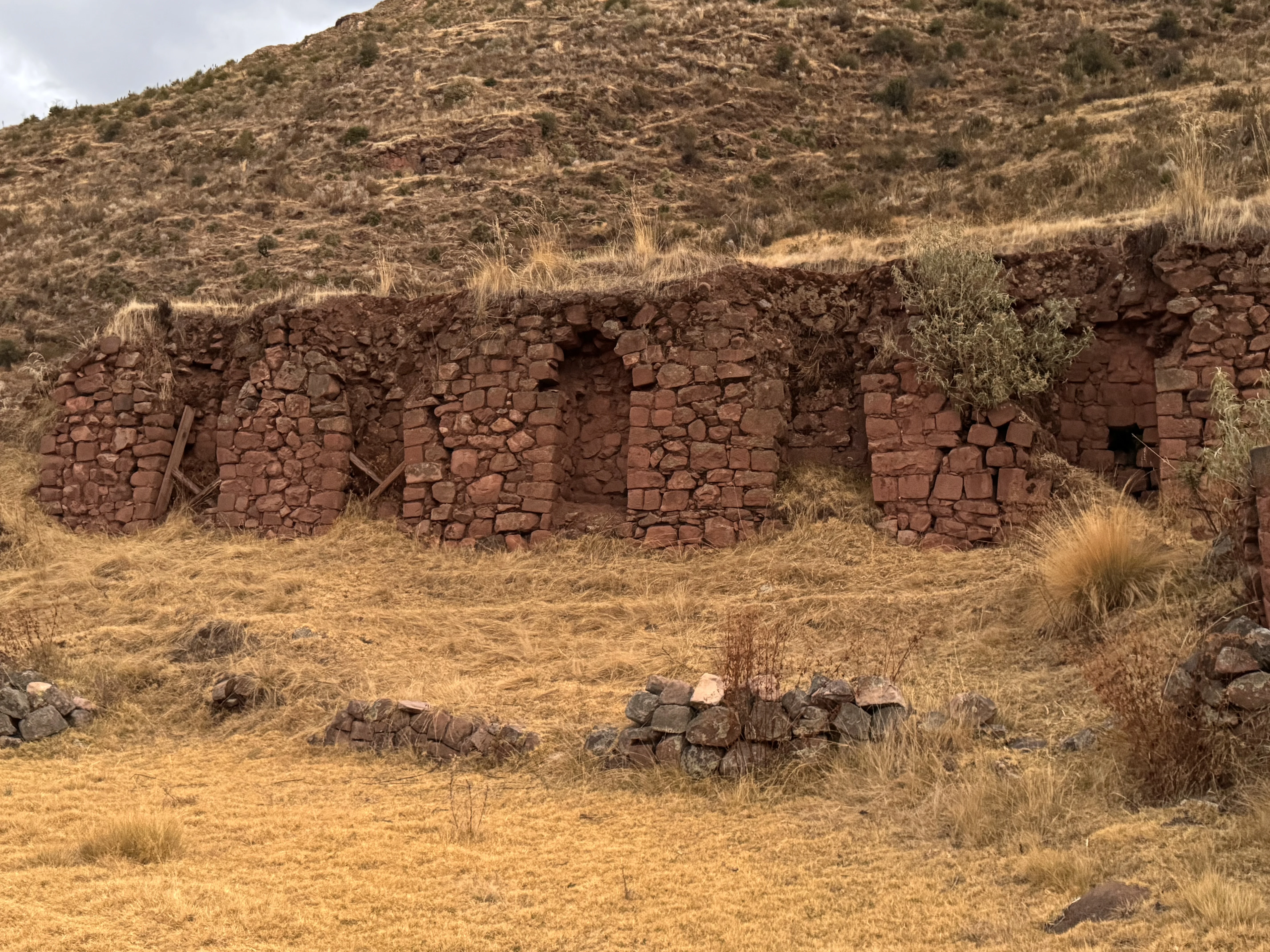
Day Hike or Two-Day Trek
As a day trek, participants drive to the trailhead, traverse the pass, see the ruins, and come down to Lamay for their return journey to Cusco. As a two-day trek, trekkers sleep in the community in the highlands and then make their way to Huchuy Qosqo on the second day, descending at a leisurely pace. The two-day trek is ideal for those wishing to add the Ñustapakana to the hike.
Descending to Lamay and Returning to Cusco
Lamay descent is the toughest section of the day. Plan on about two hours of difficult switchback descents, which will torture your knees and ankles. After reaching Lamay, you board transport back to Cusco via the Sacred Valley. Huchuy Qosqo means "Little Cusco" and was the royal property of Inca ruler Wiracocha under the older name of Kakya Qawani.
Best Time to Visit Ñustapakana
Dry Season and Rainy Season
The dry season starts from April to October, offering you the best weather, clear mornings, solid footing, and excellent views of the valley. The rain season is from November to March and offers a green environment with little traffic, but the rocks are very slippery, and the afternoon showers come regularly.
Time of Day
The morning time period outdoes all others. It has better light, clean air, comfortable weather, and avoids the afternoon rains. If you begin walking at about 7 and 9 a.m., you will enjoy your own trail.
What to Bring and How to Prepare
Altitude and Acclimatization
You will walk approximately 3,500-3,700 meters. Spend a minimum of two days in Cusco prior to beginning the hike, and more if you have just arrived from sea level. Move slowly and steadily instead of stopping and starting; drink more water than you think you need; and eat easily digestible food. The path to Huchuy Qosqo involves crossing a pass of 4,200 meters, making altitude acclimation a necessity.
Packing List
- Trekking shoes or sneakers with solid grip - the stone causeway gets slick
- Layered clothing, plus a light jacket and rain protection
- Hat, sunglasses, and high-factor sunscreen: UV at this altitude is brutal
- At least 1.5 liters of water and light snacks - there are no shops on the route
- A small first-aid kit and any personal medication
- Cash in soles for taxis and local purchases
- Trekking poles if your knees prefer them on the descent
How to Visit Responsibly
This road came back after four years of specialized work and more than ten million soles of public investment. Treat it accordingly. Stay on the marked route, never climb on walls or terraces, and leave every stone where you found it. Carry out everything you carry in.
Remember too that families live and farm inside the park. Ask before photographing people or animals, close any gate you open, and keep your distance from grazing livestock. Responsible tourism here is mostly a matter of paying attention.
Frequently Asked Questions About Ñustapakana
Is Ñustapakana worth visiting?
Yes, particularly if you have already seen the standard Cusco circuit or you enjoy walking. You get restored Inca architecture, genuine hydraulic engineering, wide views over the city, and very few other people.
Who built Ñustapakana?
The Inca built it during the imperial period, within the fifteenth- and early sixteenth-century transformation of the hills above Cusco that began under Pachacutec. The area shows earlier Killke occupation as well.
What does “Ñustapakana” mean in Quechua?
It combines ñusta, meaning princess or noblewoman, with paka, meaning to hide. The accepted reading is “the hiding place of the ñusta.”
How long does the walk take?
About an hour and a half for the 2.71-kilometer restored route, depending on pace and stops. Add 45 to 60 minutes if you walk up from the historic center instead of taking a taxi.
Is Ñustapakana free to visit?
Reports since the reopening indicate free access with no fixed hours, since the route lies outside the ticketed Sacsayhuamán complex.
Is it included in the Cusco Tourist Ticket?
The Cusco Tourist Ticket covers the Sacsayhuamán complex along with Q'enqo, Puca Pucara, and Tambomachay. The restored ritual road is reported to sit outside that ticket.
Can you hike from Ñustapakana to Huchuy Qosqo?
You can walk from the upper Chacán basin north across the puna and connect with the Huchuy Qosqo route, which normally starts at Tambomachay or the Qoricocha lagoon. It is not a signposted trail, so go with a guide who knows the crossing.
Can you visit without a guide?
Yes. The route is restored and walkable on your own. A guide adds a great deal, though, because the hydraulic features and the site's role in the Cusco water system are not obvious without explanation.
How hard is the trail?
Intermediate. Stairways, sustained slopes, and high altitude. Suitable for anyone in reasonable physical condition who has acclimatized to Cusco.