
Inti Punku, also known as the Inca sun gate, stands high in the mountains overlooking Ollantaytambo. In this complete guide, you'll find everything you need to plan your visit from its history and who built it to its location, hiking routes, entrance fees, weather, top attractions, packing tips, and essential advice for staying safe at high altitude. Let's get started.
What Is Inti Punku in Ollantaytambo?
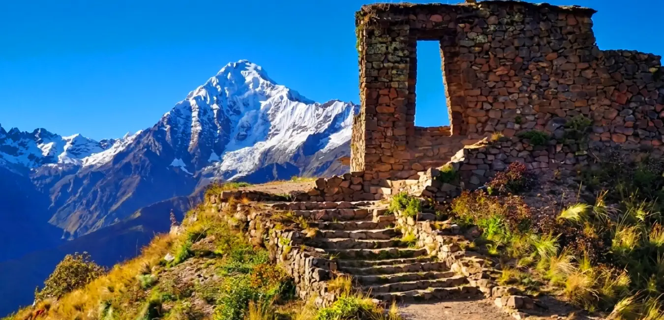
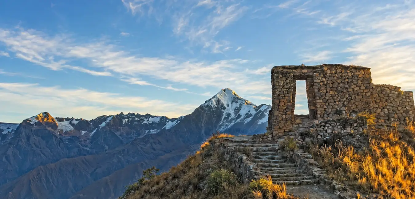
Inti Punku is an Inca ceremonial gateway with a double jamb, built of stone high in the mountains surrounding Ollantaytambo at nearly 3,900 meters (12,800 feet) above sea level. Its name means "Sun Gate" in Quechua, and its design closely resembles the famous Inti Punku on the Inca Trail, although it was constructed with rougher local stone.
Where is Inti Punku located?
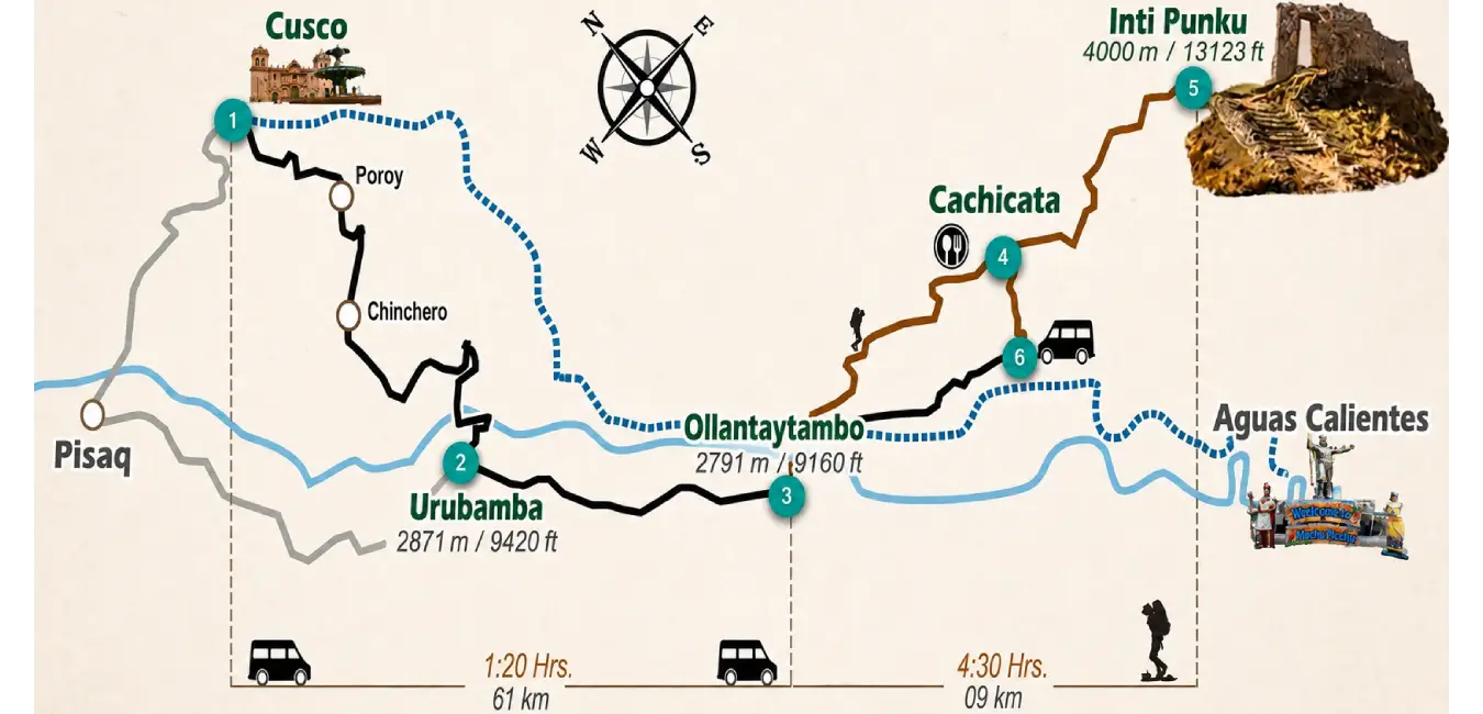
Inti Punku is located 75 km (47 miles) from the city of Cusco, high above the Kachiqhata (Cachicata) sector, on the left bank of the Vilcanota (Urubamba) River in the district of Ollantaytambo, Urubamba Province, Cusco region. In other words, it sits on the opposite side of the river from the town.
Why is it called the sun gate (Inti Punku)?
The name comes from the Quechua language, where "inti" means sun and "punku" means door or gate. Therefore, Inti Punku literally translates as "Sun Gate."
Hiking distance and duration
The exact figures vary slightly depending on the source and the GPS device used to record the route. For that reason, we've included the most reliable ranges based on currently available measurements.
Category | Classic route | Cachicata route | Notes |
Round-trip distance | 16.5 -18 km | 8 - 13.8 km | Depends on the exact starting point |
Ascent | 4 - 5 hours | 3 hours | The most physically demanding section |
Descent | 3 hours | 2 hours | Faster, but tough on the knees |
Total hiking time | 7 - 8 hours | 5 - 6 hours | Not including long breaks |
Total trip | Full day | Long half-day | Add transportation time from Cusco |
How difficult is the Inti Punku hike?
The Inti Punku hike is challenging and is classified as difficult. There are no technical climbing sections, exposed ledges, or dangerous drop offs. However, trails in this category involve long distances and steep, sustained uphill climbs. That said, if you're in reasonably good physical shape, properly acclimatized, and keep a steady pace, you'll be able to complete the hike without major difficulty.
Who is this hike for?
Recommended for | Not recommended for |
| Travelers with moderate to good fitness | Visitors who have spent less than 48 hours in the Andes |
| Travelers who have already spent at least two days acclimatizing | People with heart or respiratory conditions |
| Archaeology and mountain enthusiasts | Young children using the classic route |
| Travelers looking for uncrowded hiking trails | Those with only half a day available |
What is the altitude of Inti Punku in Ollantaytambo?
The hike begins in Ollantaytambo at approximately 2,792 - 2,807 meters (9,160 - 9,209 ft) above sea level and ends at Inti Punku, which sits between 3,874 and 3,970 meters (12,710 - 13,025 ft). This means you'll gain approximately 1,080 to 1,180 meters (3,540 - 3,870 ft) of elevation in a single day. More than the distance itself, that elevation gain is what makes this hike such a serious challenge.
Location | Approximate elevation |
| Ollantaytambo (trailhead) | 2,792 - 2,807 m (9,160 - 9,209 ft) |
| Cusco (reference) | 3,399 m (11,152 ft) |
| Inti Punku (summit) | 3,874 - 3,970 m (12,710 - 13,025 ft) |
| Veronica Mountain (viewpoint) | 5,893 m (19,334 ft) |
| Total elevation gain | 1,080 - 1,180 m (3,540 - 3,870 ft) |
Important Tip...
Above 3,500 meters (11,500 feet), the air contains roughly one-third less oxygen than at sea level. As a result, a pace that feels effortless back home can leave you short of breath within just a few minutes.
When is the best time to visit Inti Punku?
Ollantaytambo has a mild, dry climate with two distinct seasons. However, weather conditions in the mountains can change quickly, you may start your hike under bright sunshine and finish it in a hailstorm. That's why the rule is simple: always carry an extra layer and a waterproof jacket.
Category | Dry season (April - October) | Rainy season (November - March) |
Skies | Clear with snow capped peaks in full view | Cloudy; mountain peaks are often hidden |
Landscape | Brown hillsides with dry grass | Lush green valley |
Trail Conditions | Firm and dry | Muddy and slippery |
Sun | Very intense around midday | Intermittent but equally strong |
Nights | Cold, sometimes below freezing at higher elevations | Milder but more humid |
Overall Verdict | The best season for this hike | Still possible, but visibility is often limited |
Weather tip...
If your priority is photographing Waqay Willka (Mount Veronica) perfectly framed by the sun gate, plan your visit between april and october. On the other hand, if you prefer vibrant green landscapes and don't mind missing the mountain peaks, the rainy season offers a completely different and much quieter experience.
Biodiversity of Inti Punku
The trail to Inti Punku passes through several ecological zones, so the landscape changes noticeably as you gain elevation. If you'd like to learn more about the flora of the Cusco Valley, I recommend reading my blog about Native Plants of Cusco and Their Scientific Names.
Flora of Inti Punku
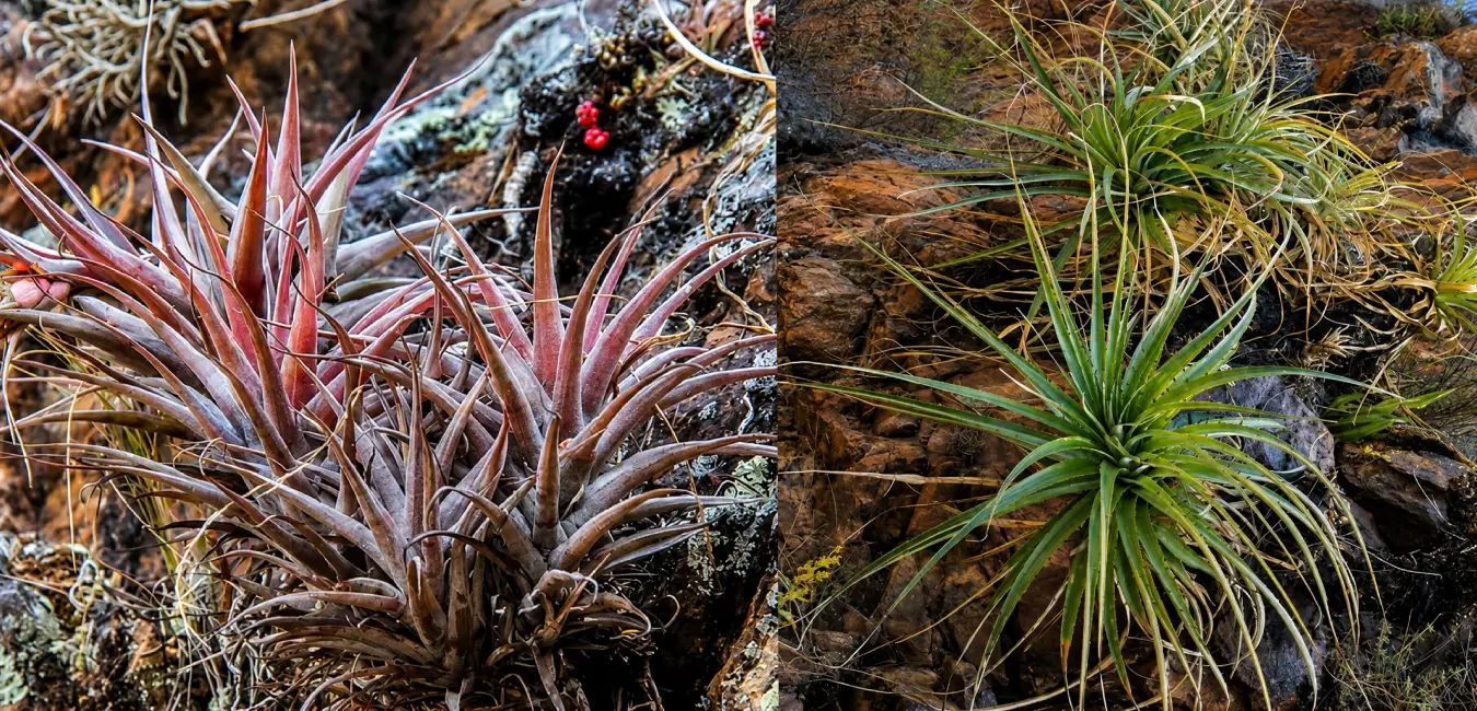
The lower sections of the trail are dominated by species adapted to the dry climate, including columnar cacti, Peruvian pepper trees, and eucalyptus. As you climb higher, you'll encounter puyas, bromeliads, tillandsias, and native orchids in the more humid areas, while the upper slopes are covered with vast ichu grasslands, a hallmark of the Andean puna ecosystem.
Wildlife at Inti Punku
The wildlife reflects this remarkable diversity of ecosystems. Along the trail, you may spot Andean condors, caracaras, and several species of birds of prey. In addition, the Sacred Valley is home to nearly 30 species of hummingbirds, including two endemic species. The surrounding mountains also provide habitat for llamas, alpacas, Andean foxes, deer, and vizcachas, especially among the rocky, high altitude terrain.
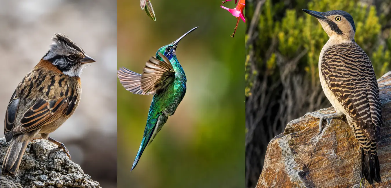
Archaeological sites along the Inti Punku trail
As you hike toward the Sun Gate, you'll enjoy the breathtaking scenery of the Sacred Valley while discovering remarkable examples of Inca engineering. Along the way, you'll visit an ancient quarry, funerary sites, and other archaeological remains that reveal how the Incas built their monuments, organized their territory, and expressed their deep spiritual beliefs. Let's get started!
Highlights of the Inti Punku Ollantaytambo hike
The Inca bridge and the Vilcanota river crossing
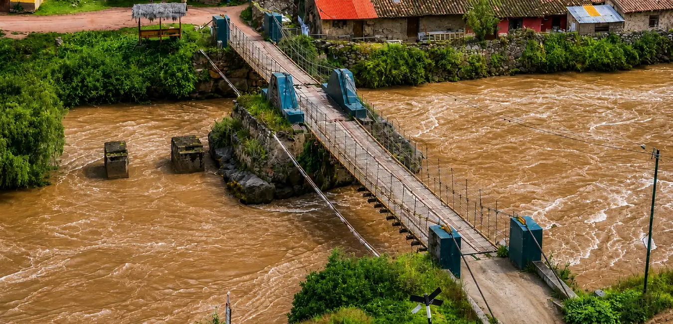
Leaving the main square behind, you'll cross the river via the historic Inca bridge. From there, the town quickly disappears from view as the trail begins climbing almost immediately. Look up and you'll see the impressive agricultural terraces of the Ollantaytambo fortress towering above the valley.
The Kachiqhata Quarries: The archaeological heart of the trail
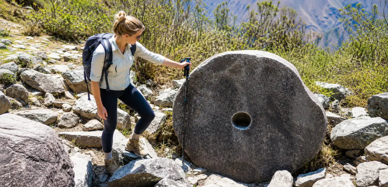
Without a doubt, this is the section that transforms the hike into an open air archaeology lesson. At Kachiqhata, the Incas quarried and shaped the massive stone blocks that now support the Temple of the Sun in Ollantaytambo. Architect Jean Pierre Protzen devoted entire chapters of his research to this site, documenting the quarrying methods, transportation techniques, and finishing process used by Inca stonemasons.
You'll still find:
- Tired stones: enormous stone blocks abandoned halfway through transport, frozen in time exactly where the work stopped.
- Stone transport ramps: the pathways used to move the megaliths downhill toward the river and eventually to the temple.
- Stone carving workshops: work surfaces marked by hammering and blocks preserved at different stages of completion.
- The true scale of the project: seeing the site in person makes it easy to understand why Ollantaytambo was never fully completed.
What to see at Inti Punku
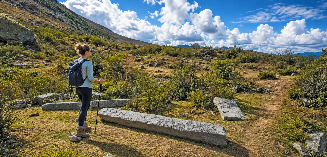
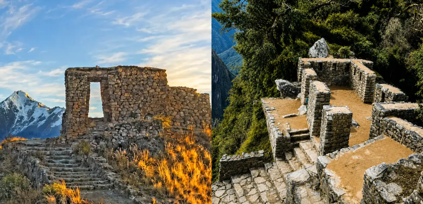
After climbing the final ridge, the gateway finally comes into view. It features a double-jamb entrance built with locally sourced stone that is rougher than the finely carved masonry found in the Ollantaytambo fortress, yet its design is strikingly similar to the famous Inti Punku at Machu Picchu.
Three things you shouldn't miss
- The gateway and Its alignment: when viewed through the opening, mount Veronica is framed with remarkable precision. That alignment is no coincidence.
- Waqay Willka (mount Veronica): standing directly in front of the gateway, its twin glaciated peaks rise above the northern slopes of the sacred valley and seem almost close enough to touch.
- The entire sacred valley: from this viewpoint, it becomes immediately clear why the Incas chose this extraordinary landscape.
Places to visit near the sun gate of Ollantaytambo
Since you're already in Ollantaytambo, make the most of your visit. These nearby attractions pair perfectly with the hike and create a well rounded itinerary through the sacred valley.
Place | Distance | Why visit? |
| Ollantaytambo archaeological site | In town | Home to the temple of the sun, massive terraces, and the fortress where Manco Inca resisted the spanish. |
| Pinkuylluna viewpoint | In town | Ancient Inca storehouses and the best panoramic view of Ollantaytambo with a short uphill hike. |
| Cachicata quarries | Along the hiking route | See the famous "tired stones," transport ramps, and ancient Inca stone carving workshops. |
| Maras salt mines | 40-minute drive | More than 4,500 salt pools that have been in continuous use since pre Inca times. |
| Moray | 1-hour drive | Circular agricultural terraces believed to have served as an Inca farming laboratory. |
| Pisac | 1 hour 30 minutes | A spectacular archaeological complex and one of Peru's most famous traditional markets. |
| Abra málaga pass | On the road to Quillabamba | Historic mountain pass used by Manco Inca, with incredible viewpoints overlooking Mount Veronica. |
| Machu Picchu | Train from Ollantaytambo | The obvious choice the train station is located right in town. |
Mysteries and fascinating facts about Inti Punku
- Two sun gates, one name: The Inti Punku of Ollantaytambo and the Inti Punku of Machu Picchu share the same name, purpose, and a remarkably similar design, even though they are separated by many miles and nearly 1,200 meters (3,940 feet) in elevation.
- The "Interdimensional" gateway: Some tour operators promote it as a mystical or multidimensional portal. That's marketingnot archaeology. Even so, standing beneath the gateway creates a powerful sense of crossing into another world, which helps explain how the legend began.
- No iron, no wheels: Jean Pierre Protzen demonstrated that Inca stonemasons shaped these enormous blocks using rounded river stones as hammer tools. No lost technology just extraordinary engineering, patience, and organization.
- The "Tired stones": The abandoned blocks scattered along the trail weren't forgotten by accident. They are tangible evidence of construction that came to an abrupt halt during the spanish conquest.
Differences between the Inti Punku of Ollantaytambo and the Inti Punku of Machu Picchu
Did you know there are actually two Inti Punku (sun gates) in the Cusco region? One marks the final stretch of the Inca trail, offering the iconic first view of Machu Picchu, while the other stands directly across from mount Veronica in the sacred valley.
Feature | Inti Punku of Ollantaytambo | Inti Punku of Machu Picchu |
| Access | Free no permit or admission ticket required | Requires a Machu Picchu entrance ticket or an Inca trail permit |
| Elevation | 3,874 - 3,970 m (12,710 - 13,025 ft) | 2,745 m (9,006 ft) |
| Main View | Mount Veronica and the sacred valley | Machu Picchu citadel |
| Crowds | Very low solitude is almost guaranteed | Busy throughout the year |
| Starting Point | Ollantaytambo main paza or Cachicata | Machu Picchu or Km 82 of the Inca Trail |
Why should you visit Inti Punku?
Inti Punku offers something that Machu Picchu can rarely provide today: silence, space, and the genuine satisfaction of reaching an extraordinary place under your own power.
- Archaeological value: It's one of the few places where you can follow the entire Inca construction process from quarry to trail, transport ramps, and the final destination all in a single hike.
- Historical value: The site belonged to the royal estate of emperor Pachacuti and formed part of the Qhapaq Ñan, the vast road network that connected the entire Inca empire.
- Cultural value: The gateway aligns the sun, the sacred mountain (Apu), and the sacred valley in a single visual axis, reflecting how the Incas designed their monuments in harmony with the landscape not against it.
- The experience: Crowds are almost nonexistent. In a valley where nearly every attraction is busy, that kind of solitude has become a luxury.
Travel options from Cusco to Inti Punku
Every trip to Inti Punku begins in Ollantaytambo, so your first step is getting to the town. Fortunately, transportation is easy, frequent, and affordable throughout the day.
Getting from Cusco to Ollantaytambo
If you're staying in Cusco, you have several transportation options to reach Ollantaytambo. Choose the one that best fits your travel style. Here are a few helpful tips to make your hike to Inti Punku as smooth as possible.
By shared van or minibus (The most popular option)
Head to pavitos street, near puente Grau in Cusco's historic center, where you'll find plenty of shared vans and minibuses heading to the sacred valley.
- Take a direct vehicle to Ollantaytambo. The journey covers approximately 75 km (47 miles).
- Travel time ranges from 1 hour 40 minutes to about 2 hours, depending on traffic.
- Fares usually start at around S/10 (10 Peruvian soles) per person.
- If you plan to hike the same day, leave Ollantaytambo before 6:00 a.m.
- Bring cash in Peruvian soles to pay your fare, although many drivers now also accept Yape.
By private taxi
If you prefer comfort or are short on time, a private taxi can take you directly to the main square or even near the Inca bridge. Expect to pay around S/15 per person when sharing the ride, or more if hiring the vehicle privately. It's the fastest and most convenient option, especially if you're traveling with a group or carrying luggage.
Spending the night in Ollantaytambo (my top recommendation)
This is the option i recommend most. Spend the night in Ollantaytambo and begin your hike between 7:00 and 8:00 a.m. You'll avoid hiking under the intense midday sun and enjoy the trail without feeling rushed.
Did you know?
Ollantaytambo sits at 2,792 m (9,160 ft), which is about 600 meters (2,000 feet) lower than Cusco. Spending the night here not only saves you an early morning commute, but also allows you to sleep better and acclimatize more comfortably before your hike.
Hiking routes to Inti Punku
There are two hiking routes to Inti Punku, and both lead to the same sun gate. However, they differ significantly in terms of effort, hiking time, and logistics. Here's how they compare.
Route 1: From Ollantaytambo main plaza (the classic route)
- Starting Point: Ollantaytambo's main plaza, crossing the historic Inca bridge over the Vilcanota river.
- Distance: Approximately 9 km (5.6 miles) uphill; 16.5 - 18 km (10.3 - 11.2 miles) round trip.
- Time: About 4 - 5 hours uphill and approximately 3 hours downhill.
- Advantage: You experience the complete trail, including the fascinating Kachiqhata quarries.
- Disadvantage: Requires good physical fitness and takes an entire day.
Route 2: From Cachicata church (the short route)
- Starting point: The village of Cachicata, accessible by vehicle.
- Distance: Approximately 4 km (2.5 miles) uphill on a marked trail.
- Time: About 3 hours to reach Inti Punku.
- Advantage: Reduces both the elevation gain and total hiking time considerably.
- Disadvantage: You'll miss the first section of the trail and the historic Inca Bridge.
Which route should you choose?
I recommend driving to Cachicata and hiking back down to Ollantaytambo. This way, you'll still experience the impressive quarries without tackling the full elevation gain. Some local operators also offer horseback rides from Ollantaytambo, which typically take around eight hours round trip.
How to visit the sun gate of Ollantaytambo on your own
Both options are excellent, but they suit different types of travelers. Compare them before deciding which experience is right for you.
Comparison: Visiting Inti Punku independently vs. With a Tour
Criteria | Independent travel | Guided tour |
| Cost | Much more affordable | Higher price, but everything is included |
| Logistics | You organize transportation, meals, and timing yourself | Everything is taken care of, including pickup, transportation, and meals |
| Historical Context | You see the ruins, but interpretation is up to you | A guide explains the quarries, transport ramps, and Inca worldview |
| Safety | You're on your own if something goes wrong | Guide, first-aid kit, and emergency support included |
| Flexibility | Complete freedom to hike at your own pace | Follows the group's itinerary |
| Local Impact | Less economic benefit for the local community | Supports local guides and businesses in Ollantaytambo |
Traveler's tip...
If you're an experienced hiker, well acclimatized, and familiar with high-altitude trekking, visiting on your own is a great option. However, if this is your first hike in the Andes, you're traveling solo, or you want to truly understand what you're seeing, hiring a guide completely transforms the experience. They won't necessarily get you there faster but they'll help you get much more out of the journey.
Frequently asked questions about Inti Punku
Is there an entrance fee for Inti Punku?
No. There is currently no admission fee to visit Inti Punku in Ollantaytambo. The trail is open to the public and does not require a tourist ticket or a permit. Your only expenses will be transportation, food, and any guide service you choose to hire.
Do i need a guide to hike to Inti Punku?
No. The trail is generally easy to follow, especially if you use an offline map such as Maps.me or another GPS app. However, if you're interested in learning about the archaeological sites, Inca engineering, and the history of the area, hiring a local guide will make the experience much more meaningful.
Can i visit Inti Punku during the rainy season?
Yes. The hike is possible throughout the year. However, between November and March, the trail can become muddy and slippery, and clouds often obscure the views of Mount Veronica (Waqay Willka). If you plan to hike during this season, wear waterproof hiking boots and bring quality rain gear.
Is Inti Punku suitable for children?
It depends on the route and the child's hiking experience. The classic route from Ollantaytambo is long and physically demanding, making it more appropriate for teenagers or children who are already accustomed to mountain hiking. Families with younger children may find the shorter Cachicata route to be a better option.
Is camping allowed at Inti Punku?
No. There are currently no designated campsites or tourism facilities at the site. Most visitors complete the hike as a full-day excursion and return to Ollantaytambo the same afternoon.
Can i combine Inti Punku with other attractions in the Sacred Valley?
Absolutely. Many travelers combine the hike with visits to the Ollantaytambo Archaeological Site, the Pinkuylluna Storehouses, the Maras Salt Mines, Moray, or even continue by train to Machu Picchu. Spending the night in Ollantaytambo also makes it easy to explore more of the Sacred Valley at a relaxed pace.
Is there cell phone service on the trail?
Cell coverage is available in some sections near Ollantaytambo, but it becomes unreliable or disappears completely as you gain elevation. Download offline maps before starting the hike and avoid relying solely on a mobile signal for navigation.
Are there restrooms or places to buy food along the trail?
No. Once you leave Ollantaytambo, there are no public restrooms, restaurants, or shops along the route. Bring enough water, snacks, and any personal supplies you'll need for the day.
What should i pack for the hike?
Pack light but be prepared for rapidly changing mountain weather. A daypack should include:
- Plenty of water
- High-energy snacks
- Waterproof jacket
- Warm layer or fleece
- Hat and sunscreen
- Hiking poles (optional but recommended)
- Offline map or GPS app