
The Santa Cruz Trek is a multi day hike through the Cordillera Blanca in Huaraz, Peru. The route covers approximately 47 km (29 miles), reaches an elevation of 4,750 m (15,583 ft) at Punta Unión Pass, and passes through Huascarán National Park. The trek ranges from moderate to challenging, so good physical preparation and proper acclimatization are essential. If you’re looking for a multi day trek that combines spectacular high altitude scenery with an authentic experience in the Andes, Santa Cruz is an excellent choice.
What is the Santa Cruz Trek?
The Santa Cruz Trek is a linear trek that crosses the heart of the Cordillera Blanca, within Huascarán National Park, in the Áncash region. The route connects two valleys: the Santa Cruz Valley and the Huaripampa Valley. Between them lies Punta Unión Pass, located at 4,750 meters (15,584 feet) above sea level.
Location of the Santa Cruz Valley
The Santa Cruz Valley is located in the Callejón de Huaylas, the valley that separates the Cordillera Blanca from the Cordillera Negra and through which the Santa River flows. In other words, you’ll be hiking through one of the densest high mountain landscapes on the planet.
Did you know…
The Cordillera Blanca is the highest tropical mountain range in the world, home to around 600 glaciers and approximately 300 glacial lakes within just 340,000 hectares of protected land, recognized by UNESCO.
How many miles is the Santa Cruz Trek?
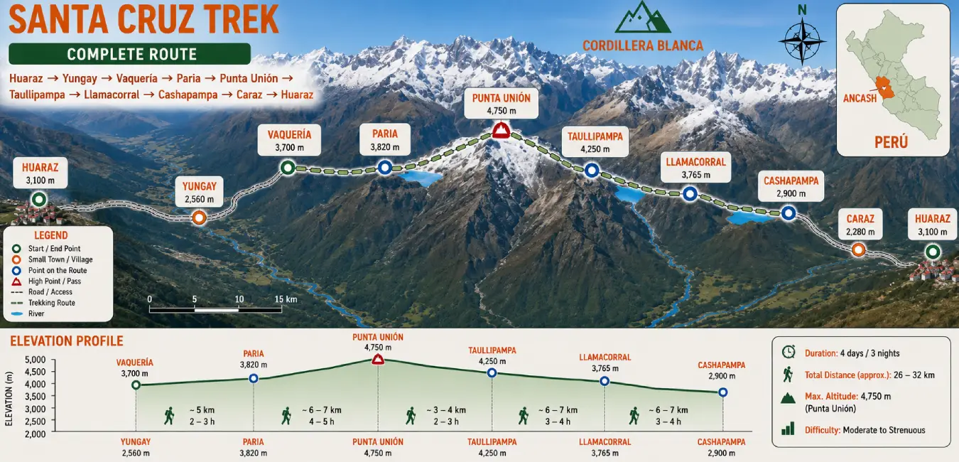
The Santa Cruz Trek covers approximately 47 km (29 miles) between Cashapampa and Vaquería. The distance may vary slightly depending on the itinerary chosen and any side trips along the way.
Why is the Santa Cruz Trek so popular?
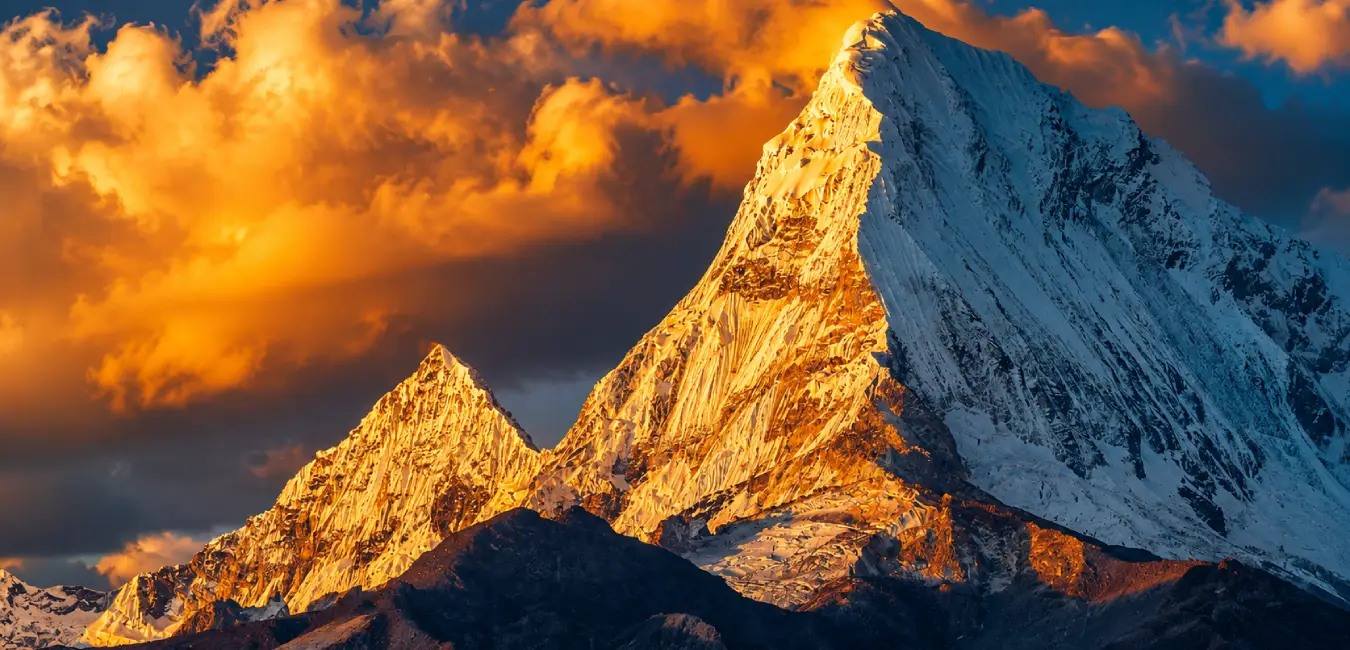
It is popular because it crosses the heart of the Cordillera Blanca and brings together some of the most impressive landscapes in the Andes along a single route. You’ll hike among turquoise lakes, Andean valleys, and enormous glaciated mountains, with unforgettable views of legendary peaks such as Alpamayo and Artesonraju.
Where does the name Santa Cruz come from?
The name comes from the Santa Cruz Valley, which in turn takes its name from Santa Cruz Mountain, rising to 6,259 m (20,535 ft), also locally known as Pucaraju. This mountain is located alongside the Pucahirca peaks.
How high does the Santa Cruz Trek reach?
The elevation changes constantly throughout the hike. You can start at around 2,900 m (9,514 ft) and finish by crossing Punta Unión at 4,750 m (15,584 ft). The campsites are also located at significant elevations, ranging from approximately 3,760 to 4,250 m (12,336 to 13,944 ft). That’s why preparing for this route depends not only on how far you can hike, but also on acclimatization.
Route Point | Elevation | What It Represents |
| Huaraz | 3,100 m (10,171 ft) | Base city and acclimatization point |
| Cashapampa | 2,900 m (9,514 ft) | Southern start (or finish) of the trek |
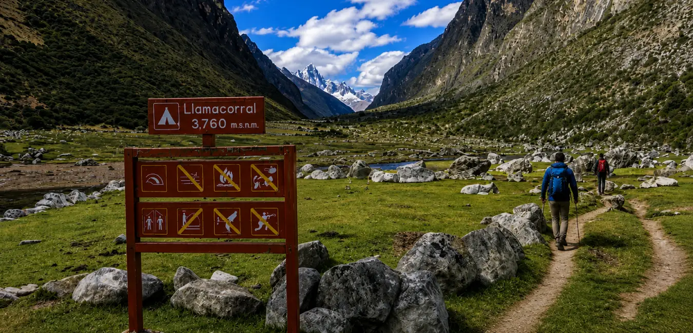
| Llamacorral Campsite | 3,760 m (12,336 ft) | First campsite when coming from the south |
| Taullipampa Campsite | 4,250 m (13,944 ft) | Highest campsite on the route |
| Punta Unión Pass | 4,750 m (15,584 ft) | Highest point and main viewpoint |
| Paria Campsite | 3,800 m (12,467 ft) | Campsite in the Huaripampa Valley |
| Vaquería | 3,700 m (12,139 ft) | Northern start (or finish) of the trek |
Key fact...
The total elevation gain exceeds 1,800 meters (5,906 ft) if you hike from Cashapampa, while the total descent exceeds 1,000 meters (3,281 ft). As a result, you need to train not only for uphill sections; you also need strong knees and, preferably, trekking poles for the long descents.
How the Santa Cruz Trek landscape was formed
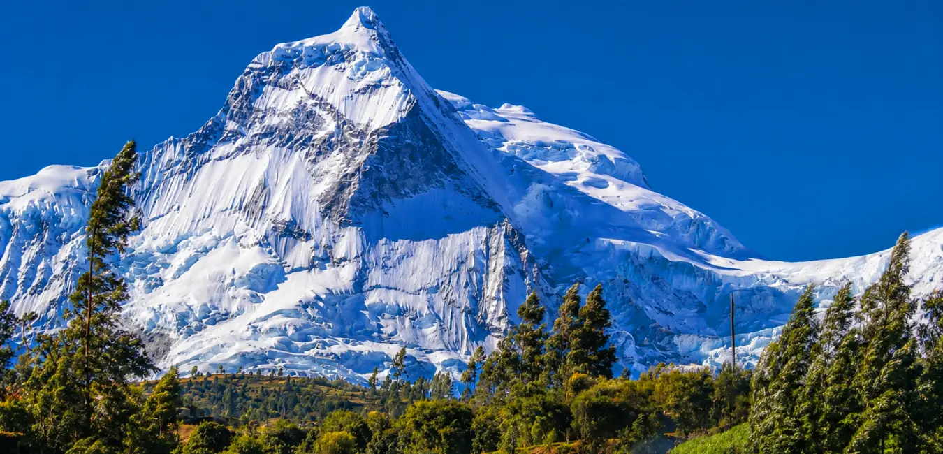
The landscape you’ll cross in Santa Cruz has two forces that shaped its formation: fire and ice. First came magma, and later, glaciers carved the landscape that remained. This combination explains much of what you’ll encounter in Santa Cruz: deep valleys, granite walls, glacial lakes, and enormous snow covered peaks.
The history preserved in the Santa Cruz Valley
Long before travelers began arriving in Huaraz to go trekking, these mountains were already part of the routes used by Andean communities. The trails in the area connected different valleys and allowed communities to exchange products. The region also preserves important archaeological remains associated with cultures such as Chavín and Wari.
Did you know…
The Cordillera Blanca entered the world mountaineering map in the mid 20th century, when Austrian, German, French, and Italian European expeditions, in particular, opened routes on its peaks. Alpamayo (5,947 m / 19,511 ft) gained particular fame: in 1966, following an international survey, it was proclaimed “the most beautiful mountain in the world,” a title it still carries today.
Creation of Huascarán National Park
Five years later, on July 1, 1975, the Peruvian government created Huascarán National Park through Supreme Decree No. 0622-75-AG, covering 340,000 hectares. UNESCO recognized it as a Biosphere Reserve in 1977 and as a World Natural Heritage Site in 1985. Therefore, when you pay your entrance fee, you are directly contributing to the conservation of a protected area with two international recognitions.
How to get to the Santa Cruz Trek
Reaching the trailhead involves three connected legs: Lima to Huaraz, Huaraz to the starting village, and finally, transportation back from the endpoint.
Most common routes to the Santa Cruz Trek
Not everyone hikes the Santa Cruz Trek the same way. Here, you can choose between different routes and variations that cross valleys, lakes, and mountain passes in the Cordillera Blanca. This will help you choose the route that best fits your time, experience, and appetite for adventure.
Step 1: Lima to Huaraz
Virtually all international travelers arrive at Jorge Chávez International Airport in Lima. From there, you have two alternatives:
Option | Duration | Approximate Cost | Pros and Cons |
| Bus (recommended) | Approx. 8 hrs. | S/ 60 - 150 | Frequent daytime and overnight departures. Sleeper services are comfortable and reliable. In addition, the gradual ascent helps with acclimatization. |
| Plane | Approx. 1 hr. | US$ 85 - 150 | Fast, but frequencies are limited and irregular. It also exposes you to a sudden change in elevation. |
| Private car or taxi | 7 - 8 hrs. | Variable | Offers flexibility, although the mountain road requires experience and careful attention. |
Our recommendation…
Take the bus. The road climbs from sea level to Conococha Pass (4,020 m / 13,189 ft) before descending to Huaraz, and this gradual elevation profile prepares your body better than a direct flight.
Step 2: Huaraz to the Trailhead
Toward Vaquería (northern trailhead, 3,700 m / 12,139 ft)
Vaquería is on the other side of the Cordillera Blanca, so the transfer takes between 3 and 4 hours and crosses the spectacular “Portachuelo de Llanganuco Pass” (4,767 m / 15,639 ft). If you’re traveling independently, you’ll need to connect two forms of transportation:
1. Huaraz to Yungay: Take a colectivo or combi from the terminal, approximately S/ 5 to 10 and 1 hour of travel.
2. Yungay to Vaquería: Take a colectivo that crosses Llanganuco and Portachuelo, costing between S/ 20 and 30 and taking about 2 to 3 hours. It leaves early, so arrive in Yungay before 7:00 a.m.
Toward Cashapampa (southern trailhead, 2,900 m / 9,514 ft)
Cashapampa is located above Caraz, in the same Callejón de Huaylas, so access is simpler and faster:
3. Huaraz to Caraz: Take a colectivo from the terminal, approximately S/ 7 to 12 and 1.5 hours.
4. Caraz to Cashapampa: Take a colectivo from the central market, around S/ 10 and 1 hour.
What are the routes for the Santa Cruz Trek?
The trek can be done in two directions, and both follow the same trail. However, the experience changes considerably depending on where you start because the order in which you gain elevation matters to your body.
Aspect | Cashapampa to Vaquería (south to north) | Vaquería to Cashapampa (north to south) |
| Starting elevation | 2,900 m (9,514 ft) | 3,700 m (12,139 ft) |
| Elevation gain | Gradual, spread over two days | Rapid, concentrated at the beginning |
| Day of the pass | Day 3 | Day 2 |
| First day | Long, hot, and dusty climb | Easy, mostly downhill day toward Paria |
| Final days | Descent toward Portachuelo | Continuous descent to Cashapampa |
| Ideal for | Those with limited prior acclimatization | Those who have already spent 3 or more days at high altitude |
| Return transportation | From Vaquería, crossing Llanganuco | From Cashapampa via Caraz, with more frequent transportation |
Comparison of Vaquería to Cashapampa vs. Cashapampa to Vaquería
Vaquería to Cashapampa | Cashapampa to Vaquería | |
| Starting point | 3,700 m (12,139 ft) | 2,900 m (9,514 ft) |
| Punta Unión | Day 2 | Day 3 |
| Initial difficulty | Easier | More demanding |
| Best for | Well acclimatized hikers | First time trekkers |
| Advantage | Reach the pass early | Gradual ascent |
Which direction is best for you?
- If your acclimatization period was short. Choose Cashapampa to Vaquería. You start 800 meters (2,625 ft) lower and reach Punta Unión on the third day, after having two days of adaptation behind you. The trade off is a tough first day: a sustained climb along a dry trail exposed to the sun.
- If you’re already acclimatized. The Vaquería to Cashapampa option can be much more comfortable. The first day is easy, you reach the mountain pass early, and much of the rest of the route is downhill. After acclimatizing with routes such as Wilcacocha, Churup, or Laguna 69, this option allows you to enjoy the Santa Cruz Trek at a more relaxed pace.
Less traveled variations
- Santa Cruz in 3 days: Combines hiking days and eliminates one campsite. It works if you’re well acclimatized and maintain a good pace, but it sacrifices optional side trips.
- Santa Cruz + Alpamayo Base Camp: Adds the climb into the Arhuaycocha Valley to get a closer look at Alpamayo. It adds between 2 and 4 hours.
- Santa Cruz + Laguna 69: Several agencies combine the trek with the region’s most famous lake, taking advantage of the route through Llanganuco.
- Cedros + Alpamayo: A long 8 to 12 day circuit that includes Santa Cruz. Only for experienced hikers with plenty of time.
What is the recommended Santa Cruz Trek itinerary?
Below, we detail the classic 4 day itinerary traveling from Vaquería to Cashapampa. If you hike in the opposite direction, simply read the days in reverse order.
Day 1: Huaraz - Yungay - Vaquería - Paria Campsite
Transfer: 3 to 4 hours by vehicle, crossing Llanganuco and Portachuelo (4,767 m / 15,639 ft).
- Hiking: 4 to 5 hours.
- Distance: approx. 11 km (6.8 miles).
- Elevation: from 3,700 m (12,139 ft) to 3,800 m (12,467 ft) at Paria Campsite.
The perfect start to the Santa Cruz Trek
The day starts early with an immediate reward: the road to Vaquería winds past the Llanganuco lakes and climbs to a viewpoint overlooking Huandoy, Pisco, and Chopicalqui. After lunch, you begin hiking, descend to the Huaripampa hamlet, and continue through the valley of the same name among fields, eucalyptus trees, and queñuales.
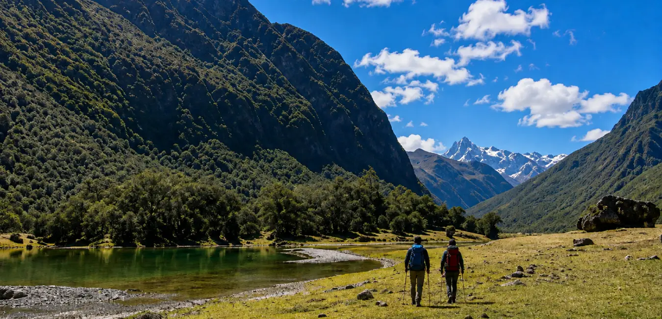
Day 2: Paria Campsite - Punta Unión Pass - Taullipampa Campsite
- Hiking: 7 to 8 hours.
- Distance: approx. 11 to 14 km (6.8 to 8.7 miles).
- Elevation: from 3,800 m (12,467 ft) to 4,750 m (15,584 ft) at Punta Unión, then descending to 4,250 m (13,944 ft).
The day Santa Cruz puts you to the test
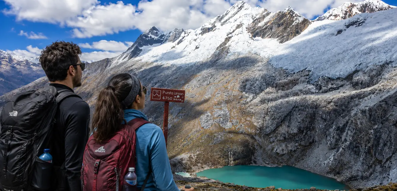
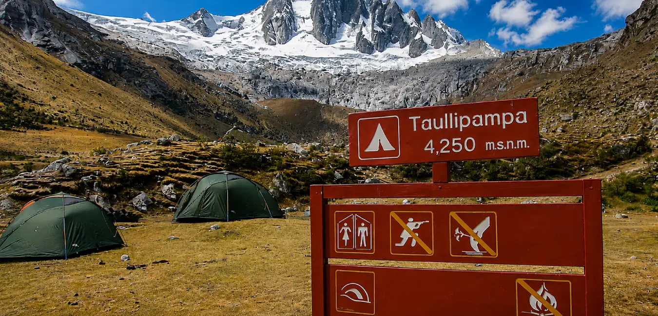
The most demanding day begins among grasslands and continues across moraines and granite boulders until you reach Punta Unión. The climb ends at a narrow rock gap where the landscape changes completely. From there, you’ll see Taullicocha Lake, the Santa Cruz Valley, and the imposing Taulliraju (5,830 m / 19,127 ft). You then descend to Taullipampa, the highest campsite and one of the most photogenic places on the route.
Day 3: Taullipampa Campsite - Llamacorral Campsite
- Hiking: 6 to 8 hours.
- Distance: approx. 15 km (9.3 miles).
- Elevation: from 4,250 m (13,944 ft) to 3,760 m (12,336 ft).
The trail where the mountains appear and disappear
This day takes you downhill through the Santa Cruz Valley, passing Jatuncocha and Ichiccocha lakes, with Artesonraju and Alpamayo appearing and disappearing between the ridgelines. This is also where you’ll find the optional turnoff toward the Arhuaycocha Valley and Alpamayo Base Camp, which adds about 2 to 3 hours. If the weather cooperates and your group still has the energy, it is absolutely worth it.
Day 4: Llamacorral Campsite - Cashapampa - Huaraz
- Hiking: 3 to 4 hours.
- Distance: approx. 10 to 12 km (6.2 to 7.5 miles).
- Elevation: from 3,760 m (12,336 ft) to 2,900 m (9,514 ft).
The final descent from the mountains to the valley
The final section descends through a narrow canyon where the Santa Cruz River runs between granite walls. The vegetation changes quickly: cacti, shrubs, and eventually cultivated fields appear. You arrive at Cashapampa, where transportation awaits to take you to Caraz and then Huaraz.
Day | Section | Distance | Hours | Campsite Elevation |
| 1 | Vaquería - Paria | approx. 11 km | 4 - 5 hrs | 3,800 m |
| 2 | Paria - Punta Unión - Taullipampa | approx. 12 km | 7 - 8 hrs | 4,250 m |
| 3 | Taullipampa - Llamacorral | approx. 15 km | 6 - 8 hrs | 3,760 m |
| 4 | Llamacorral - Cashapampa | approx. 11 km | 3 - 4 hrs | Return to Huaraz |
How difficult is the Santa Cruz Trek and how long does it take?
We classify the Santa Cruz Trek as moderate to challenging. It does not require any technical skills, but it does require aerobic endurance and, above all, tolerance for high altitude.
How should you train before the trek?
- Go on weekly hikes lasting 4 to 6 hours, preferably with elevation gain.
- Gradually increase your backpack weight: 3 kg, then 5 kg, then 10 kg.
- Add leg workouts (squats, lunges, and stair climbing) twice a week.
- Include continuous cardiovascular training: running, swimming, or cycling for at least 40 minutes.
- Strengthen your ankles and core because rocky terrain puts your stability to the test.
How many days should you spend on the Santa Cruz Trek?
The standard version takes 4 days and 3 nights. There are 3 day versions for fast, well acclimatized hikers, as well as 5 day versions that include Alpamayo Base Camp or a rest day. However, if this is your first multi day high altitude trek, the 4 day format offers the best balance between pace and enjoyment.
What is the best season for the Santa Cruz Trek?
The Andean dry season runs from May through October, and this is unquestionably the recommended period. During these months, skies are mostly clear, trails are firm, river crossings are manageable, and the chances of finding Punta Unión covered in clouds decrease considerably.
Period | Conditions | Recommendation |
| May - June | Clear air, recently snow covered mountains, fewer people | Excellent. The best balance of weather and tranquility. |
| July - August | More stable weather, but peak visitor numbers | Very good. Book in advance. |
| September | Dry and quiet, somewhat dustier conditions | Good. Ideal if you want to avoid crowds. |
| April and October | Transitional months, possible afternoon storms | Acceptable with flexibility and proper gear. |
| November - March | Persistent rain, mud, risk of landslides | Not recommended. Avoid it. |
Important fact...
Weekends attract more Peruvian visitors, so starting on a Monday or Tuesday gives you quieter campsites. On the other hand, if you’re looking for complete solitude, the transitional months offer nearly empty trails, although the weather is unpredictable and fog can make navigation more difficult.
What to see during the Santa Cruz Trek
The route brings together some of the most impressive landscapes in the tropical Andes, with the following being the highlights you shouldn’t miss.
The snow capped mountains you’ll see along the route
Mountain | Elevation | Why It Stands Out |
| Taulliraju | 5,830 m (19,127 ft) | Dominates Punta Unión Pass. Its sharp silhouette has earned it the nickname “the cathedral.” |
| Alpamayo | 5,947 m (19,511 ft) | Proclaimed “the most beautiful mountain in the world” in 1966. It can be seen from the turnoff to Arhuaycocha. |
| Artesonraju | 6,025 m (19,767 ft) | Almost perfect pyramid, popularly associated with the Paramount Pictures logo. |
| Chacraraju | 6,001 m (19,688 ft) | An ice-covered peak considered one of the most technically difficult summits in Peru. |
| Quitaraju | 6,036 m (19,803 ft) | Neighbor of Alpamayo, visible from the upper section of the valley. |
| Santa Cruz (Pucaraju) | 6,259 m (20,535 ft) | Gives its name to the valley and the entire trek. |
| Huandoy and Pisco | 6,395 m / 5,752 m (20,981 ft / 18,871 ft) | Visible from the road to Vaquería and from Llanganuco. |
The lakes along the route
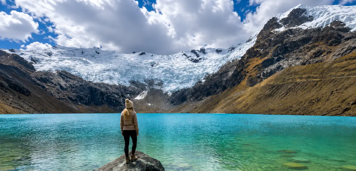
- Jatuncocha: “The large lake” in Quechua. It stretches across the bottom of the Santa Cruz Valley and has an intense turquoise color.
- Ichiccocha: “The small lake,” its smaller counterpart, separated from Jatuncocha by an alluvial deposit.
- Taullicocha: Appears below Punta Unión Pass and offers one of the classic views of the trek.
- Arhuaycocha: Located at the end of the turnoff toward Alpamayo Base Camp, with direct views of the glaciers.
Flora and fauna you may see
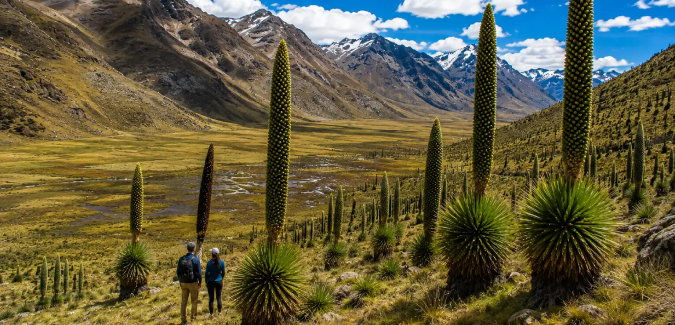
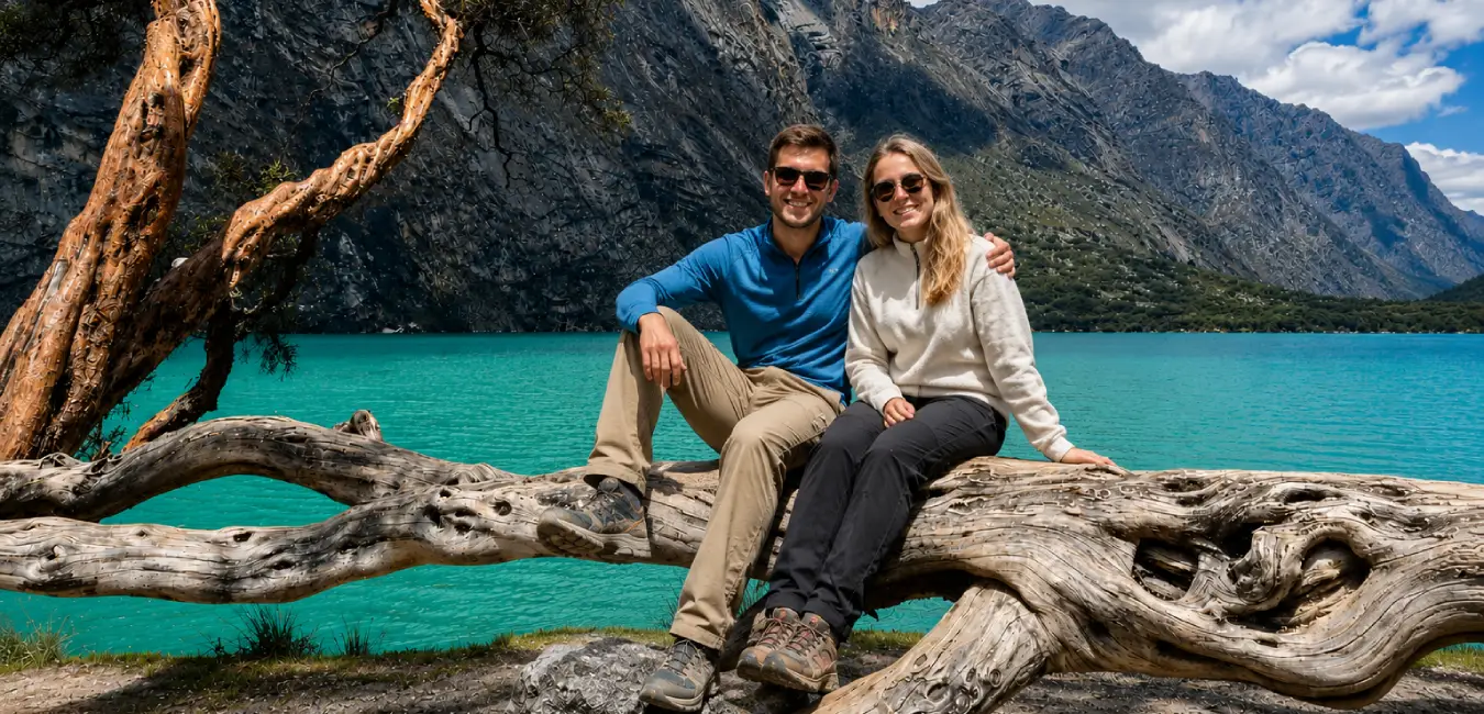
The park protects puna ecosystems, relict forests, and high Andean wetlands, where you may see Queñua (Polylepis), Puya Raimondi, which grows in the Carpa sector of the park on the way to Pastoruri, ichu and puna grasslands, vizcachas, Andean condors, huallatas, puna ducks, llamas, and alpacas.
Other attractions near the Santa Cruz Trek
Huaraz serves as a base for a dozen outstanding excursions. Some are also useful for acclimatization beforehand, while others are best enjoyed after the trek, once you’ve adapted to the altitude.
Acclimatization hikes (Before the trek)
Attraction | Elevation | Duration | Why Do It |
| Wilcacocha Lake | 3,750 m (12,303 ft) | Half day | Easy and offers panoramic views of the entire Cordillera Blanca. Perfect for your first day. |
| Churup Lake | 4,450 m (14,600 ft) | Full day | Challenging, with a section of rock secured with a rope. An excellent altitude test. |
| Laguna 69 | 4,604 m (15,105 ft) | Full day | The most famous lake in the region. Ideal as your final acclimatization hike before Santa Cruz. |
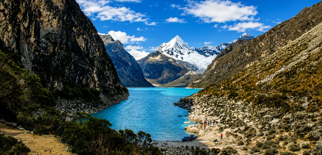
| Parón Lake | 4,185 m (13,730 ft) | Full day | The largest lake in the range, with Artesonraju in the background. |
Other destinations in the Áncash Region
- Llanganuco Lakes (Chinancocha and Orconcocha): At 3,855 m (12,648 ft), between Huascarán and Huandoy. You pass them on the way to Vaquería.
- Pastoruri Mountain: At 5,240 m (17,192 ft), one of the few glaciers accessible on foot without technical equipment. Its retreat is a case study of climate change.
- Chavín de Huántar: Ceremonial center declared a UNESCO World Heritage Site, with underground galleries and the Lanzón monolith.
- Wilcahuaín: Wari archaeological complex 8 km (5 miles) from Huaraz, featuring three-level funerary architecture.
- Yungay Campo Santo: Memorial to the city buried by the 1970 landslide. Sobering and necessary.
- Cordillera Huayhuash: Its longer counterpart, lasting 8 to 12 days, wilder, and more demanding.
- Hatun Machay: Volcanic rock forest and a mecca for sport climbing in the Cordillera Negra.
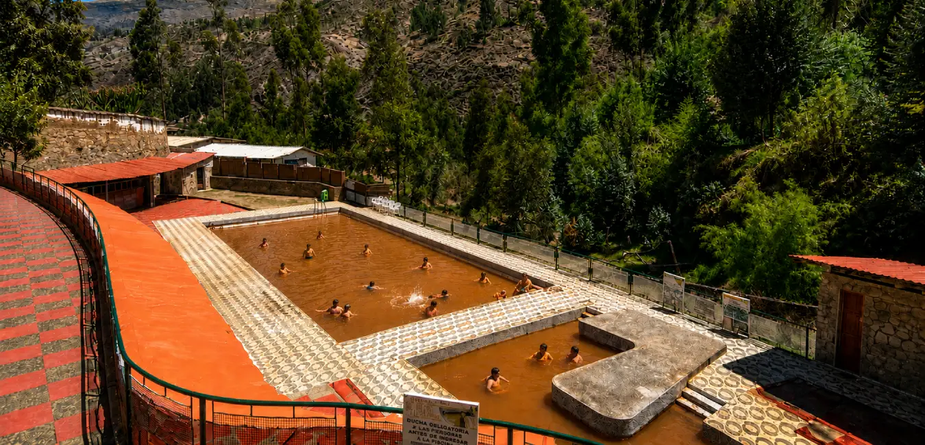
- Monterrey and Chancos Hot Springs: Just a few miles from Huaraz. The perfect plan for the day after the trek.
Do you need a guide for the Santa Cruz Trek?
Yes, to carry out tourist activities in Huascarán National Park, SERNANP requires the use of authorized tour operators. If you choose an agency, make sure it operates within the framework authorized by the park.
Guided vs. Independent Trek comparison
Option | What It Includes | Advantages | Disadvantages |
| Full guided tour | Guide, cook, muleteers, mules, tents, meals, and transportation | You only carry a daypack. Maximum comfort and safety. | Higher cost. Less flexibility with schedules. |
| Independent with muleteers | Muleteer and mules for heavy equipment Independence with a lighter load. | Mid-range cost. | You manage food, navigation, and emergencies. |
| Fully independent | Nothing: you carry and organize everything | Maximum freedom and lowest cost. | Heavy backpack at high altitude. No support in case of unexpected situations. |
You need to pay an entrance fee for Huascarán National Park
Yes, the route passes entirely through Huascarán National Park, administered by the National Service of Natural Areas Protected by the State (SERNANP). Therefore, every hiker must pay the entrance fee and register at the control posts.
Where can you buy Huascarán National Park entrance tickets?
- At the park's control posts: Cashapampa, Huaripampa, and Llanganuco entrance gates, among others. This is the most common option.
- At the SERNANP office in Huaraz: Located at Jirón Federico Sal y Rosas 555. This is convenient if you prefer to have everything taken care of before leaving.
- Through your agency: Many operators include it in the package. Confirm this explicitly before paying.
Approximate cost breakdown for the Santa Cruz Trek.
Approximate cost breakdown for the Santa Cruz Trek
Pass Duration | Foreigners | Nationals (Adults) | Locals (Adults) |
| 1 day | S/ 30 | S/ 12 | S/ 5 |
| 2 to 3 days | S/ 60 | S/ 30 | S/ 15 |
| 4 to 30 days | S/ 150 | S/ 75 | S/ 35 |
Rates change...
SERNANP periodically updates entrance fees. Check the current rate at the Huaraz office or with your operator before traveling, especially if you are planning several months in advance.
How much does the Santa Cruz Trek cost?
The budget varies considerably depending on the option you choose. Below, we break down the three most common scenarios, using approximate prices from the Huaraz market.
Cost of a guided Santa Cruz Trek
A 4 day group trek with a guide, cook, muleteers, mules, tents, full meals, and transportation usually costs between US$ 175 and US$ 350 per person. The range is broad because it reflects real differences in group size, tent and sleeping bag quality, the experience of the guide, menu variety, and whether the park entrance fee is included.
Approximate cost breakdown
Item | Approximate range | Note |
| 4-day guided trek | US$ 175 – 350 | Group tour. Private services cost more per person. |
| Huascarán National Park entrance ticket | S/ 150 (approx. US$ 40) | 4 - to 30 day pass for foreigners. |
| Team tips. | S/ 100 – 150 | Shared among the guide, cook, and muleteers |
| Muleteer (if traveling independently) | S/ 70 – 90 per day | One muleteer handles 2 or 3 mules. |
| Pack mule | S/ 70 – 90 per day | Carries up to approximately 30 kg. |
| Round trip public transportation | S/ 50 – 80 | Colectivos and combis from Huaraz. |
| Sleeping bag rental | S/ 15 – 25 per day | Check the actual temperature rating. |
| Tent rental | S/ 20 – 40 per day | Only if it is not included. |
| Trekking pole rental | S/ 10 – 15 per day | Highly recommended for descents. |
| Sleeping pad rental | S/ 5 – 10 per day | Essential thermal insulation. |
Realistic total budget…
- With a guided tour: between US$ 215 and US$ 400 all-inclusive (trek, entrance ticket, tips, and a couple of meals in Huaraz).
- Independently with a muleteer: between US$ 130 and US$ 220, including food, transportation, rentals, and entrance ticket.
- Fully independent: from US$ 90, although the savings come with more weight to carry, more planning, and a smaller margin of safety.
Everything you need to know before the Santa Cruz Trek
Preparing properly for the Santa Cruz Trek will allow you to enjoy its landscapes much more and better handle changes in elevation and weather. Before setting out, there are a few details worth knowing, from where to sleep and eat to what to pack. Here’s what you need to know to organize your adventure.
Weather during the Santa Cruz Trek
The weather during the Santa Cruz Trek is changeable, depending on elevation and season. During the day, temperatures range from 13 °C to 23 °C, with plenty of sunshine during the dry season, while at night they can drop as low as −3 °C at the higher campsites. In areas such as Punta Unión (4,750 m / 15,584 ft), the cold and wind can feel much more intense.
Best time to book the Santa Cruz Trek
- Peak season (June to August): Book two to four weeks in advance. Quality operators fill their departures first; those that always have availability are often the ones applying the fewest standards.
- Shoulder season (May and September): One week in advance is usually enough.
- If you’re traveling as a group or want private service: Book one or two months in advance. Organizing muleteers and mules requires advance coordination.
- If you’re looking for specific dates: fixed departures sell out before private departures. Check the operator’s calendar.
Where to stay and what to eat in Huaraz before the Santa Cruz Trek
Before and after the Santa Cruz Trek, Huaraz is the perfect place to rest, eat well, and prepare for the mountains. You’ll find everything from comfortable hotels to budget options near the city center. Also, take the opportunity to try some of Áncash’s traditional dishes.
Hotels for resting in Huaraz
Huaraz has everything from backpacker hostels to three and four star hotels. So, almost everything is within walking distance of the Plaza de Armas and Jirón Luzuriaga.
- Andino Club Hotel Asociado Casa Andina: Jr. Pedro Cochachín 357, Huaraz, Áncash.
- Hotel El Patio de Monterrey: Carretera Huaraz Caraz, Km 206, Monterrey, Huaraz, Áncash.
- La Aurora: Av. Mariscal Toribio Luzuriaga 915, Huaraz, Áncash.
- Hotel Santa Cruz: Gabino Uribe 255, Huaraz, Áncash.
- Cordillera Hotel: José Mercedes Villanueva 1205, Huaraz, Áncash.
Best restaurants in Huaraz
The cuisine of Áncash and Huaraz combines traditional cooking with an international food scene that has developed around mountain tourism. Take advantage of the days before your trek to try local cuisine at the “best restaurants in Huaraz”.
Where to look for each type of food
At Huaraz Central Market, along Jirón Luzuriaga and the surrounding area, in the Barrio de Soledad, and at countryside restaurants along the road to Caraz.
Traditional Áncash dishes you should try
I recommend trying Picante de cuy, Cuchicanca, Pachamanca, Llunca de trigo, pork Charqui and jamón ancashino, Huaraz-style tamales, Chicha de jora, and ponche.

What to pack for the Santa Cruz Trek
The right gear makes all the difference. The most common mistake isn’t packing too little, but packing too much. Pack in layers and avoid bringing multiple items that serve the same purpose.
Recommended items to bring:
- A 55 to 70 liter backpack with a good suspension system, padded hip belt, and ventilated back panel. The total weight should not exceed 20% of your body weight.
- A lightweight personal first aid kit. Consult your doctor beforehand, especially regarding acetazolamide and any pre-existing condition.
- Mid or high cut hiking boots because they support your ankles on long descents, with a rubber sole.
- Long- and short sleeved shirts. Avoid cotton because it retains moisture.
- Waterproof down or synthetic jacket with a hood and quick drying rain pants
- 3 or 4 pairs of technical socks, preferably merino wool.
- 3 or 4 sets of quick drying underwear.
Protection and accessories
- Warm hat and sun hat.
- Gloves or mittens, Buff or multifunctional neck gaiter.
- Sunglasses with UV protection, SPF 50 sunscreen, and lip balm with sun protection.
- Trekking poles, headlamp with spare batteries
- Two 1 liter reusable bottles and a water purification system such as tablets, a filter, or a UV purifier.
- Fully charged power bank; cold temperatures drain batteries faster.
- Microfiber towel, wet wipes, hand sanitizer, and toilet paper.
- Cash in Peruvian soles and a copy of your passport or national ID.
Camping gear
- Sleeping bag: with a comfort rating of −10 °C and an insulated inflatable or foam sleeping pad.
- Three or four season tent, camping stove, and fuel.
How to prevent altitude sickness during the Santa Cruz Trek
Acute mountain sickness (AMS), known in Peru as soroche, occurs when your body ascends faster than it can adapt. On a route that reaches 4,750 meters (15,584 ft) and camps above 4,200 meters (13,780 ft), preventing it is the number one priority.
Acclimatization: The step you cannot skip
Spend at least three full days in Huaraz before starting the trek. In addition, use those days to hike at altitude progressively. A sequence that works well is to rest, walk around the city, stay hydrated, and eat light meals.
Symptoms: When to be concerned
Level | Symptoms | What to Do |
| Mild (AMS) | Headache, nausea, fatigue, loss of appetite, disturbed sleep | Stop, hydrate, rest, and do not continue ascending until you improve. Inform your guide. |
| Moderate | Headache that does not improve with pain medication, vomiting, persistent dizziness | Do not continue. Descend and consider abandoning the route. |
| Severe: pulmonary edema | Shortness of breath at rest, wet cough, chest tightness, bluish lips | Medical emergency. Descend immediately and seek medical attention. |
| Severe: cerebral edema | Confusion, loss of coordination, unusual behavior, severe headache | Medical emergency. Descend immediately and seek medical attention. |
The golden rule
The only reliable treatment for severe altitude sickness is immediate descent. No medication, portable oxygen, or determination can replace descending to a lower elevation. Therefore, tell your guide honestly how you are feeling.
Santa Cruz Trek vs. Salkantay Trek vs. Inca Trail Comparison
Feature | Santa Cruz | Salkantay | Inca Trail |
| Duration | 4 days | 4 - 5 days | 4 days |
| Highest elevation | 4,750 m | ~4,630 m | ~4,215 m |
| Machu Picchu | No | Yes | Yes |
| Main landscape | Glaciers and lakes | Mountains and jungle | Archaeology |
| Location | Huaraz | Cusco | Cusco |
Safety tips for the Santa Cruz Trek
Enjoying the Santa Cruz Trek also means knowing when to keep going and when to stop. High altitude, cold temperatures, changing weather, and the terrain can present challenges along the route. These recommendations will help you prepare better and make safer decisions in the mountains.
Precautions that can make a difference
Before you leave
- Purchase travel insurance that covers high-altitude trekking and helicopter evacuation. Many standard policies exclude activities above a certain elevation, so read the fine print.
- Leave your detailed itinerary with a trusted contact, including dates, campsites, and your agency’s information.
- Write down emergency numbers on paper, not just on your phone.
- Check the weather forecast and ask about current conditions at the park office.
- Check your gear piece by piece the night before.
During the hike
- Do not hike alone; join a group.
- Start early each day, especially on the day you cross the pass.
- When you encounter donkeys or mules, move to the inside of the trail, away from the drop-off, and let them pass.
- Keep your eyes on the trail to avoid accidents, twists, and falls.
- Do not light fires.
- If the weather deteriorates at the pass, turn back. The mountain will still be there next season.
- Pack out all your trash and take it back with you.
- Do not feed wildlife or approach livestock belonging to local communities.
- Stay on marked trails.
- Do not remove plants, flowers, or rocks.
The five most common mistakes
- Underestimating the altitude. By far, this is the number one mistake. No level of fitness can compensate for inadequate acclimatization.
- Buying the cheapest tour on the street. The savings often come back later in the form of poor-quality food, leaking tents, or an untrained guide
- Assuming the park entrance ticket is included. Ask explicitly before paying.
- Traveling without high-altitude evacuation insurance. A rescue in a remote area can cost thousands of dollars.
Frequently asked questions about the Santa Cruz Trek
Do you need previous experience for the Santa Cruz Trek?
You do not need previous mountaineering experience, but you should be accustomed to walking for several hours. The route has significant elevation changes and reaches 4,750 m (15,584 ft), so it’s important to arrive physically prepared.
What level of fitness do you need for the Santa Cruz Trek?
Ideally, you should have a moderate to good level of fitness. You should be able to hike for several hours a day, go up and down uneven terrain, and maintain a steady effort for several days.
Is the Santa Cruz Trek suitable for families?
Yes, it can work well for families with teenagers and adults who are accustomed to hiking. For young children, it can be demanding because of the altitude, long hiking days, and changing weather conditions.
Is the Santa Cruz Trek suitable for people over 50?
Yes. Age is not the main factor; your fitness level, acclimatization, and hiking experience matter more. If you do not exercise regularly, it’s a good idea to prepare several weeks in advance.
Do you need mountain experience for the Santa Cruz Trek?
You do not need climbing or technical mountaineering experience. You should be comfortable hiking at high altitude, on uneven terrain, and for several hours each day.
Do you need to acclimatize?
Yes, it is essential. The trek reaches 4,750 m (15,584 ft), so we recommend spending at least 2 or 3 days in Huaraz before starting and doing light activities so your body can gradually adapt to the altitude.
How should you train before the Trek?
Start several weeks in advance with long hikes, elevation gain, and exercises to strengthen your legs and core. Gradually increase the distance and practice hiking with a light backpack to get used to the effort.
Which companies have coverage?
In Huaraz, you’ll find operators such as Movistar, Claro, Bitel, and Entel, but you will not have cell service throughout the entire Santa Cruz Trek. In more remote areas, coverage may disappear, so download your maps and bring a power bank before setting out.