
Lake Titicaca stretches across Perú and Bolivia, surrounded by the dramatic landscapes of the andean highlands and communities that continue to preserve centuries old traditions. Sitting at more than 12,500 feet (3,800 meters) above sea level, its waters are home to natural islands and the famous floating Uros islands. Its history is deeply connected to ancient andean cultures and stories passed down through generations. Today, lake Titicaca remains one of the most iconic destinations in the Andes.
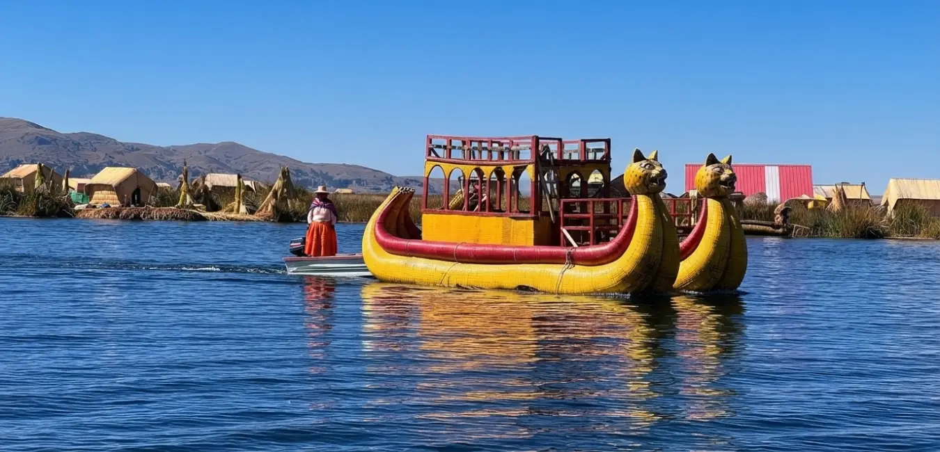
Where is lake Titicaca located?
Lake Titicaca lies high in the andean altiplano, right along the border shared by Peru and Bolivia, at 3,810 meters (12,500 feet) above sea level. That elevation is no small detail: it has earned Titicaca the title of the highest navigable lake in the world. And as if that were not impressive enough, it is also one of the most important freshwater ecosystems in south america.
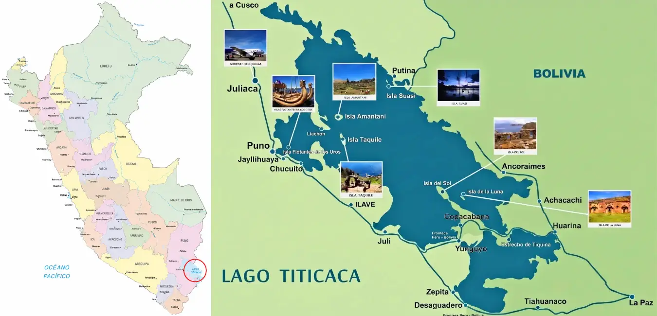
Lake Titicaca on the peruvian side
The lake stretches across the provinces of Puno, San Román, Azángaro, Huancané, Moho, El Collao, Chucuito, and Yunguyo, all within the Puno region. On the Bolivian side, it extends through the provinces of Ingavi, Murillo, Los Andes, Aroma, Pacajes, Camacho, Omasuyos, and Manco Cápac, in the department of La Paz. In other words, this is a lake shared and cared for by two countries.
Important fact...
Peru holds approximately 56% of the lake, while Bolivia has the remaining 44%. Every day, boats depart from the city of Puno on the western shore and head toward the lake's main attractions, including the Uros Floating Islands, Taquile, and Amantaní.
Key facts about lake Titicaca
Before diving into its history, let's take a quick look at the numbers that make this lake so unique:
Feature | Information |
| Elevation | 3,810 m (12,500 ft) above sea level |
| Countries | Peru and Bolivia |
| Surface area | 8,372 km² |
| Maximum depth | 281 m |
| Main city | Puno, Peru |
Why should this lake matter so much to you?
Because Titicaca is much more than water and scenery. Nature, history, and culture all come together here. Indigenous communities continue to preserve traditions that date back to pre-Inca times, so visitors find much more than a beautiful destination: they step into a place where the Andean past is still very much alive.
And speaking of the past... did you know the name “Titicaca” hides a puma and a sacred rock? Keep reading.
Geography of lake Titicaca
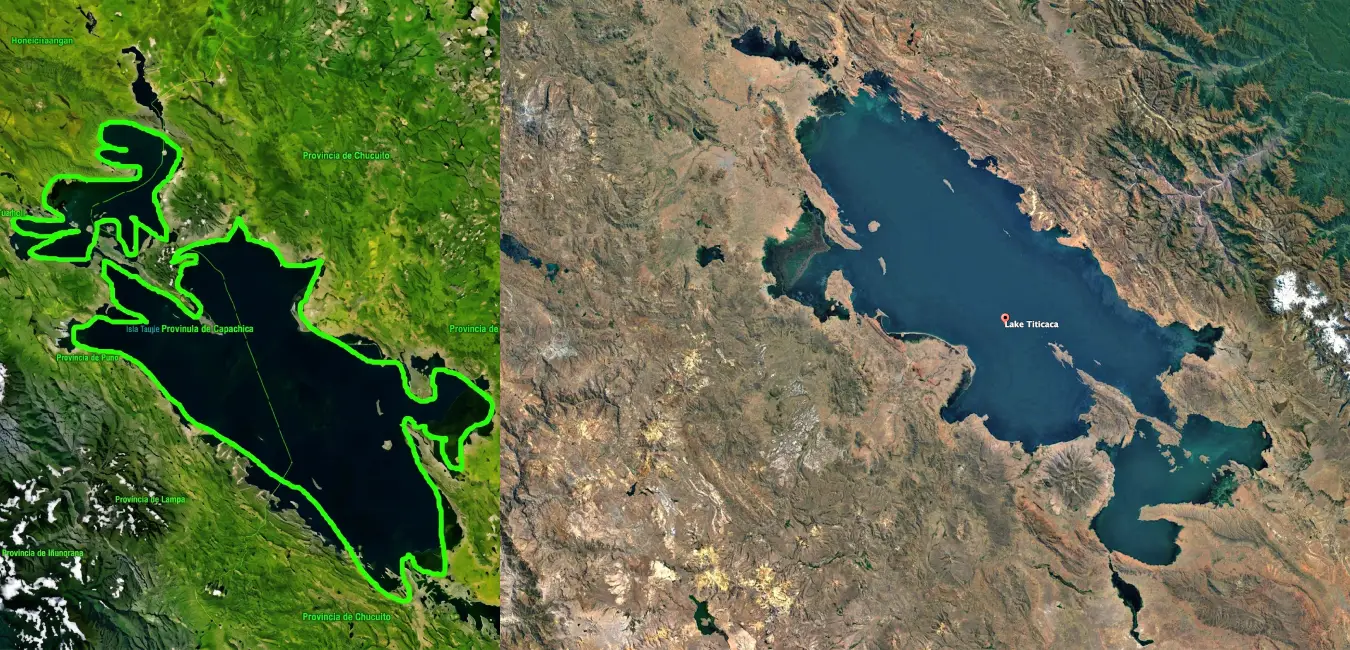
Lake Titicaca covers approximately 8,300 km² and stretches 190 kilometers from northwest to southeast, reaching a maximum width of 80 kilometers. A narrow channel known as the Strait of Tiquina divides the lake into two sections: the smaller southeastern section is called Lake Huiñaimarca in Bolivia and Small Lake in Peru. In terms of depth, the lake averages between 140 and 180 meters, although the lakebed drops sharply toward the Bolivian shore and reaches its deepest point at approximately 280 meters near Soto Island.
Why is the lake called Titicaca?
- One theory traces the name back to Intikjarka Island, a word combining Aymara and Quechua terms: “Inti” means sun, while “Kjarka” means rock or crag. According to this interpretation, the name could mean something like “the rock of the sun.”
- But there is another equally fascinating theory. In Aymara, “Titi” means puma, while “Qaqa” or “Kaka” means rock. The lake's name would therefore mean “Rock of the Puma,” referring to a sacred rock on the Island of the Sun. Whichever theory you prefer, both point to the same idea: this lake has always been deeply connected to the sacred.
History and origins of lake Titicaca
Get ready for a journey back in time, because the history of this lake is measured not in years, but in millions of years. From its geological origins to the civilizations that lived along its shores, here is the story behind everything that makes Titicaca such a remarkable place. Let's start at the very beginning.
How was lake Titicaca formed?
Millions of years ago, during the miocene, lake Titicaca was part of a massive lake that covered much of the Altiplano and also included what is now lake Poopó. This enormous body of water remained until the Pleistocene. As the climate became increasingly dry and glaciers retreated, the lake gradually shrank until it eventually split into two separate bodies of water: Titicaca to the north and Poopó to the south.
The lakes that came before Titicaca
Before becoming the lake we know today, Titicaca was actually part of a succession of ancient lakes. First came Lake Mataro, located at an elevation of 3,950 meters. As the glaciers retreated, it gave way to Lake Cabana, at 3,900 meters. At that time, a single body of water stretched from the northern Peruvian Altiplano to the central Bolivian plateau, and the Desaguadero River did not even exist yet.
The succession of lakes that created modern, day Titicaca
Then came lake Ballivián at 3,860 meters, lake Michin at 3,825 meters, and lake Tauca at 3,815 meters. Each one helped shape the landscape for the next, like chapters in the same geological story.
Important fact...
Today, lake Titicaca sits at 3,810 meters above sea level, while lake Poopó lies at 3,686 meters. The two can reconnect through the Desaguadero river during periods of heavy rainfall and high water levels.
How old is lake Titicaca?
Between 2 and 3 million years old. Over time, its water level dropped by approximately 60 to 100 meters until the lake reached the shape we recognize today. Its remarkable age makes Titicaca one of the oldest lakes on Earth, a true survivor of the planet's geological history.
Ancient cultures of lake Titicaca
Not just one civilization flourished along the shores of the lake, but many. Chiripa, Wankarani, Pucará, Sillustani, Cutimbo, and above all, Tiwanaku, left their mark on the region over the centuries. Around AD 1000, severe drought and migration brought that period of prosperity to an end. But new regional kingdoms soon emerged: the Pacajes, Lupacas, Collas, and eventually the Incas. Let's take a closer look at each one.
Chiripa
Established on Bolivia's Taraco Peninsula between 1500 BC and AD 100, the Chiripa culture was a pioneer in raised-field agriculture and textile production. Its double, walled adobe houses and social organization helped lay the foundations for what would later become Tiwanaku.
Pucará Culture
Between 500 BC and AD 200, Pucará built one of the first major ceremonial centers in the Altiplano, featuring monumental architecture, polychrome pottery, and stone sculptures. Its most recognizable legacy? The famous Toritos de Pucará, or Little Bulls of Pucará, which have become an iconic symbol of southern Peru.
Tiwanaku culture (Tiahuanaco)
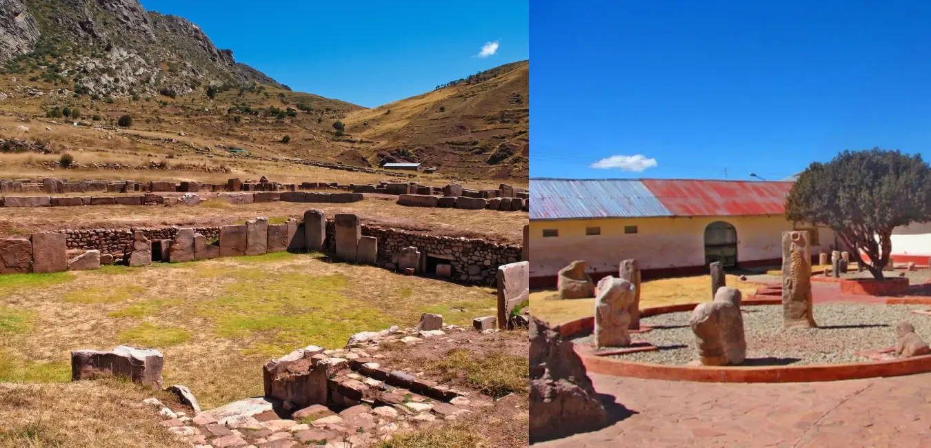
Between ad 300 and 1000, Tiwanaku reached the height of its political, religious, and artistic power. Its ceremonial center, located near present, day Tiwanaku, influenced much of the Andes. Monuments such as the Gateway of the sun, the Kalasasaya temple, and the Akapana pyramid continue to amaze visitors with their architectural and astronomical precision.
Lupaca and Colla
The Lupaca occupied the southwestern shore of the lake and were involved in frequent conflicts over territorial control. They were organized around pukaras, or fortified centers. The Colla, meanwhile, settled north and northwest of the lake during the 12th century, bringing together several ethnic groups. Both were powerful and highly organized societies.
Did you know?
The Lupaca and Colla were among the most powerful and centralized nations in the Andes, nearly as strong as the Incas during the early years of their expansion.
Timeline of the ancient civilizations of lake Titicaca
Approximate period | Culture or society | Area of development | Main characteristics |
|---|---|---|---|
| Approx. 1500 BC - 100 BC | Chiripa | Southern Lake Titicaca Basin, present-day Bolivia | One of the region's earliest major sedentary societies. It developed ceremonial centers, agriculture, and organized communities. |
| Approx. 500 BC - AD 400 | Pukara or Pucará | Northern Titicaca Basin, present-day Puno region | Known for its ceremonial centers, stone sculptures, and pottery. It developed a strong cultural influence throughout the Altiplano. |
| Approx. AD 500 - 1000 | Tiwanaku or Tiahuanaco | Southern Titicaca Basin, present-day Bolivia | It became one of the leading political and religious centers of the Andes. It developed monumental architecture and widespread regional influence. |
| Approx. AD 1000 - 1450 | Aymara Kingdoms | Altiplano and Lake Titicaca Basin | Following the decline of Tiwanaku, several regional kingdoms emerged and controlled territories around the lake. |
| 13th - 15th centuries | Collas | North and northwest of Lake Titicaca | A powerful Aymara kingdom associated with the Collao region. It built monumental funerary structures known as chullpas. |
| 13th - 15th centuries | Lupacas | Southwest of Lake Titicaca | An important Aymara kingdom organized around regional centers. It controlled Altiplano resources and maintained connections with valleys in other Andean regions. |
| 13th - 15th centuries | Pacajes and Other Aymara Kingdoms | Southern Lake Titicaca Basin | They formed part of the complex political landscape of the Altiplano before Inca expansion. |
| 15th century - AD 1532 | Incas | Lake Titicaca Basin and the Collao Region | They incorporated the region into Qullasuyu, one of the four major divisions of the Tahuantinsuyu. The lake gained enormous religious importance within Inca tradition. |
Lake Titicaca during the Inca empire
The Lupaca and Colla were bitter enemies, and the Incas knew how to use that rivalry to their advantage. Viracocha Inca negotiated with both sides, but fearing an alliance between the Lupaca and the Incas, the Colla went to war.
Inca expansion into the Collao
The decisive clash took place on the plains of Paucarcolla, where the Lupaca ruler emerged victorious and later made peace with Viracocha. Later, Pachacutec defeated the Colla at Ayaviri, and finally Tupac Inca Yupanqui extended the Inca conquest throughout the Altiplano, incorporating the region into the Tahuantinsuyu after overcoming Aymara resistance.
Myths and legends of lake Titicaca
Manco Cápac and Mama Ocllo
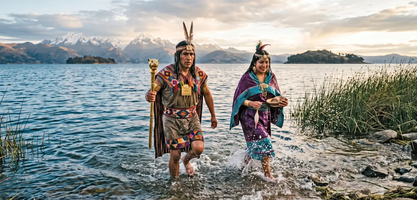
According to tradition, Viracocha sent Manco Cápac and Mama Ocllo to guide the Andean peoples toward a wiser and more organized way of life. The two emerged from the lake carrying a golden staff and traveled across the Andes until the staff sank into the ground in the Cusco Valley. There, they founded the city and taught the people agriculture, giving rise to the Inca Empire. Quite a beginning.
The birth of the sun
Another legend tells of a time when the world was covered in complete darkness. Then the creator appeared at Lake Titicaca and, from one of its islands, brought forth the sun, the moon, and the stars. This is why many of the lake's islands and rocks are considered sacred: according to ancient Andean tradition, light itself was born here.
Lake Titicaca in the 19th century
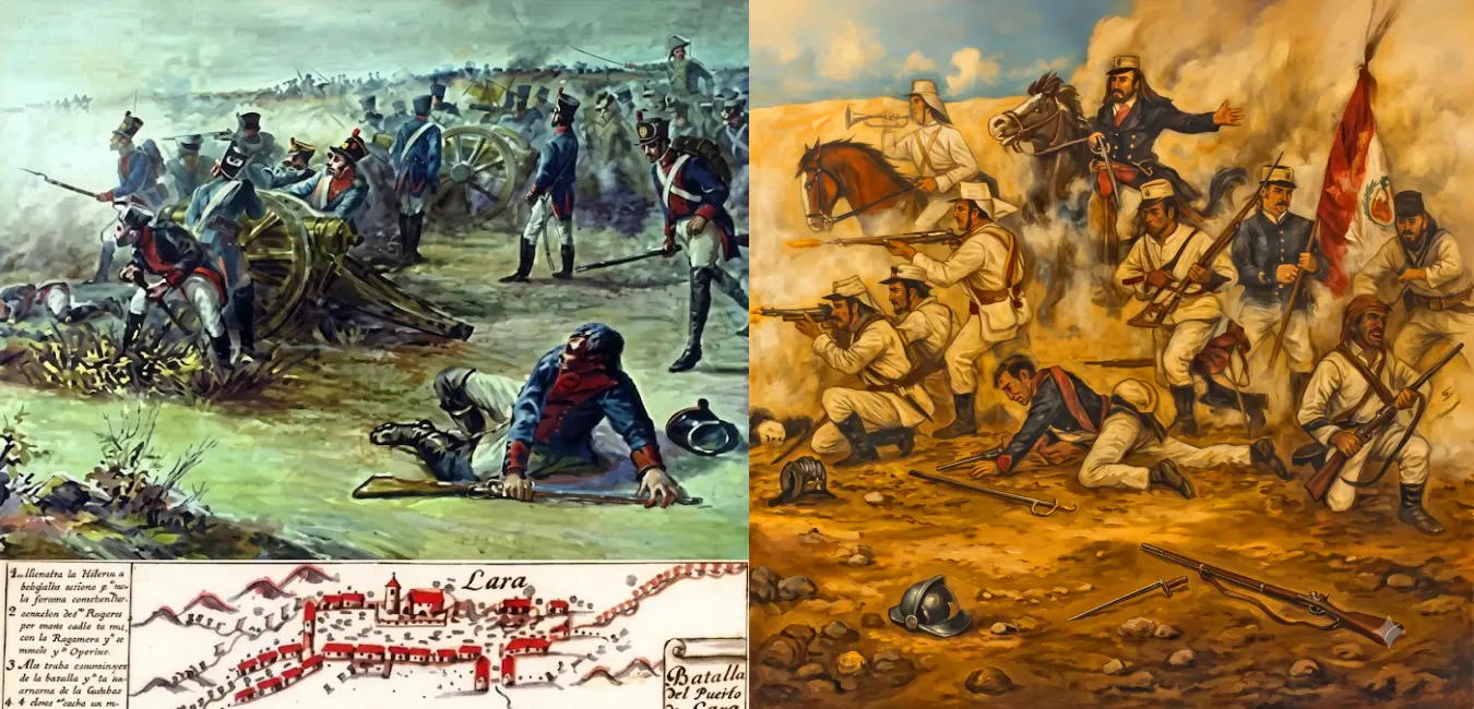
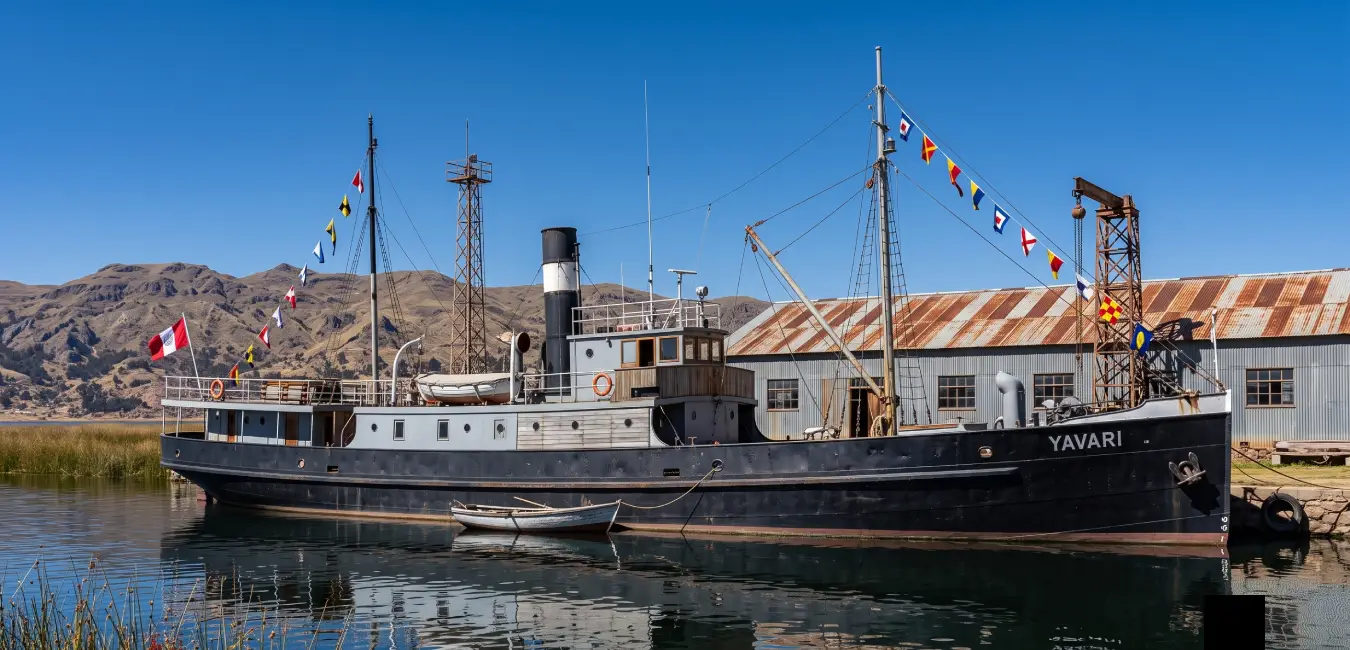
The lake continued to play a role in history. During the 19th century, it witnessed key battles of the independence era, including Guaqui and Zepita. In 1862, Peruvian president Ramón Castilla commissioned two steamships from England, the Yavarí and the Yapurá. Their parts crossed the ocean and were then carried across the Andes by mule before finally reaching Puno. Beginning in 1872, the ships transported passengers between places such as Yunguyo and Copacabana. Today, Lake Titicaca is a cultural and travel destination proudly shared by Peru and Bolivia.
Who explored lake Titicaca?
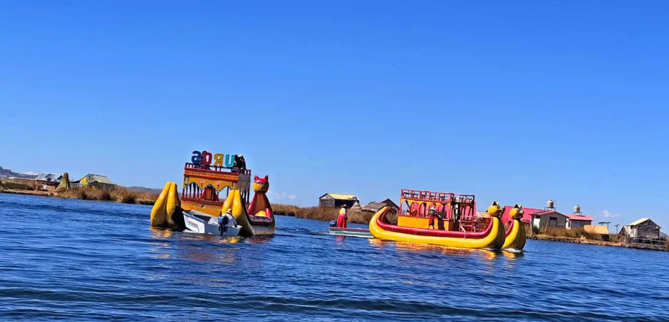
There is an important distinction to make here: Lake Titicaca was never truly “discovered.” Long before outsiders arrived, the Uros people were already navigating its waters aboard totora reed boats. In reality, they were the lake's first navigators. That said, European explorers also left their mark, and their story is worth telling.
The first european to visit lake Titicaca
In 1534, two Spaniards, Diego de Agüero and Pedro Martín, arrived in the Altiplano after being sent from Cusco by Francisco Pizarro. They were searching for gold, silver, and above all, the treasures rumored to be hidden on the Island of the Sun. They explored the lakeshore for around forty days before returning to Cusco with astonishing accounts of enormous herds of llamas and alpacas, abundant fish, and fields of potatoes, quinoa, and oca stretching as far as the eye could see.
The first european navigator to explore lake Titicaca
Around 1548, a well, built Spanish vessel sailed across these waters for the first time. At the helm was Captain Juan Ladrillero, an experienced sailor who had navigated both the Atlantic and Pacific oceans. His two, masted brigantine was not there for war, but for exploration. His voyage marked the beginning of European navigation on Lake Titicaca.
The first modern vessels
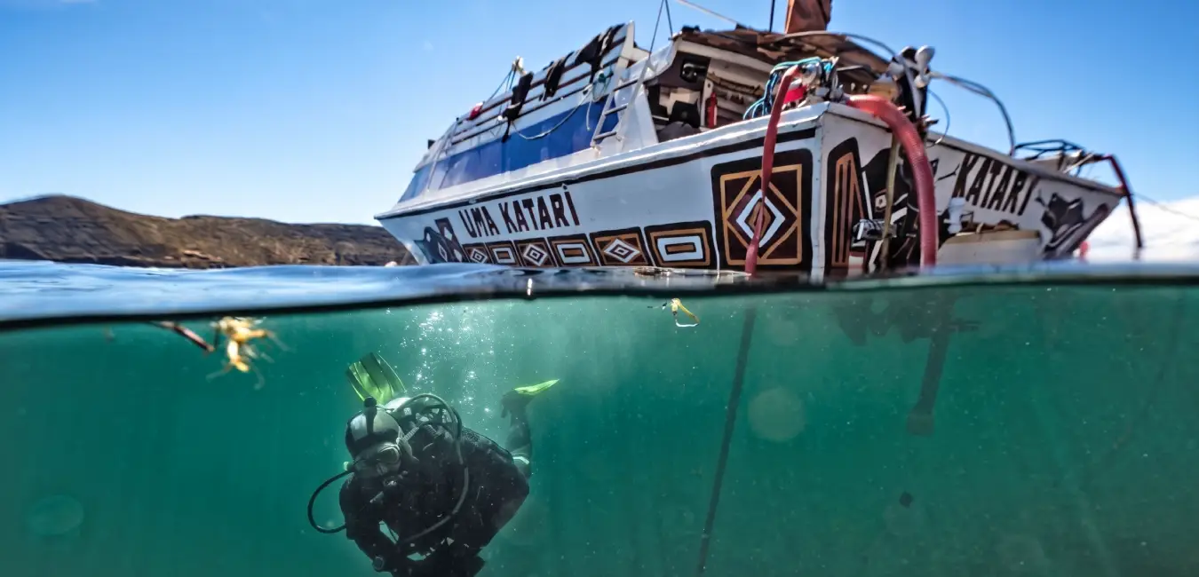
The first steamships on lake Titicaca were the Yavarí and the Yapurá, built in England in 1862 at the request of Peruvian president Ramón Castilla. Their parts made an extraordinary journey from the coast to Puno, first through Arica and Tacna and then across the andes on pack animals. The vessels were eventually assembled and entered service between 1870 and 1873. Beginning in 1872, they also transported passengers between towns such as Yunguyo and Copacabana.
Modern underwater exploration
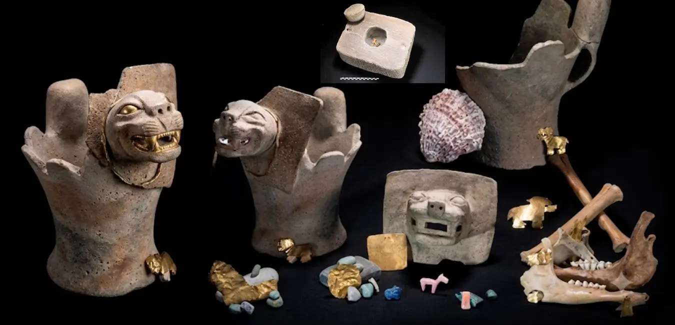
The story jumps forward several centuries and becomes even more intriguing. Beginning in the 1950s, divers, including the le endary Jacques Cousteau, started exploring the lakebed. The result? More than two dozen stone boxes containing Inca offerings. As it turns out, lake Titicaca still holds submerged secrets that archaeologists continue to bring to light.
Who protects lake Titicaca's heritage today?
This heritage is not left unprotected. The peruvian ministry of culture oversees underwater archaeological heritage, the National University of the Altiplano (UNA - Puno) supports research into andean cultures, and several international archaeology projects collaborate with european universities. Thanks to their work, the lake continues to reveal new discoveries from time to time.
Lake Titicaca's official recognitions
Its importance is not only symbolic; it has also received official recognition:
- Part of the lake is included in Peru's National System of Protected Natural Areas (SINANPE) as a national reserve.
- In 1997, it was designated a Wetland of International Importance.
- In 2005, it was added to UNESCO's World Heritage Tentative List as a mixed cultural and natural site, although final World Heritage designation is still pending.
Main islands on the peruvian side
We have reached what may be the part that interests you most if you are planning a trip. Lake Titicaca is home to more than one hundred islands and islets: 58 in the Large Lake, 15 in the Gulf of Puno, and 29 in the Small Lake. Some are natural, while others were built by the people who live on them. Let's take a closer look.
Islands on the peruvian side
Lake Titicaca is home to numerous natural islands and island communities spread across Peru and Bolivia. On the Peruvian side, the most visited are Taquile and Amantaní, along with the famous Uros floating islands. Other islands such as Soto, Suasi, Anapia, Yuspique, and Tikonata are also part of the lake's geography and history.
Uros floating islands
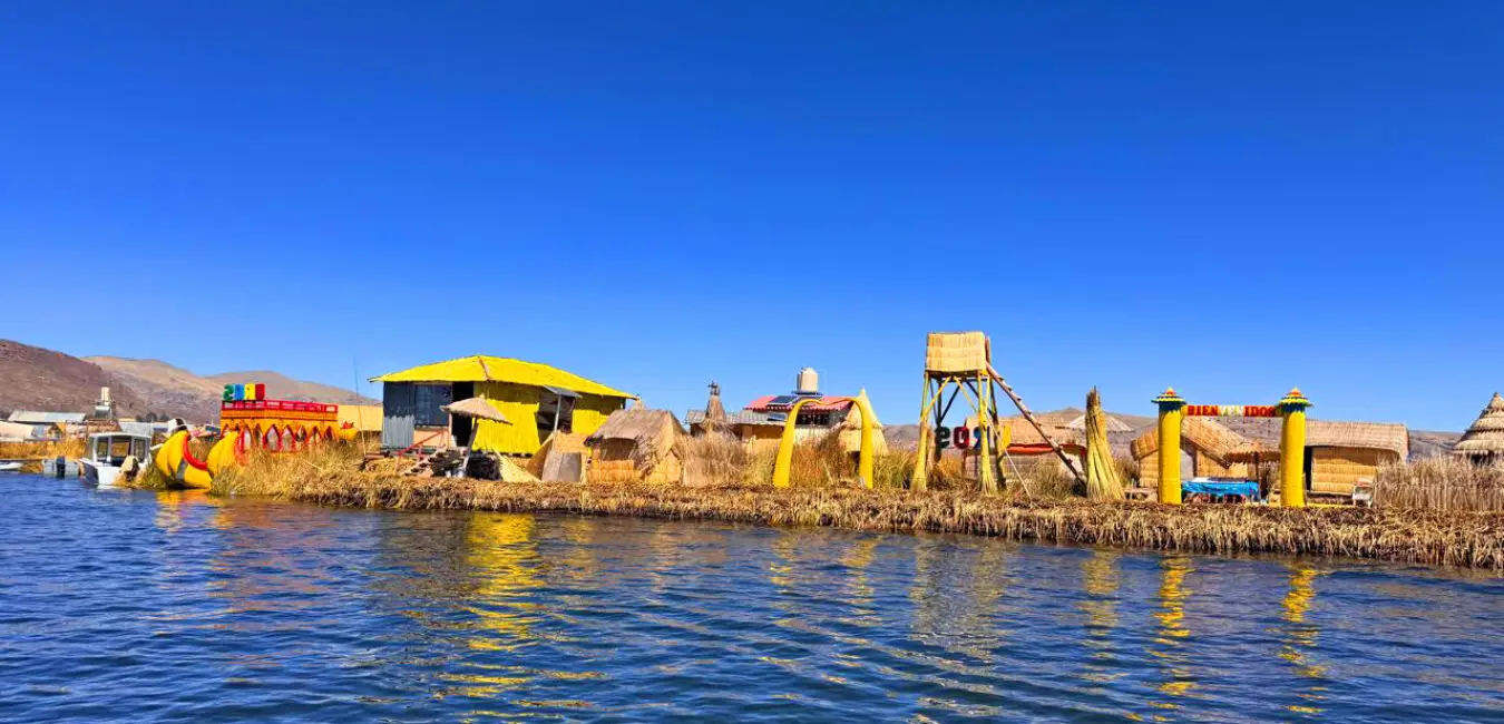
The Uros floating islands are often the first big surprise visitors encounter on the lake. The islands are built from totora reeds, a plant that grows naturally in lake Titicaca, so the ground moves gently beneath your feet as you walk across them.
The origin of the Uros floating islands
The Uros people built these islands using the totora reeds that grow along the lake's shores to create large floating platforms on the water. Over time, and through constant maintenance, these structures developed into habitable islands. Originally, however, they were created as refuges to protect the Uros from the expansion of the Inca Empire and other neighboring peoples.
Important fact...
“Uro” means brave and untamed. The Uros inhabited the Altiplano even before the Aymara and have lived on their floating islands for around 600 years.
How are the Uros floating islands built?
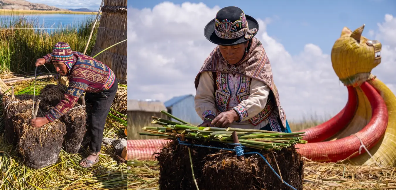
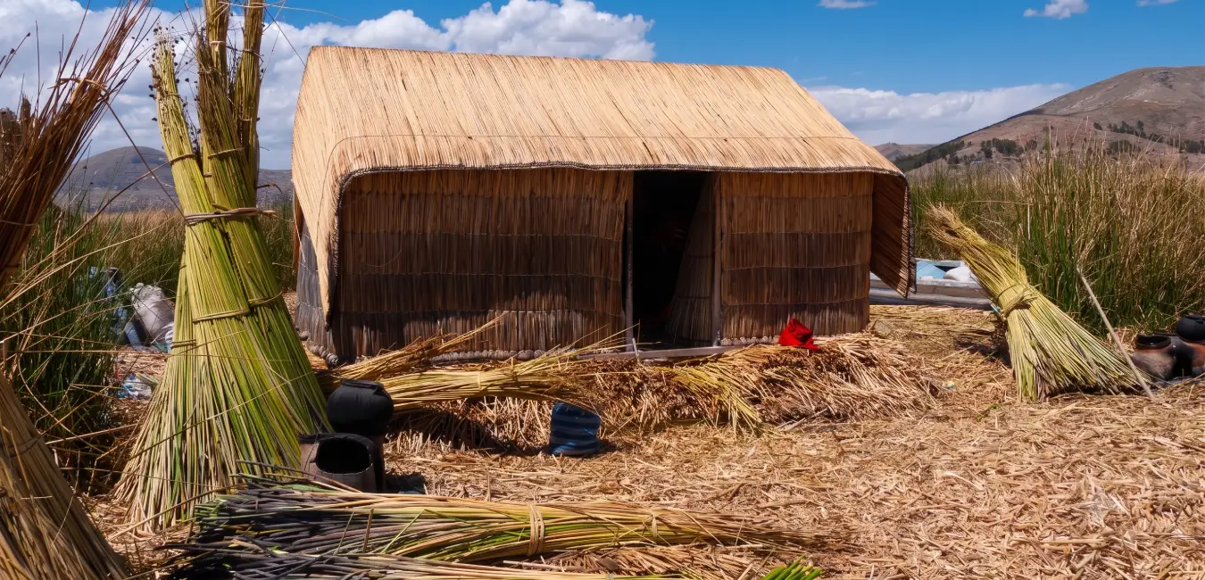
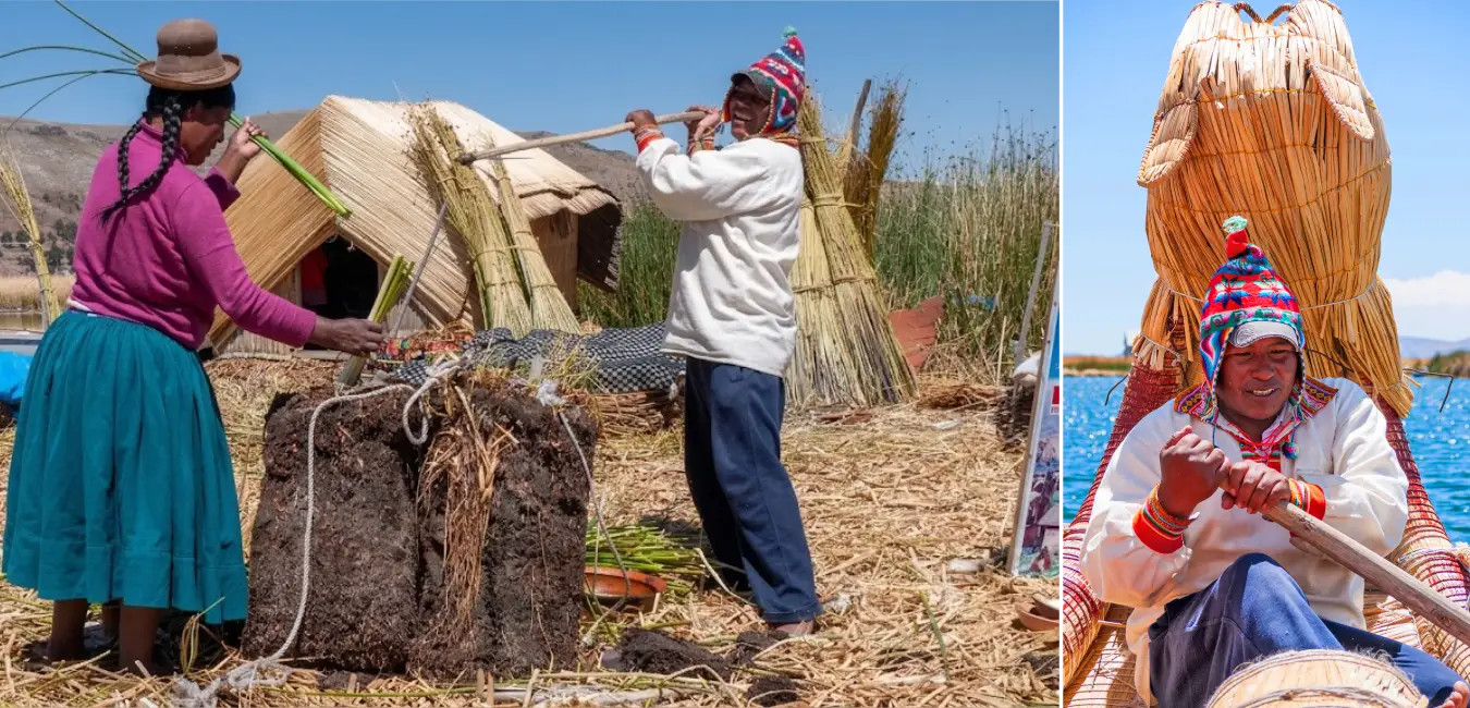
The Uros Floating Islands are built mainly from totora reeds and khili, a natural block formed from intertwined roots and plant matter. Residents cut out large blocks of khili and join them together to create a floating base. They then place several layers of dried totora reeds across the surface until they form solid ground where homes can be built and daily activities can take place.
Khili forms the base of the island
Everything begins with khili, the root mass of the totora reed that forms compact blocks capable of floating. These blocks are cut and tied together to create the island's main platform. On top of this base, the Uros lay layers of totora reeds in different directions to cover the surface and provide greater stability.
Layers of totora reeds form the ground
Dried totora reeds are spread over the khili until they create a surface sturdy enough to walk on. However, the lower layers remain in constant contact with the water and gradually decompose. For this reason, families must regularly add fresh layers of totora to preserve the surface and keep the island habitable.
How do they keep the islands from moving?
Although they float on lake Titicaca, the islands do not drift freely around Puno Bay. To keep them in a specific area, residents anchor them using large eucalyptus poles secured to the lakebed. This system helps prevent wind and water movement from carrying the platforms away.
The maintenance never ends
Building an island is only the beginning. Moisture and constant contact with the water slowly break down the lower layers of totora, so the Uros must regularly add new material to the surface. This ongoing maintenance keeps the islands intact and is part of an ancestral body of knowledge passed down from one generation to the next.
How many Uros floating islands are there?
There is no single permanent number of Uros floating islands. The number can change over time as platforms are expanded, reorganized, or divided according to changes within the families and communities that live on them. For this reason, official sources and records from different years may provide different figures.
Important fact...
A project by Peru's ministry of housing referred to 94 artificial totora islands. However, this figure should not be considered a permanent number, since the organization of the floating platforms can change over time.
Taquile island
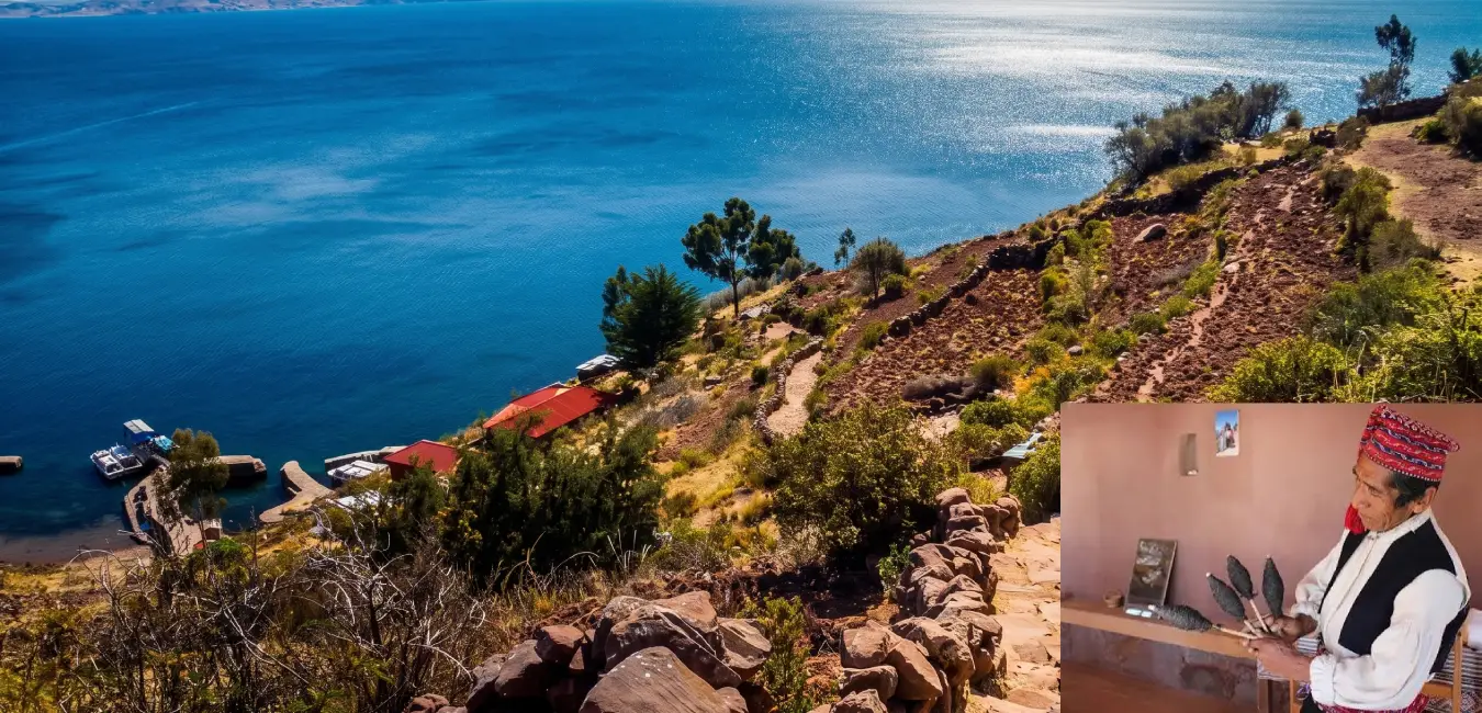
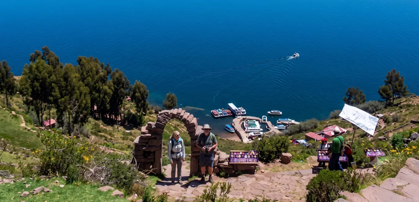
Taquile welcomes you with stone paths, ancient terraces, and sweeping views of the lake that follow you with every step. Here, textile traditions are not simply observed, they are lived. Weaving is a fundamental part of the community's identity and has been recognized by UNESCO as intangible cultural heritage of humanity.
What makes Taquile special?
On this island, men learn to knit from childhood, and every piece of clothing tells a story about their life and marital status. Looking at their hats and woven belts is almost like reading a short personal story.
Amantaní
Amantaní invites you to disconnect from the pace of everyday life and spend time with local families who welcome visitors into their homes. Here, the lake is best enjoyed in silence, especially at sunset, when the sky changes color over the horizon.
Island of the sun
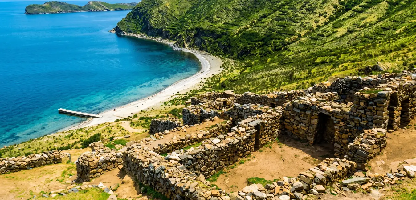
On the Bolivian side of lake Titicaca, the island of the sun combines sweeping landscapes with deep historical significance. According to tradition, this is where Manco Cápac and Mama Ocllo began their journey, making the island closely connected to the origins of the Inca Empire.
Important fact...
Covering 14.3 km², the Island of the Sun is the largest island in lake Titicaca. Nearby lies the island of the moon, also known as Koati. Both are considered sacred and are home to archaeological sites, trails, and spectacular viewpoints.
List of the most important islands
No. | Island or islet | Sector |
| 1 | Amantaní | Large lake |
| 2 | Taquile or Intika | Large lake |
| 3 | Soto | Large lake |
| 4 | Suasi | Large lake |
| 5 | Esteves | Puno bay |
| 6 | Anapia | Small lake / Wiñaymarca |
| 7 | Yuspique or Juspique | Small lake / Wiñaymarca |
| 8 | Suana or Suaana | Small lake / Wiñaymarca |
| 9 | Caana or Ccana | Small lake / Wiñaymarca |
| 10 | Iscaya | Small lake / Wiñaymarca |
| 11 | Patahuata | Small lake / Wiñaymarca |
| 12 | Huatacaana | Small lake / Wiñaymarca |
| 13 | Yute | Small lake / Wiñaymarca |
| 14 | Caño Islet | Small lake / Wiñaymarca |
| 15 | Chivata | Lake Titicaca, Peruvian sector |
| 16 | Ustute | Lake Titicaca, Peruvian sector |
| 17 | Leviel | Lake Titicaca, Peruvian sector |
| 18 | Tikonata | Lake Titicaca, Peruvian sector |
Uros, Taquile, and Amantaní comparison table
If you are trying to decide where to go and do not know where to start, this comparison makes things easier:
| Uros islands | Taquile island | Amantaní island |
| Visit duration | 2 to 3 hours | Half day or full day | 2 days / 1 night (recommended) |
| Difficulty level | Very easy | Moderate (uphill walks and stairs due to the altitude) | Moderate (high-altitude walking) |
| Type of experience | Cultural and educational | Cultural, scenic, and traditional | Cultural immersion and local homestay experience |
| Ideal for | Travelers with limited time, families, and older adults | Photographers, hikers, and culture lovers | Travelers looking for authentic experiences |
| Scenery | Floating totora islands and lake views | Agricultural terraces, viewpoints, and panoramic views of Lake Titicaca | Hills, ceremonial temples, and sunsets over the lake |
| Interaction with local communities | Brief, during the guided visit | Moderate, with cultural demonstrations and handicrafts | High, staying with a local family |
| Boat travel time from Puno | 30 to 45 minutes | Approximately 2 hours | Between 3 and 4 hours (with a stop at Uros on some tours) |
| Overnight stay | No | Optional on some itineraries | Yes, in local family homes |
| Main activities | Visiting the floating islands, riding totora reed boats, and shopping for handicrafts | Hiking, traditional weaving, local cuisine, and scenic viewpoints | Hiking, traditional ceremonies, local homestays, and stargazing |
| Recommended for children | Yes | Yes, if they are comfortable walking | Yes, although the hikes may be challenging for younger children |
| Recommended time | Half day | One full day | Two days |
Which rivers feed lake Titicaca?
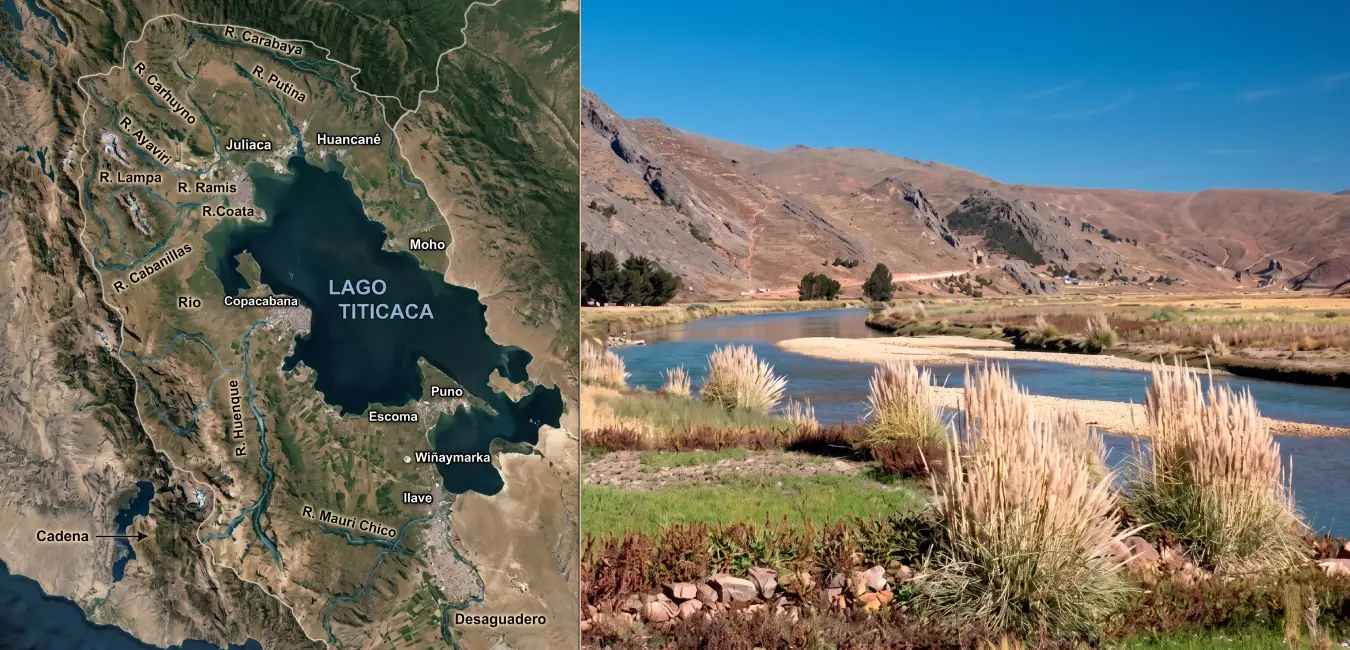
Lake Titicaca is fed by five main rivers. The most important are the Ramis, Coata, Ilave, Huancané, and Suches rivers. Interestingly, most of the water the lake loses does not flow out through a river, it disappears through evaporation. Only a small fraction leaves through the Desaguadero River.
Its main tributaries
The Ramis is the undisputed leader: it is the longest and carries the greatest volume of water. It is followed by the Coata, which drains the central Puno area; the Ilave, which flows down from the south; the Huancané, in the northeast; and the Suches, which begins in the mountains and marks part of the border with Bolivia. Together, these rivers provide the freshwater that keeps the lake's ecosystem alive.
The challenges they face
Unfortunately, the picture is not entirely positive. Informal mining releases heavy metals into some river basins, urban wastewater and garbage affect water quality, and climate change is altering river flows. Protecting these rivers has therefore become an urgent priority for preserving the lake we care so deeply about.
Culture along the shores
Lakeside communities preserve fairs, dances, and patron saint festivals filled with Aymara and Quechua identity. Many families continue to practice traditional agriculture and raise camelids, so traveling through these areas offers a chance to experience both nature and living culture along the same route.
Lake Titicaca's climate
Here is one piece of advice you will appreciate: Lake Titicaca's climate is cold and dry for most of the year, and temperatures can change dramatically between day and night. Knowing what to expect can make the difference between enjoying your trip and spending it shivering. Here's what you need to know.
Temperatures and humidity
During sunny days, temperatures can rise above 15°C (59°F). At night, especially during the dry season, temperatures frequently drop to 0°C (32°F) or below. Relative humidity generally ranges between 50% and 65%. The key takeaway: dress in layers.
Rainy season (december to march)
- Rainfall and cloud cover increase.
- The landscape turns a vibrant green.
- Rain can affect boat travel and outdoor activities.
Dry season (april to october)
- Clear skies and sunny days are common.
- Nights, however, can be extremely cold.
- This season offers the best conditions for exploring the islands.
How does the climate affect life in the lake?
A great deal. The cold and high altitude have shaped a unique ecosystem: species have adapted to low temperatures and intense solar radiation, while summer rains encourage totora growth and bird reproduction. Each season, in short, creates a different rhythm of life on the lake.
And since we mentioned totora reeds and birds... let's meet the true inhabitants of Lake Titicaca.
Biodiversity of lake Titicaca
Its wildlife: Species you won't see anywhere else
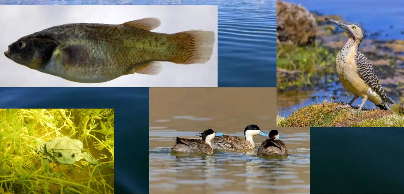
Lake Titicaca is home to 13 families of wild birds, including species such as the puna teal, Andean goose, Andean flamingo, and Andean gull. But two remarkable species deserve special attention.
The Titicaca water frog
Its scientific name is Telmatobius culeus, and one of its most remarkable characteristics is that it spends almost its entire life underwater. It has become a true symbol of the lake's endemic wildlife, and today, it is a species in need of protection.
The Titicaca grebe
This bird has wings, but it rarely flies. Instead, it swims and dives with remarkable skill. Its survival depends entirely on maintaining a healthy lake ecosystem.
And beneath the water...
Carachi and suche, traditional fish species of the region, swim through the lake. During the 20th century, trout and silverside were introduced and eventually became important to the local economy.
Its flora: The kingdom of totora reeds
The lake is home to 13 types of totora, two of which are floating varieties. This plant dominates shallow areas, forms extensive wetlands, and provides shelter for birds, fish, and other animals. For local communities, it is also a vital resource that supports both the ecosystem and the local economy.
Did you know?
Totora usually grows in water between 2.5 and 4.5 meters deep, although it can grow at depths of up to 5.5 meters. It reaches its greatest growth during the rainy season, between January and March.
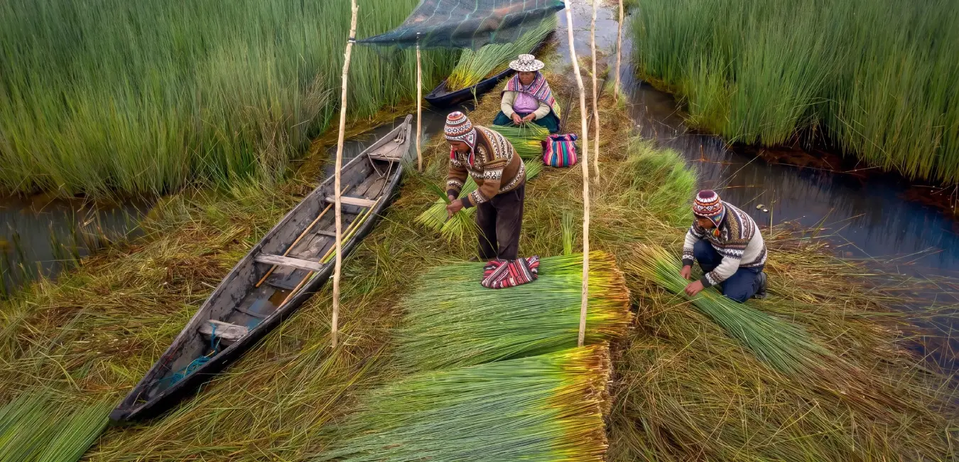
Culture and traditions of lake Titicaca
Lake Titicaca's communities preserve traditions closely connected to the land, the lake, and agricultural cycles. Offerings to Pachamama, patron saint festivals, dances, and planting and harvest rituals are all part of cultural life in the Altiplano.
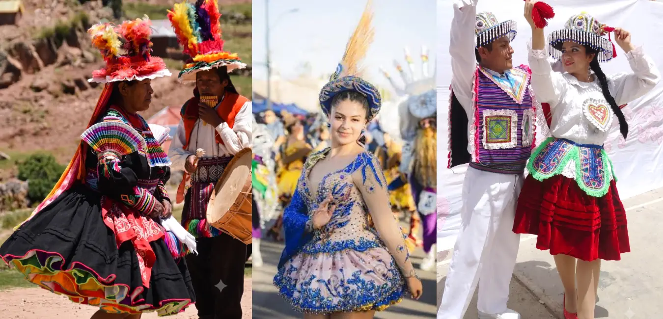
Traditions and festivals
Cultural expressions include dances such as the Diablada and Sikuris. Patron saint festivals and agricultural rituals also continue to mark important moments throughout the communities' annual calendar.
How totora reeds are used on lake Titicaca
Totora reeds play an important environmental and cultural role. Local communities use them to make mats, boats, handicrafts, and a variety of structures.
Quesanas or reed mats
Quesanas, also known as reed mats, are made by joining or tying totora stems together to create a flat sheet approximately 1 meter wide and 1.5 to 2 meters long, although they can be made in whatever size is needed. Traditionally, the reeds are tied together using cord made from chilligua grass or straw (Stipa spp.).
Totora reed boats
Building totora reed boats is a deeply rooted craft, especially in the Chimú sector and the community of Suriqui in the Small Lake. Interestingly, boats made in this area can last for up to a year, while those built elsewhere on the lake generally last only five to six months. Since ancient times, these boats have been used for transportation, fishing, bird hunting, collecting eggs and totora reeds, and, more recently, tourism.
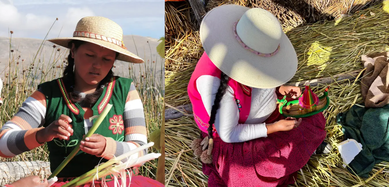
Totora decorations and souvenirs
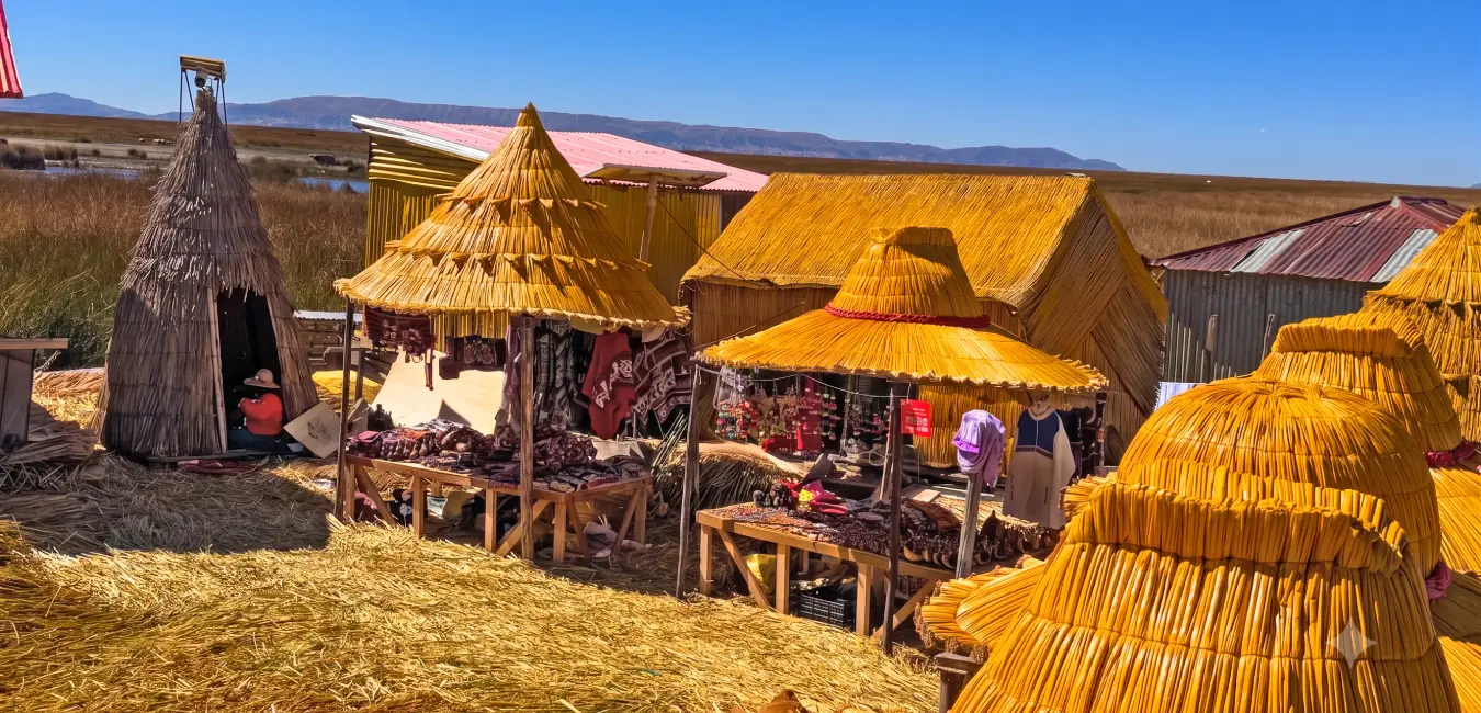
Small decorations and souvenirs made from totora reeds are also produced on the floating islands. These include miniature boats measuring between 15 and 50 centimeters, home and table decorations, Christmas ornaments, and lampshades. Because they are lightweight and compact, these objects are easy for travelers to carry.
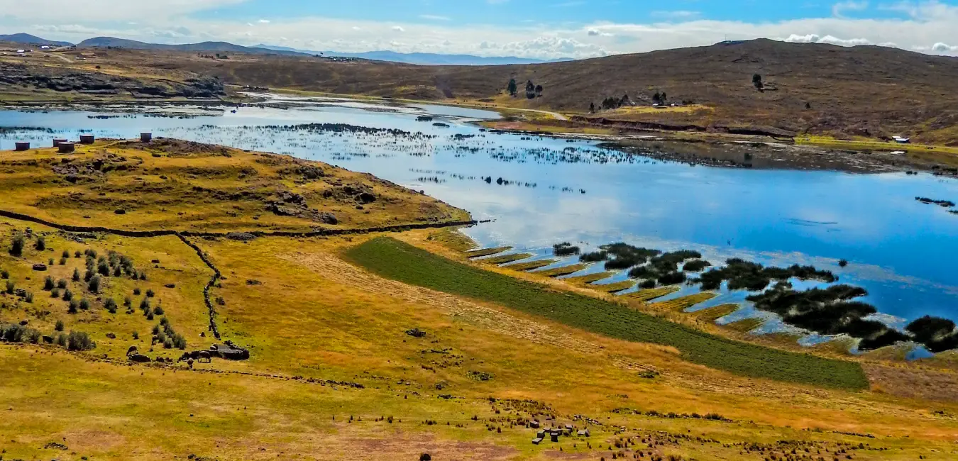
Ancient agriculture: Waru waru
Corn, potatoes, chuño, quinoa, cañihua, oca, and barley grow along the shores of the lake, often using one of the most ingenious agricultural techniques developed in the Andes: waru waru. How does it work? Crops are planted on raised fields surrounded by water channels. During the day, the water absorbs heat from the sun. At night, it slowly releases that heat, helping protect the crops from frost. It is a natural heating system developed centuries ago, without a single machine.
Did you know?
Waru waru reveal the deep understanding ancient Lake Titicaca societies had of climate, agriculture, and the surrounding landscape.
Traditions that are still alive
Here, culture is not kept in a museum, it lives in the streets and people's homes. Offerings to Pachamama, patron saint festivals featuring dances such as the Diablada and Sikuris, and planting and harvest rituals continue to shape the calendar. And, of course, there are Taquile's textile traditions and the techniques of the Uros, passed from parents to children without losing their essence along the way.
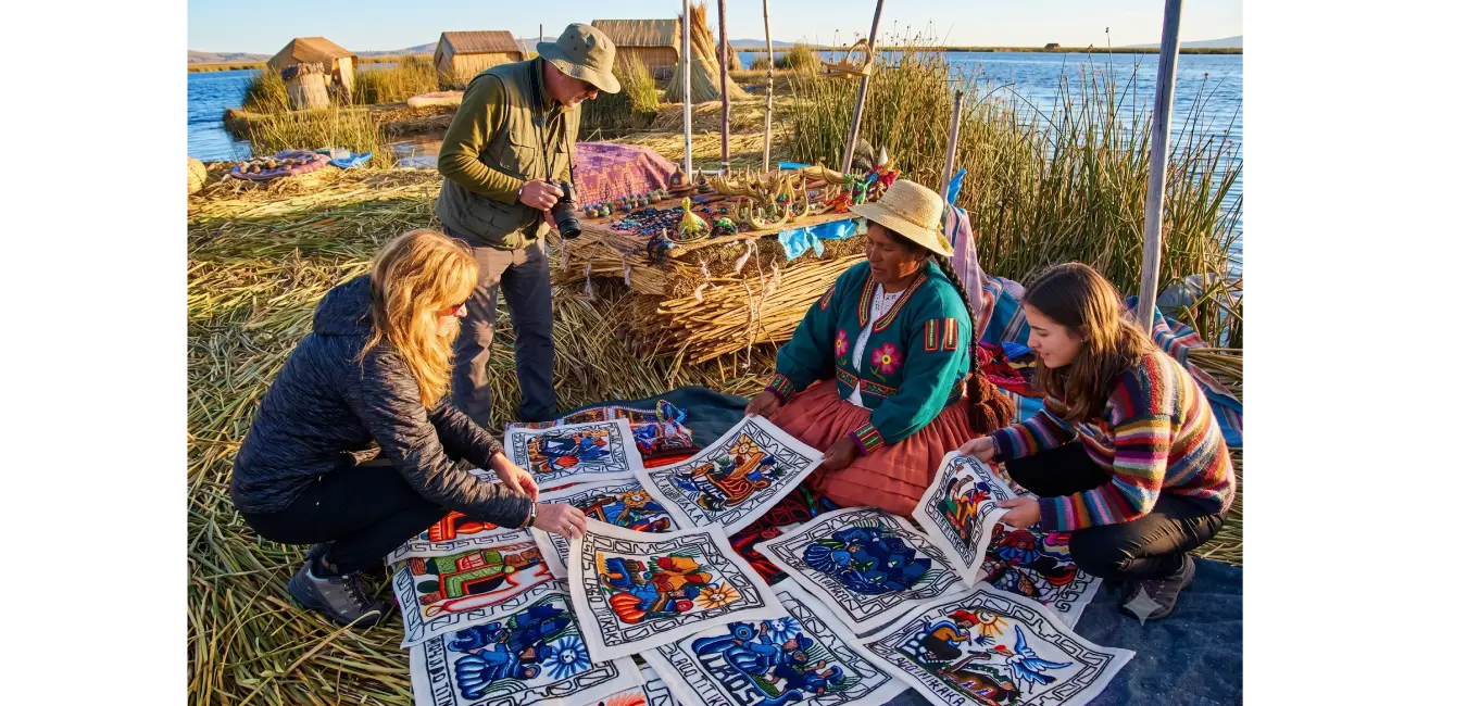
An ordinary day in an aymara community
The day begins early. Families divide their time between farming, herding camelids and sheep, fishing, and making handicrafts. Community work, known as ayni, is at the heart of daily life: neighbors help one another. As evening falls, families gather around simple meals made with potatoes, quinoa, and trout.
How to visit respectfully
- Ask permission before taking photos of people.
- Buy handicrafts directly from local families. It is one of the best ways to support them.
- Respect ceremonial spaces and local customs.
- Do not leave trash behind, and help protect the lake.
- Try learning a few words in Aymara or Quechua. Local people will appreciate the effort.
Frequently asked questions about lake Titicaca
Where is lake Titicaca?
Lake Titicaca is located in the Andean Altiplano along the border between Peru and Bolivia, at 3,810 meters (12,500 feet) above sea level. The city of Puno, Peru, is the main gateway to the lake.
Why is lake Titicaca the highest navigable lake in the world?
Because it combines a high elevation of 3,810 meters (12,500 feet) with enough surface area and depth to allow relatively large vessels to navigate its waters, something extremely uncommon at this altitude.
How much time do you need to visit lake Titicaca?
A basic visit to the Uros Islands and Taquile takes a full day. However, for a more complete experience that includes an overnight stay on Amantaní, at least two days are recommended.
What is the best time to visit lake Titicaca?
April, May, September, and October generally offer clear skies and slightly less intense nighttime cold, making them ideal months for exploring the islands.
Is it safe to travel to lake Titicaca?
Yes. Puno and the islands are well-established travel destinations. Even so, it is important to acclimatize to the altitude, bring warm clothing, and book tours with responsible operators.
What can you eat at lake Titicaca?
Local cuisine includes fresh trout, quinoa, native potatoes, and traditional Aymara dishes, often prepared by the local families who host visitors.