
When most people hear the term Inca Trail, they immediately think of the famous hiking route that winds through the Andes, passes remarkable Inca archaeological sites, and ends at the breathtaking citadel of Machu Picchu. However, the story of the Inca Trail began centuries before the rise of the Inca Empire and extends far beyond the world-famous trek visited by thousands of travelers each year.
Long before the Incas unified the Andes under the Tawantinsuyu, ancient civilizations had already established networks of trails connecting the Pacific coast, fertile valleys, and the high Andes. These early routes allowed communities to exchange goods, access natural resources from different ecological zones, and maintain contact across vast and rugged landscapes.
But who really built these roads? Were they all constructed by the Incas? What was the purpose of the Qhapaq Ñan, and how did this immense road network eventually give rise to one of the world's most famous hiking trails?
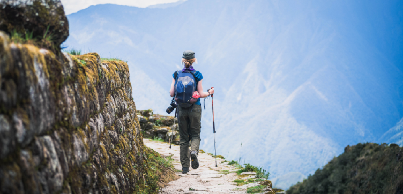
The Origin of the Inca Trail: Ancient Trade Routes Before the Inca Empire
One of the biggest misconceptions about the Inca Trail is that the Incas built the entire road network from scratch. In reality, centuries before the Tawantinsuyu existed, ancient Andean civilizations were already crossing mountains, deserts, and deep valleys to trade goods between regions with completely different climates and ecosystems.
Communities regularly traveled from the highlands to the Pacific coast to obtain fish, while others journeyed into the mountains to exchange products such as llama wool, meat, potatoes, and maize. These trade routes were essential for survival in a region where each ecological zone offered different resources.
You can think of the Qhapaq Ñan as an ancient manuscript that was continuously expanded and refined by successive civilizations. Earlier cultures, especially the Wari, developed sophisticated routes and gained an exceptional understanding of Andean geography long before the Incas came to power.
When the Inca Empire expanded, its engineers did not replace these ancient roads. Instead, they incorporated existing routes, widened many sections, and built entirely new roads to connect newly conquered territories across the empire.
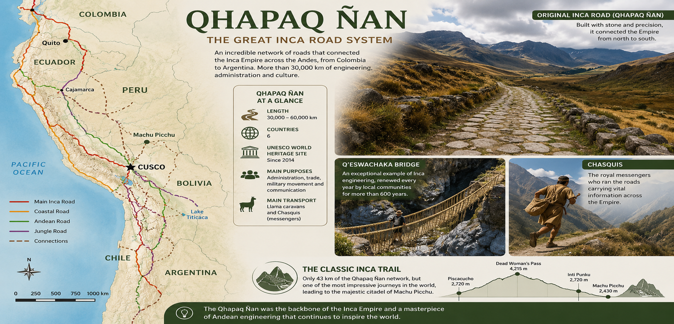
The result was the Qhapaq Ñan, also known as the Great Inca Road System, an engineering masterpiece that eventually stretched for more than 30,000 to 60,000 kilometers (18,600 to 37,000 miles) across what are now Colombia, Ecuador, Peru, Bolivia, Chile, and Argentina.
Did you know?
The Qhapaq Ñan is considered one of the largest ancient road networks ever built. Although often compared to the Roman roads, the Inca Road System crossed far more extreme environments, including deserts, snow-covered mountain passes above 5,000 meters (16,400 ft), cloud forests, and tropical valleys—all without the use of wheels or draft animals.
Which Civilizations Built Roads Before the Incas?
Long before the Inca Empire ruled the Andes, several advanced civilizations had already created transportation networks to connect settlements, facilitate trade, move armies, and strengthen political control across one of the world's most challenging landscapes.
The Wari Civilization (AD 500–1000)
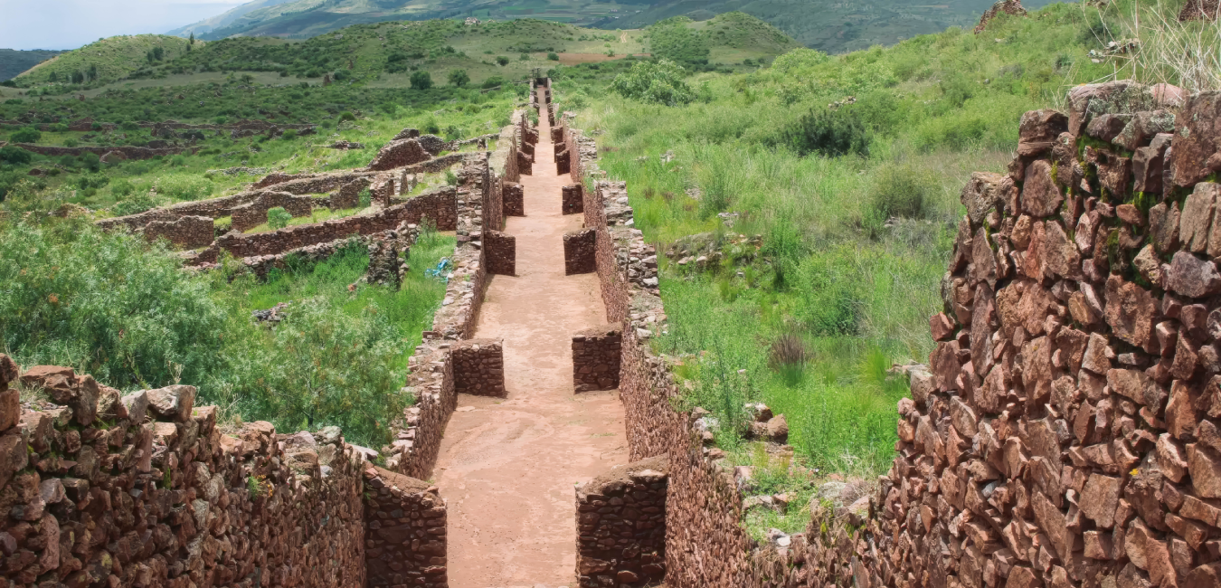
The Wari are widely considered the true pioneers of road construction in the central and southern Andes of Peru. They developed extensive routes connecting major administrative centers such as Pikillacta, near Cusco, laying the foundation for what would later become part of the Qhapaq Ñan.
The Tiwanaku Civilization
Around Lake Titicaca, the Tiwanaku civilization built an important network of roads linking communities throughout present-day Bolivia and southern Peru, promoting trade and regional integration.
The Moche and Chimú Civilizations
Along Peru's northern coast, the Moche and later the Chimú designed transportation routes adapted to the harsh desert environment, using construction techniques that allowed travelers to navigate shifting sands and arid terrain.
As the Inca Empire expanded, these existing roads became the foundation of an extraordinary continental transportation system. Inca engineers connected agricultural valleys, ceremonial centers, military outposts, and administrative cities by constructing roads across deserts, steep mountains, cloud forests, and deep canyons. They also built remarkable suspension bridges, including the famous Q'eswachaka Bridge, allowing travelers to cross rivers and dramatic gorges.
The Incas' greatest achievement was not inventing the roads themselves, it was transforming thousands of kilometers of regional pathways into a unified imperial transportation network capable of connecting one of the largest empires in the Americas.
The Expansion of the Inca Trail: Timeline and the Inca Rulers Who Built the Qhapaq Ñan
Although the foundations of the Qhapaq Ñan date back thousands of years, the road network reached its greatest expansion during the height of the Inca Empire in the 15th and early 16th centuries. Under the leadership of several visionary rulers, the Incas transformed existing regional trails into the largest transportation system in pre-Columbian America.
Pachacuti Inca Yupanqui (1438–1471) 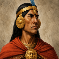
| Pachacuti is widely regarded as the architect of the Inca Empire. He began expanding the Inca road network, also he realized that efficient communication and transportation were essential for governing such a vast territory. During his reign, he ordered the construction and improvement of the main roads connecting Cusco, the imperial capital, with the four regions of the Tawantinsuyu—Chinchaysuyu, Antisuyu, Collasuyu, and Contisuyu. These routes became the backbone of the Qhapaq Ñan, allowing people, goods, armies, and information to move efficiently across the empire. |
Túpac Inca Yupanqui (1471–1493) 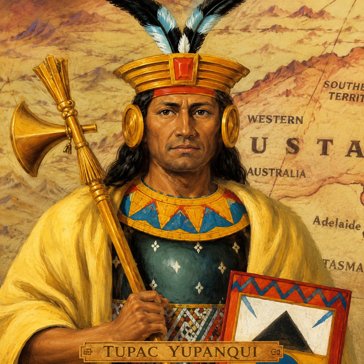
| Following his father's vision, Túpac Inca Yupanqui continued expanding the Inca Road System to its greatest extent, Tupac Inca Yupanqui extended the roads north and south. Under his rule, the Qhapaq Ñan stretched across much of western South America, reaching present-day Argentina and Chile in the south and extending north into what is now Ecuador. This remarkable expansion connected thousands of communities under a single administrative network. |
Huayna Capac (1493–1525) 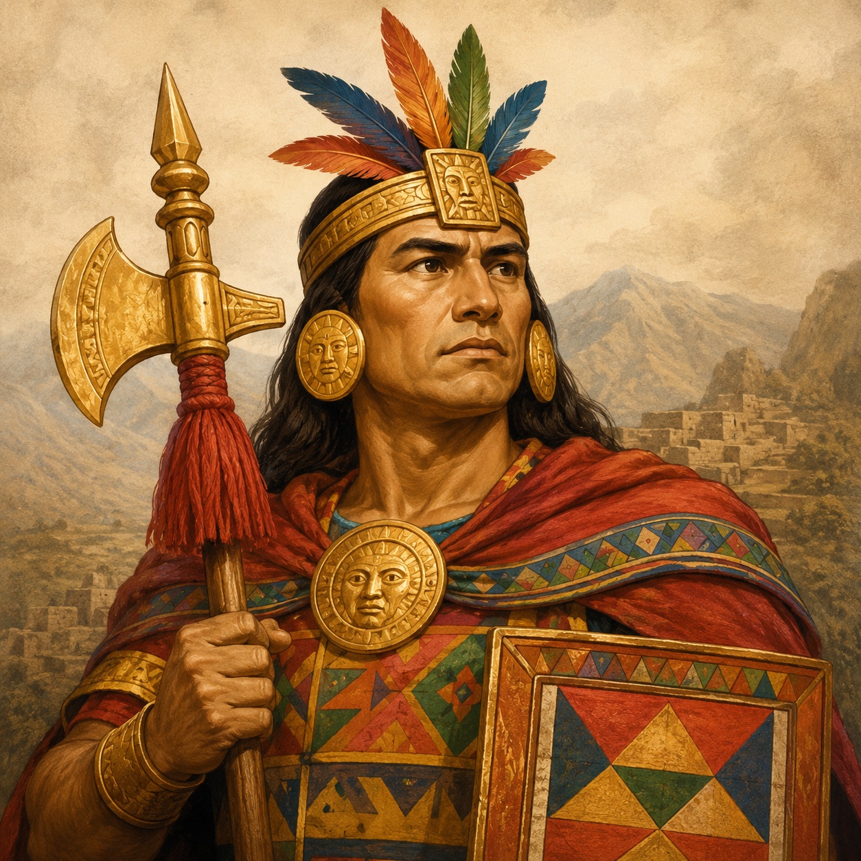
| Huayna Capac focused much of his attention on the northern provinces of the empire, further improving the road network and strengthening communication throughout the region.Huayna Capac completed many strategic sections. His engineers constructed impressive mountain roads, retaining walls, bridges, and stone stairways that crossed some of the most difficult terrain in the northern Andes. These projects permanently connected the empire with territories that are now part of Ecuador and southern Colombia, reinforcing the political and economic unity of the Tawantinsuyu. |
Why Is It Called the Royal Road?
Many travelers wonder why the network is called the Qhapaq Ñan instead of simply the "Inca Road."
In Quechua, Qhapaq means royal, noble, or principal, while Ñan means road or path. Together, the name refers to the principal roads that connected the administrative, political, military, and ceremonial centers of the Inca Empire.
How Did the Incas Build Their Roads?
Without the wheel, draft animals, or iron tools, the Incas created one of the world's greatest engineering achievements. Much of this work was carried out through the Mit'a, a system of mandatory public labor that required communities to contribute workers for state construction projects.
Rather than forcing a single design across every landscape, Inca engineers adapted each section of the road to the surrounding geography. This flexibility is one of the main reasons why so much of the Qhapaq Ñan has survived for centuries.
| Terrain | Inca Engineering Solution: |
Steep Mountains 
| The Qhapaq Ñan crossed some of the steepest mountains in the Andes. To overcome this challenging terrain, Inca engineers built massive stone staircases, retaining walls, and roads carved directly into mountainsides. These structures stabilized the slopes, reduced the risk of landslides, and allowed travelers, Chasquis, and llama caravans to move safely through high-altitude passes. |
Rainforest and Cloud Forest 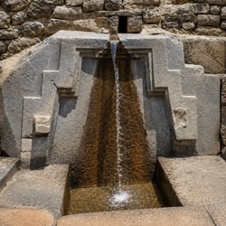
| In the humid cloud forests surrounding Machu Picchu, the Incas constructed carefully paved stone roads with sophisticated drainage channels. These advanced systems diverted rainwater away from the trail, preventing erosion, reducing flooding, and preserving the road surface. More than 500 years later, many of these original drainage systems continue to function remarkably well. |
Rivers and Deep Gorges 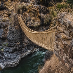
| Suspension bridges woven from ichu grass, along with stone bridges, wooden bridges such as those near Machu Picchu, and floating bridges where necessary. The famous Q'eswachaka Bridge, still rebuilt every year, remains one of the best examples of this engineering.In the arid coastal deserts of Peru, paving roads with stone was often unnecessary. Instead, the Incas marked the Qhapaq Ñan using wooden posts, low adobe walls, and carefully defined pathways that guided travelers across vast stretches of shifting sand. These simple but effective markers helped merchants, messengers, and llama caravans navigate one of the driest environments on Earth while maintaining reliable connections between coastal settlements and the Andean highlands. |
Coastal Deserts 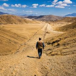
|
In the arid coastal deserts of Peru, paving roads with stone was often unnecessary. Instead, the Incas marked the Qhapaq Ñan using wooden posts, low adobe walls, and carefully defined pathways that guided travelers across vast stretches of shifting sand. These simple but effective markers helped merchants, messengers, and llama caravans navigate one of the driest environments on Earth while maintaining reliable connections between coastal settlements and the Andean highlands. |
This remarkable ability to adapt to every type of environment allowed the Inca Road System to cross some of the most challenging landscapes on Earth.
Did You Know?
Some sections of the Qhapaq Ñan have survived for more than 500 years with remarkably little restoration. The combination of carefully fitted stonework, natural drainage systems, and adaptation to the landscape has allowed many original roads to remain in use today.
Qhapaq Ñan vs. the Inca Trail: What's the Difference?
Many travelers assume that the Qhapaq Ñan and the Inca Trail are the same thing. In reality, they refer to two very different concepts.
The Qhapaq Ñan, meaning "Royal Road" or "Great Inca Road System," was an immense transportation network stretching between 30,000 and 60,000 kilometers (18,600–37,000 miles) across six modern countries: Colombia, Ecuador, Peru, Bolivia, Chile, and Argentina. It served as the primary communication and transportation system of the Inca Empire, connecting cities, agricultural centers, temples, military outposts, and administrative hubs throughout the Tawantinsuyu.
The Classic Inca Trail, on the other hand, is only a small section of this enormous network.
The trail most visitors know today covers approximately 43 kilometers (26.7 miles) within the Historic Sanctuary of Machu Picchu. Along the way, hikers pass six remarkable Inca archaeological sites before entering Machu Picchu through Inti Punku (the Sun Gate), the original entrance used during the Inca period.
Today, the Classic Inca Trail to Machu Picchu is one of the world's most iconic trekking routes, offering the unique opportunity to walk on original Inca stone paths while experiencing spectacular mountain scenery and centuries of history preserved along the route.
What Was the Purpose of the Qhapaq Ñan in the Inca Empire?
Far more than a transportation network, the Qhapaq Ñan was the backbone of the Inca Empire. According to renowned archaeologist John Hyslop, one of the world's leading experts on the Inca Road System, these roads were not simply routes for travel—they were essential tools for governing, connecting, and sustaining one of the largest empires in the Americas.
The Qhapaq Ñan enabled the Incas to administer an enormous territory that stretched across mountains, deserts, valleys, and cloud forests. It supported communication, trade, military operations, religious ceremonies, and the movement of people and goods throughout the Tawantinsuyu.
Fast Communication Through the Chasquis 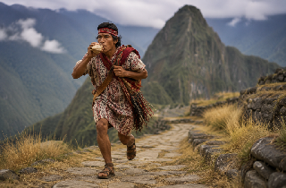
| One of the greatest strengths of the Inca Road System was its communication network. The Incas relied on highly trained messengers known as Chasquis, who ran short distances between relay stations strategically located along the roads. Each messenger passed information to the next, allowing official messages, government orders, and quipus (knotted recording devices) to travel hundreds of miles in just a few days. This relay system was remarkably efficient and played a crucial role in maintaining political control across the empire. |
Logistics and Supply Centers (Tambos) 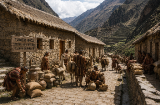
| Throughout the Qhapaq Ñan, the Incas built tambos, which served as roadside lodges, supply depots, and administrative centers. These facilities provided food, shelter, and storage for government officials, soldiers, Chasquis, and llama caravans transporting agricultural products, textiles, tools, and tribute collected from different regions of the empire. The tambos ensured that travelers could move efficiently across long distances while supporting the daily operation of the Inca state. |
Political and Military Control 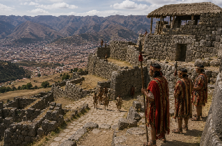
| The extensive road network was essential for maintaining control over newly incorporated territories. Thanks to the Qhapaq Ñan, Inca armies could be deployed quickly to protect strategic areas, suppress rebellions, and secure imperial borders. At the same time, government officials traveled throughout the empire to oversee local administration and collect tribute. Without this sophisticated transportation system, governing such a vast empire would have been nearly impossible. |
Spiritual and Ceremonial Connections 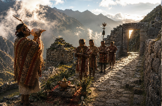
| For the Incas, roads had both practical and spiritual significance. Many sections of the Qhapaq Ñan connected important temples, ceremonial centers, sacred mountains known as Apus, and natural springs revered as holy places. Traveling these roads was often part of religious pilgrimages, reinforcing the close relationship between the Inca people, their architecture, and the sacred Andean landscape. |
Amazing Fact
Modern studies estimate that the Chasqui relay system could transmit messages across hundreds of kilometers in just a few days, an extraordinary speed for a civilization without horses, wheeled vehicles, or written language.
Did You Know?
Archaeologists estimate that the Inca Empire maintained thousands of tambos of different sizes throughout the Qhapaq Ñan. Some were simple shelters for travelers, while larger tambos functioned as administrative centers with storage buildings, military quarters, and lodging for officials.
Why Was the Qhapaq Ñan So Effective?
The efficiency of the Qhapaq Ñan came from its integration with every aspect of the Inca state. Roads connected forts, administrative centers, agricultural lands, and storage facilities, allowing armies, officials, and supplies to move rapidly across vast distances. This logistical advantage helped the Incas govern one of the largest empires in the Americas.
How Long Did It Take to Build the Qhapaq Ñan?
Unlike many famous monuments that were built over a few decades, the Qhapaq Ñan evolved over centuries. Early Andean civilizations established regional trails long before the rise of the Incas. During the 15th century, Inca rulers expanded and unified these routes into a continental transportation network stretching more than 30,000 kilometers across six modern countries.
Why Didn't the Incas Use Wheels?
One of the most common questions about the Inca civilization is why they built such an extensive road system without wheeled transportation.
Although the wheel was known in pre-Columbian America through small ceremonial objects and toys, the rugged terrain of the Andes made wheeled vehicles impractical. Steep stairways, narrow mountain paths, suspension bridges, and rocky slopes were far better suited to pedestrians and llama caravans than to carts.
How Many People Built the Qhapaq Ñan?
There is no exact historical record, but historians estimate that hundreds of thousands of workers participated in constructing and maintaining the road network over several generations through the Mit'a, the Inca system of mandatory public labor.
What Happened to the Inca Trail After the Spanish Conquest?
The arrival of the Spanish in the 16th century dramatically transformed the organization of the Tawantinsuyu and the future of the Qhapaq Ñan.
As the centralized Inca government collapsed, the administrative system responsible for maintaining the vast road network disappeared. Without continuous upkeep, many sections gradually deteriorated or were reclaimed by dense vegetation.
Spanish colonial authorities also reorganized transportation routes to serve their own economic interests. Instead of preserving the original Inca network, they adapted only the roads that were useful for moving people, livestock, and valuable resources between colonial settlements.
Despite these changes, the Qhapaq Ñan never completely disappeared.
Many Andean communities continued using portions of the ancient roads for daily travel, agriculture, trade, and local communication. Thanks to generations of Indigenous communities who preserved and maintained these routes, significant sections of the Inca Road System have survived to the present day.
Today, the Qhapaq Ñan should be understood as a living cultural landscape that has evolved over centuries while remaining deeply connected to the traditions and identity of the Andean people.
From the Ancient Qhapaq Ñan to the Classic Inca Trail
Today, when people hear the words Inca Trail, they usually think of the famous four-day trek to Machu Picchu. However, this iconic hiking route represents only a small section of the much larger Qhapaq Ñan, an extraordinary road network that once stretched across more than 30,000 to 60,000 kilometers (18,600–37,000 miles) through present-day Colombia, Ecuador, Peru, Bolivia, Chile, and Argentina.
Understanding the origins of the Classic Inca Trail requires looking back long before the rise of the Inca Empire.
Today, the Classic Inca Trail is one of Peru's most famous hiking experiences, but the route preserves engineering techniques and architectural features that date back centuries.
The trail covers approximately 43 kilometers (26.7 miles) within the Historic Sanctuary of Machu Picchu, passing six remarkable Inca archaeological sites before reaching the ancient citadel.
Along the way, hikers walk across original stone paths, climb perfectly carved staircases, and cross sophisticated drainage systems that continue to function despite centuries of exposure to the region's humid mountain climate.
Unlike most visitors who enter Machu Picchu by bus, hikers following the Classic Inca Trail arrive through Inti Punku (the Sun Gate), the original ceremonial entrance used during the Inca period. From this spectacular viewpoint, the first panoramic view of Machu Picchu unfolds just as it did centuries ago.
For this reason, the Classic Inca Trail is much more than a hiking adventure. It is one of the few places in the world where travelers can walk on original Inca roads while experiencing the engineering, history, and cultural legacy of the Qhapaq Ñan exactly as they were designed over 500 years ago.
Why Is the Inca Trail Still Important Today?
The Inca Trail is far more than a scenic hiking route to Machu Picchu. It preserves one of the most remarkable examples of Inca engineering and offers travelers a unique opportunity to experience a surviving section of the ancient Qhapaq Ñan, the vast road network that once connected the entire Inca Empire.
Its significance extends well beyond its destination. Throughout the trail, hikers encounter original stone pathways, carved staircases, terraces, and archaeological sites that demonstrate how the Incas adapted their engineering techniques to some of the most challenging landscapes in South America, including rugged mountains, cloud forests, and steep valleys.
The Classic Inca Trail is also located within the Historic Sanctuary of Machu Picchu, a protected area recognized worldwide for its exceptional cultural and natural value. Walking this route allows visitors to appreciate not only Inca architecture but also the extraordinary biodiversity of the Peruvian Andes.
Because of its historical and environmental importance, hiking the Inca Trail also comes with a responsibility. Visitors, guides, and tour operators all play an essential role in preserving this fragile cultural heritage by respecting archaeological sites, following conservation regulations, and protecting the surrounding natural environment.
More than five centuries after the fall of the Inca Empire, many sections of the ancient Qhapaq Ñan remain part of everyday life in the Andes. The Classic Inca Trail to Machu Picchu is the most famous surviving section, but it represents only a small portion of one of the greatest engineering achievements in the history of the Americas.
The 6 Most Important Archaeological Sites on the Inca Trail to Machu Picchu
One of the most unforgettable aspects of hiking the Inca Trail to Machu Picchu is that the journey itself is just as extraordinary as the destination. Along the approximately 43-kilometer (26.7-mile) route, hikers pass through some of the best-preserved Inca archaeological sites before finally reaching Machu Picchu.
Each site served a unique purpose within the Qhapaq Ñan, from agricultural centers and military checkpoints to ceremonial complexes and sacred gateways.
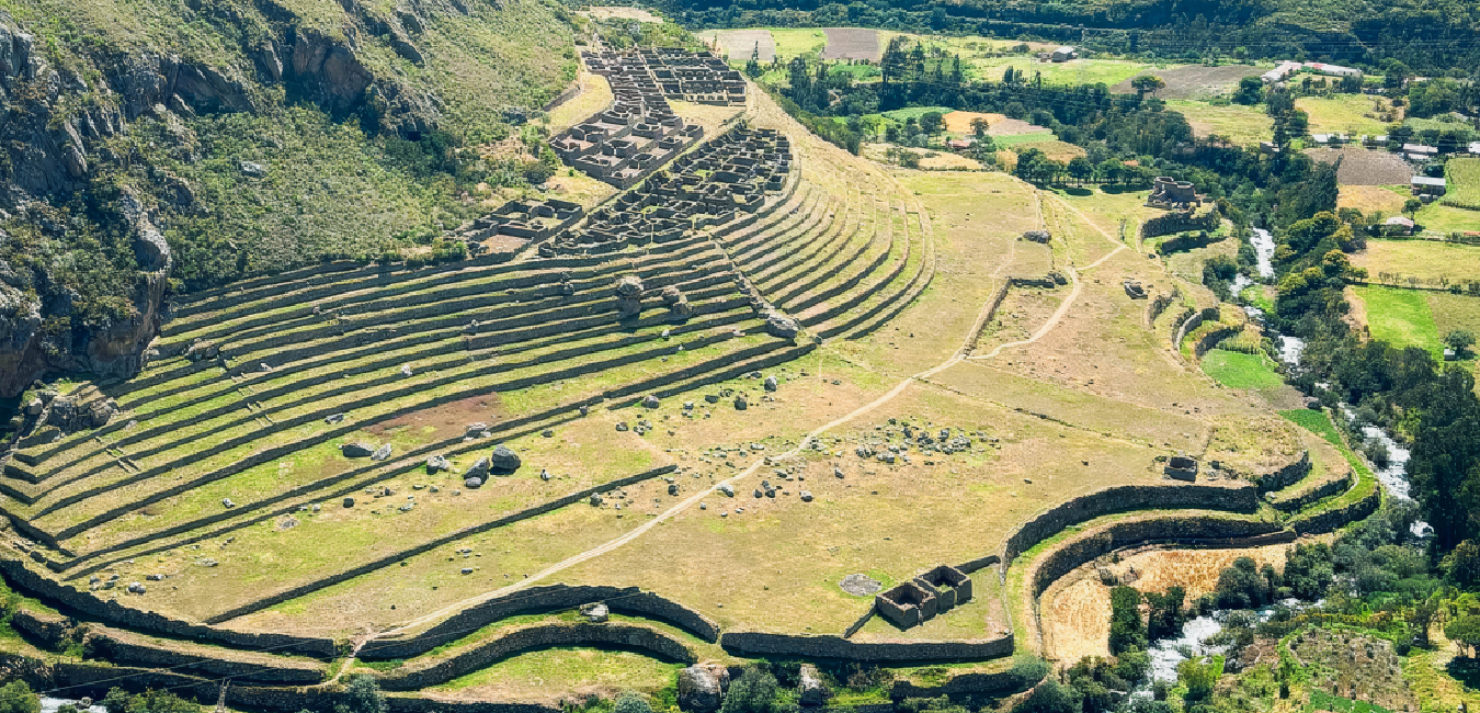
Llactapata (Patallacta)
The name Llactapata comes from the Quechua words llaqta, meaning town, village, or settlement, and pata, meaning terrace, elevated place, or platform. It is commonly translated as "The Town on the Heights" or "The Terraced Settlement."
This is the first major Inca archaeological site encountered on the trail. Archaeologists believe Llactapata functioned as a large agricultural complex strategically positioned above the Urubamba River.
Its extensive terraces were used to cultivate crops such as corn and potatoes, providing food for travelers, Chasquis, and the inhabitants of Machu Picchu. From the panoramic viewpoints above the site, hikers gain their first real sense of the scale and sophistication of Inca agricultural engineering.
Runkurakay
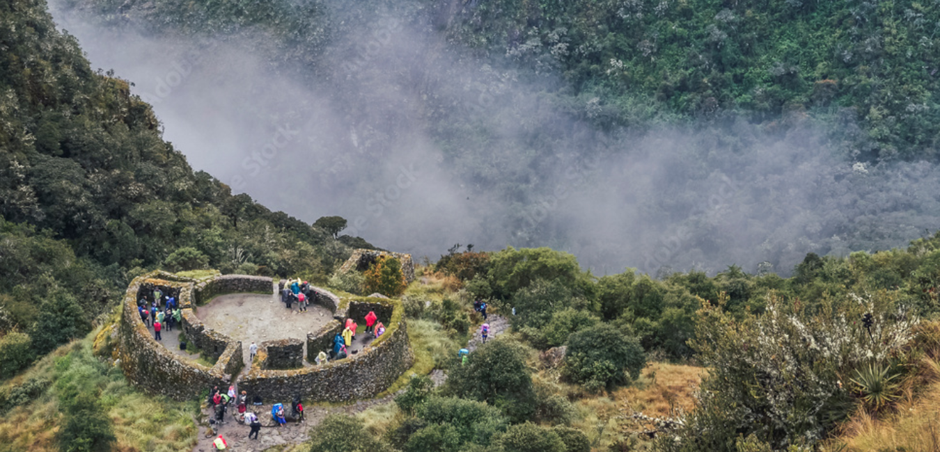
The name Runkurakay combines the Quechua words runku, meaning basket or oval shape, and rakay, meaning building or shelter.
Located shortly after crossing Warmiwañusca Pass (Dead Woman's Pass)—the highest point on the Classic Inca Trail—this semicircular archaeological site is believed to have served as a checkpoint and resting place for Chasquis.
Here, messengers could recover before continuing their relay runs across the mountains, while travelers found protection from the harsh winds and cold temperatures of the high Andes.
Sayacmarca
The name Sayacmarca comes from sayaq, meaning standing or dominant, and marka, meaning town or settlement. The name is commonly translated as "The Standing Town" or "The Dominant Settlement."
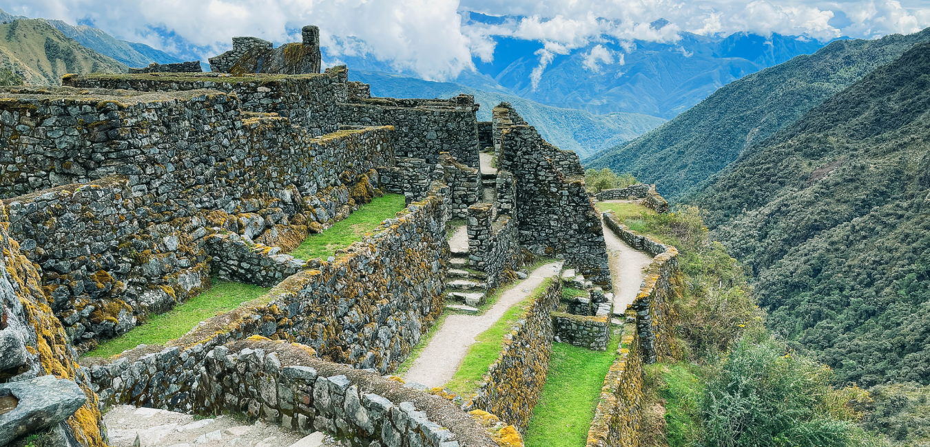
Reaching this spectacular site requires climbing a series of steep stone staircases carved into the mountainside.
Perched dramatically above a deep canyon and surrounded by cloud forest, Sayacmarca occupies one of the most strategic defensive locations along the Inca Trail. Its narrow passageways, ceremonial buildings, and commanding views illustrate the Incas' extraordinary ability to combine military planning with sophisticated architectural design.
Phuyupatamarca
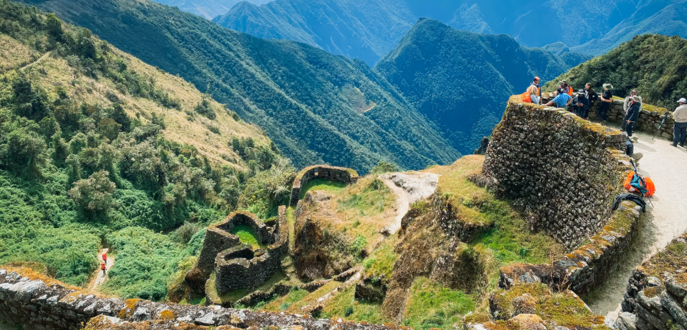
One of the most beautiful Quechua names along the trail, Phuyupatamarca combines phuyu (cloud), pata (high place), and marka (town), meaning "The Town Above the Clouds."
Rather than serving primarily as a military site, Phuyupatamarca is believed to have been an important ceremonial center.
Its most remarkable feature is an advanced hydraulic system that still channels crystal-clear water through a series of fountains and ceremonial baths more than 500 years after they were built.
Many archaeologists believe pilgrims performed ritual purification ceremonies here before continuing their journey toward Machu Picchu.
Wiñay Wayna
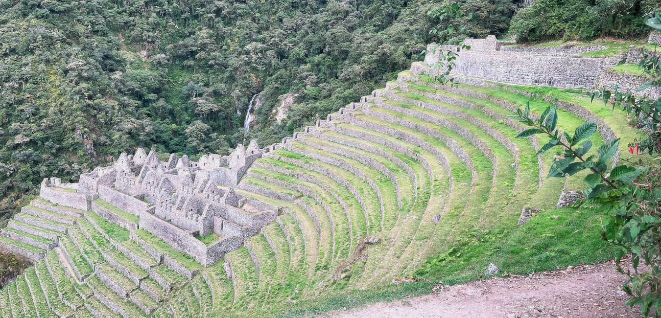
The Quechua name Wiñay Wayna translates as "Forever Young," combining wiñay (eternal) and wayna (young).
Widely considered one of the most beautiful archaeological sites on the Classic Inca Trail, Wiñay Wayna features spectacular agricultural terraces that cling dramatically to the mountainside.
Its finely carved stone buildings suggest it served an important religious and ceremonial function reserved for members of the Inca elite.
Surrounded by waterfalls and lush cloud forest, this site offers one of the most memorable landscapes along the entire hike.
Inti Punku (The Sun Gate)
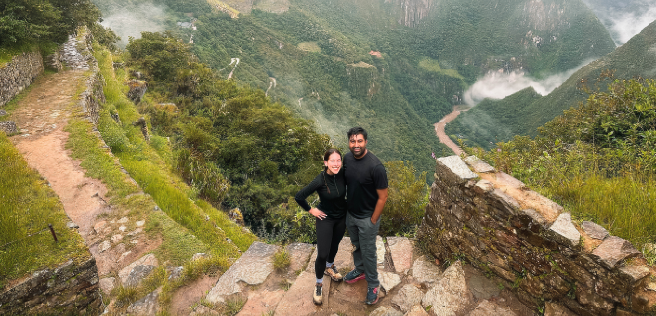
Few places on the Inca Trail are as emotionally powerful as Inti Punku, whose name combines the Quechua words Inti (Sun) and Punku (Gate), meaning "The Sun Gate."
For hikers, this is the moment they have anticipated throughout the entire journey.
Far more than a simple entrance, Inti Punku served as the original ceremonial gateway to Machu Picchu during the Inca period.
As travelers pass through its stone gateway at sunrise, the cloud forest suddenly opens to reveal the first panoramic view of the ancient citadel, illuminated by the morning light and surrounded by the sacred peaks of the Andes.
It is an unforgettable moment that perfectly captures why the Classic Inca Trail to Machu Picchu is considered one of the greatest hiking experiences in the world.
The Colonial Transformation and the Modern Recognition of the Qhapaq Ñan
The Colonial Transformation and the Modern Recognition of the Qhapaq Ñan
The arrival of the Spanish conquistadors in 1532 marked a major turning point for the Qhapaq Ñan, the vast Inca Road System that had connected the Inca Empire for centuries. Built for pedestrians and llama caravans, the roads were not designed for horses, mules, or heavy colonial transport. As a result, many sections were damaged or abandoned.
The Fragmentation of the Inca Road System
During the colonial period, the once-unified Qhapaq Ñan gradually fragmented. The Spanish dismantled the Inca administrative system, including the Mit'a, which had maintained the roads, bridges, and public infrastructure. Without regular maintenance, many routes were reclaimed by vegetation, landslides, and the harsh Andean climate.
Colonial authorities preserved only the roads that supported their economic interests, especially routes used to transport silver and other minerals from mining centers such as Potosí. Even so, many Indigenous communities continued using sections of the Inca Road System for travel, trade, agriculture, and cultural traditions, helping preserve this remarkable network.
From Forgotten Trail to UNESCO World Heritage Site
Despite centuries of neglect, the exceptional Inca engineering behind the Qhapaq Ñan allowed many sections to survive. In 2014, the Qhapaq Ñan was designated a UNESCO World Heritage Site through a joint effort by Argentina, Bolivia, Chile, Colombia, Ecuador, and Peru.
Today, the Qhapaq Ñan is recognized as one of the greatest achievements of Inca engineering and a shared cultural landscape that reflects centuries of history, communication, trade, and cultural exchange across the Andes. It remains one of the most important symbols of South America's cultural heritage.